
Downeastnc
Member


BULLETIN
Hurricane Polo Advisory Number 34
NWS National Hurricane Center Miami FL EP172026
800 PM MST Mon Sep 28 2026
...POLO ABOUT TO MAKE LANDFALL IN BAJA CALIFORNIA SUR...
...LIFE-THREATENING WINDS AND FLASH FLOODING ONGOING...
SUMMARY OF 800 PM MST...0300 UTC...INFORMATION
----------------------------------------------
LOCATION...25.9N 112.5W
ABOUT 75 MI...125 KM N OF CABO SAN LAZARO MEXICO
ABOUT 95 MI...155 KM S OF SANTA ROSALIA MEXICO
MAXIMUM SUSTAINED WINDS...115 MPH...185 KM/H
PRESENT MOVEMENT...NE OR 35 DEGREES AT 13 MPH...20 KM/H
MINIMUM CENTRAL PRESSURE...963 MB...28.44 INCHES
——————-
Hurricane Polo Discussion Number 34
NWS National Hurricane Center Miami FL EP172026
800 PM MST Mon Sep 28 2026
Polo is about to make landfall on Baja California Sur. Heavy rains
and hurricane-force winds have already spread across the peninsula,
and the worst conditions will likely occur in the hurricane warning
area within the next few hours. Polo is not as well organized as it
was earlier, with the eye filling in satellite images. The initial
intensity is held at 100 kt near the high end of the latest
satellite estimates, but this could be a little generous.
FORECAST POSITIONS AND MAX WINDS
INIT 29/0300Z 25.9N 112.5W 100 KT 115 MPH
12H 29/1200Z 27.7N 110.9W 75 KT 85 MPH
24H 30/0000Z 31.0N 107.7W 30 KT 35 MPH...POST-TROP/INLAND
36H 30/1200Z...DISSIPATED
$$
Forecaster Cangialosi
———————-
Josh about to get hit hard!
Looking at satellite, I'm going with the intensity being very generous .

No offense to the chasers, but I’m routing on decent weakening:
Regardless, Josh noted things picking up 13 minutes ago:


Fay must have most of the ACE this season, lol.Fay was again downgraded to a TD and looks like it is dissipating. However, the 12Z UKMET restrengthens Fay to a TS this weekend that then comes within 175 miles ESE of Bermuda. I’m not yet buying this, but I’m not assuming anything with the Energizer Bunny that is Fay. This is the 3rd run in a row near Bermuda and the umpteenth run in a row that keeps the Energizer Bunny going:
TROPICAL DEPRESSION FAY ANALYSED POSITION : 24.3N 47.1W
ATCF IDENTIFIER : AL062026
LEAD CENTRAL MAXIMUM WIND
VERIFYING TIME TIME POSITION PRESSURE (MB) SPEED (KNOTS)
-------------- ---- -------- ------------- -------------
1200UTC 29.09.2026 0 24.3N 47.1W 1013 22
0000UTC 30.09.2026 12 23.4N 48.7W 1013 21
1200UTC 30.09.2026 24 23.0N 51.2W 1014 23
0000UTC 01.10.2026 36 23.0N 53.1W 1014 23
1200UTC 01.10.2026 48 23.8N 55.4W 1015 26
0000UTC 02.10.2026 60 24.4N 57.2W 1015 26
1200UTC 02.10.2026 72 25.6N 59.1W 1014 28
0000UTC 03.10.2026 84 26.5N 60.6W 1013 30
1200UTC 03.10.2026 96 27.5N 61.9W 1011 32
0000UTC 04.10.2026 108 28.7N 62.3W 1011 33
1200UTC 04.10.2026 120 30.1N 62.2W 1010 36
0000UTC 05.10.2026 132 31.5N 61.9W 1010 36
1200UTC 05.10.2026 144 33.1N 61.0W 1009 39
0000UTC 06.10.2026 156 35.1N 59.4W 1008 32
1200UTC 06.10.2026 168 37.5N 56.2W 1006 34

I’m pulling for Fay to dissipate and reform again so it can have some notoriety. I’m not aware of any storms that dissipated and reformed twice, although I suspect its happened at some point. Anybody got some examples?Fay was again downgraded to a TD and looks like it is dissipating. However, the 12Z UKMET restrengthens Fay to a TS this weekend that then comes within 175 miles ESE of Bermuda. I’m not yet buying this, but I’m not assuming anything with the Energizer Bunny that is Fay. This is the 3rd run in a row near Bermuda and the umpteenth run in a row that keeps the Energizer Bunny going:
TROPICAL DEPRESSION FAY ANALYSED POSITION : 24.3N 47.1W
ATCF IDENTIFIER : AL062026
LEAD CENTRAL MAXIMUM WIND
VERIFYING TIME TIME POSITION PRESSURE (MB) SPEED (KNOTS)
-------------- ---- -------- ------------- -------------
1200UTC 29.09.2026 0 24.3N 47.1W 1013 22
0000UTC 30.09.2026 12 23.4N 48.7W 1013 21
1200UTC 30.09.2026 24 23.0N 51.2W 1014 23
0000UTC 01.10.2026 36 23.0N 53.1W 1014 23
1200UTC 01.10.2026 48 23.8N 55.4W 1015 26
0000UTC 02.10.2026 60 24.4N 57.2W 1015 26
1200UTC 02.10.2026 72 25.6N 59.1W 1014 28
0000UTC 03.10.2026 84 26.5N 60.6W 1013 30
1200UTC 03.10.2026 96 27.5N 61.9W 1011 32
0000UTC 04.10.2026 108 28.7N 62.3W 1011 33
1200UTC 04.10.2026 120 30.1N 62.2W 1010 36
0000UTC 05.10.2026 132 31.5N 61.9W 1010 36
1200UTC 05.10.2026 144 33.1N 61.0W 1009 39
0000UTC 06.10.2026 156 35.1N 59.4W 1008 32
1200UTC 06.10.2026 168 37.5N 56.2W 1006 34
I’m pulling for Fay to dissipate and reform again so it can have some notoriety. I’m not aware of any storms that dissipated and reformed twice, although I suspect its happened at some point. Anybody got some examples?
I took a stab at researching (which isn’t easy with these parameters), but this could become the only recorded history of TS > Dissipate > TS > Dissipate > TS in the Atlantic basin going back to 1851. The closest I found was Lisa 2004, but that was TS > TD > TS > TD > TS. (it briefly became a weak hurricane during one of those 3 instances of reaching TS)Similar to the 0Z, the 12Z UKMET has Fay start off 100% deceased but then she’s miraculously revived on Friday and becomes a TS on Tue!
NEW TROPICAL CYCLONE FORECAST TO DEVELOP AFTER 60 HOURS
FORECAST POSITION AT T+ 60 : 27.3N 60.5W
LEAD CENTRAL MAXIMUM WIND
VERIFYING TIME TIME POSITION PRESSURE (MB) SPEED (KNOTS)
-------------- ---- -------- ------------- -------------
0000UTC 03.10.2026 60 27.3N 60.5W 1014 27
1200UTC 03.10.2026 72 29.3N 60.6W 1013 28
0000UTC 04.10.2026 84 31.8N 60.1W 1012 30
1200UTC 04.10.2026 96 34.0N 58.9W 1012 30
0000UTC 05.10.2026 108 35.6N 57.1W 1011 29
1200UTC 05.10.2026 120 37.5N 55.3W 1009 30
0000UTC 06.10.2026 132 40.2N 53.3W 1004 33
1200UTC 06.10.2026 144 44.7N 49.2W 996 41
0000UTC 07.10.2026 156 51.2N 44.3W 992 43
1200UTC 07.10.2026 168 CEASED TRACKING

Would be weird considering we’re in a strong El Niño right now.I took a stab at researching (which isn’t easy with these parameters), but this could become the only recorded history of TS > Dissipate > TS > Dissipate > TS in the Atlantic basin going back to 1851. The closest I found was Lisa 2004, but that was TS > TD > TS > TD > TS. (it briefly became a weak hurricane during one of those 3 instances of reaching TS)
If Fay could pull this off, it would be a weird record to break. Kinda like setting a record for most times going back and forth between single A and triple A in the minors.
Also Ivan in 2004 made landfall on the eastern Gulf coast as a hurricane, dissipated over the northeast several days later, then the remnants were tracked back into the Gulf a week later and became a tropical storm againFound one more that’s similar, Fred 2021. TS > TD > TS > Dissipate > TS
Yea, I remember that one pretty well since it was a bit controversial at the time for NHC to redesignate the remnants as Ivan. Pretty notable too (much more than Fay will ever be).Also Ivan in 2004 made landfall on the eastern Gulf coast as a hurricane, dissipated over the northeast several days later, then the remnants were tracked back into the Gulf a week later and became a tropical storm again
NHC has lemonized Fay one more time, lol.Similar to the 0Z, the 12Z UKMET has Fay start off 100% deceased but then she’s miraculously revived on Friday and becomes a TS on Tue!
NEW TROPICAL CYCLONE FORECAST TO DEVELOP AFTER 60 HOURS
FORECAST POSITION AT T+ 60 : 27.3N 60.5W
LEAD CENTRAL MAXIMUM WIND
VERIFYING TIME TIME POSITION PRESSURE (MB) SPEED (KNOTS)
-------------- ---- -------- ------------- -------------
0000UTC 03.10.2026 60 27.3N 60.5W 1014 27
1200UTC 03.10.2026 72 29.3N 60.6W 1013 28
0000UTC 04.10.2026 84 31.8N 60.1W 1012 30
1200UTC 04.10.2026 96 34.0N 58.9W 1012 30
0000UTC 05.10.2026 108 35.6N 57.1W 1011 29
1200UTC 05.10.2026 120 37.5N 55.3W 1009 30
0000UTC 06.10.2026 132 40.2N 53.3W 1004 33
1200UTC 06.10.2026 144 44.7N 49.2W 996 41
0000UTC 07.10.2026 156 51.2N 44.3W 992 43
1200UTC 07.10.2026 168 CEASED TRACKING
NHC has lemonized Fay one more time, lol.

Regardless, we still may not have heard the last about Fay and I don’t just mean about her tenacity. I mean that she could conceivably be declared the season’s only hurricane (at least to this point) in post-season analysis!
Regardless, we still may not have heard the last about Fay and I don’t just mean about her tenacity. I mean that she could conceivably be declared the season’s only hurricane (at least to this point) in post-season analysis!


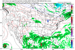
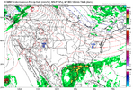
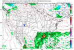
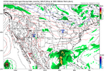
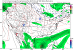
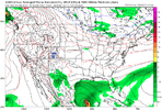
It looks like a storm coming out of the climatologically favored Bay of Campeche, threatening the Northern Gulf Coast, has legs. ALL operationals have the system by week's end. I see the NHC has painted a 30% lemon, too.
View attachment 198421
View attachment 198422
View attachment 198423
View attachment 198424
View attachment 198425
View attachment 198426
Very true. I think much depends on how early the system develops and how fast it progresses. I could be wrong here, though, since the EURO is slower.Thanks for posting these. An important question is whether this would be T, ST, or ET. For example, the 0Z/6Z Euro has a non-tropical looking non-compact, elongated surface low with no high winds although it also shows it warmer at 700 mb near the center vs surrounding areas suggesting it could have some ST characteristics.
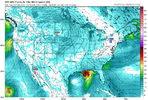


Another thing it has going for it is the shape of the Bay of Campeche coastline, and untouched, above normal water temps in the Gulf. The longer it can meander in the BOC before coming north, the more impactful it's likely to be.If something attempts to go in the gulf its going to have a lot of help from the jet and the ull to its NW. 12z Gfs may be a bit aggressive with its quick spin up as it seems to be tied to a convective blob but the signal has been there for something for at least a few days now within the ensembles
If something attempts to go in the gulf its going to have a lot of help from the jet and the ull to its NW. 12z Gfs may be a bit aggressive with its quick spin up as it seems to be tied to a convective blob but the signal has been there for something for at least a few days now within the ensembles


