• Hello, please take a minute to check out our awesome content, contributed by the wonderful members of our community. We hope you'll add your own thoughts and opinions by making a free account!

Tropical 2026 Tropics Thread 🌀

It's crazy P storms in the Pacific are like the I storms in the Atlantic. Legendary

And as far as I know Patricia is the only one sub 900 over there also in a super El Nino year. Of course Patricia was a month from now back then..
 
TD 15E had formed in the E PAC back on Sep 13th from an AEW that had moved off of Africa way back on Aug 27th. This was actually the very next wave after the one that produced Dolly in the Atlantic! This then degenerated in the E PAC into an open wave late on Sep 15th.

But one week later (late last night), this reorganized back to TD 15E 405 miles SSE of Hilo, Hawaii, moving WNW. It’s forecasted to become a TS later today and then turn sharply N tonight. It is then forecasted to become a H tomorrow night and reach high end cat 2 H status Fri night while not too far S of the big island of Hawaii meaning a potential serious threat there then:

From the NHC discussion of the 5AM EDT advisory:

The depression is moving west-northwestward at about 10 kt on the
southwest side of a low- to mid-level ridge. This ridge is expected
to shift eastward and weaken while a mid- to upper-level low dives
southwestward near the northwestern Hawaiian Islands. This pattern
change should cause the cyclone to slow down and then turn northward
or north-northeastward later this week. That motion should take the
cyclone near the Big Island of Hawaii late Friday or on Saturday.

Around that time, the upper low is expected to weaken and move
westward, allowing mid-level ridging to become re-established to the
north of the system. In response, the cyclone should turn and then
accelerate westward.


FORECAST POSITIONS AND MAX WINDS

INIT 23/0900Z 14.0N 153.7W 30 KT 35 MPH
12H 23/1800Z 14.4N 154.7W 35 KT 40 MPH
24H 24/0600Z 14.6N 155.5W 45 KT 50 MPH
36H 24/1800Z 15.0N 155.6W 55 KT 65 MPH
48H 25/0600Z 15.9N 155.2W 70 KT 80 MPH
60H 25/1800Z 17.0N 154.9W 85 KT 100 MPH
72H 26/0600Z 17.9N 154.7W 95 KT 110 MPH
96H 27/0600Z 18.3N 156.0W 95 KT 110 MPH
120H 28/0600Z 18.2N 159.0W 95 KT 110 MPH


This may deserve its own thread.
 
Last edited:
From the 11AM EDT advisory for TD 15E:

...INTERESTS IN THE HAWAIIAN ISLANDS SHOULD CLOSELY MONITOR THE
PROGRESS OF THIS SYSTEM...


SUMMARY OF 500 AM HST...1500 UTC...INFORMATION
----------------------------------------------
LOCATION...14.5N 154.4W
ABOUT 320 MI...520 KM SSE OF SOUTH POINT HAWAII
ABOUT 525 MI...840 KM SSE OF HONOLULU HAWAII
MAXIMUM SUSTAINED WINDS...35 MPH...55 KM/H
PRESENT MOVEMENT...WNW OR 290 DEGREES AT 6 MPH...9 KM/H
MINIMUM CENTRAL PRESSURE...1004 MB...29.65 INCHES


WATCHES AND WARNINGS
--------------------
Interests in the Hawaiian Islands should closely monitor the
progress of this system. A Hurricane or Tropical Storm Watch will
likely be required for a portion of the state later today.
——————————

The depression has slowed since the last advisory and seems to be
moving west-northwestward at about 5 kt. A ridge to the northeast
of Hawaii is forecast to weaken and slide eastward as a mid-
latitude trough drops over the northwestern Hawaiian islands.
This evolution is likely to the cause the cyclone to slow down
later today or tonight and then turn northward or north-
northeastward by tomorrow with some increase in forward speed. The
trough is forecast to move westward this weekend as the ridge
rebuilds north of Hawaii, which should force a sharp westward turn
while the cyclone is close to the Big Island
. At this time frame,
it is impossible to know exactly when that turn will happen and,
unsurprisingly, there is a large north-south spread in the guidance.
Our best guidance is on the northern side of the track envelope,
and new NHC forecast remains essentially the same as the last
advisory. Interests in the Hawaiian Islands, especially on the Big
Island, should closely monitor the system, with life-threatening
catastrophic flooding possible over the steep terrain on this track.


The depression should intensify slowly at first, given the current
structure of the low-level center not co-located with the mid-level
circulation as seen on satellite. However, after the system
develops an inner core, the environment seems conducive for
significant strengthening, with low shear, high mid-level moisture
and SSTs from 28-29C. The rapid intensification probabilities are
increasing, and the best model guidance is showing this as a major
hurricane in a few days. Given the environment and the
best-performing aids (Google DeepMind and HCCA) again showing
major-hurricane strength, the NHC forecast is raised from the
previous one and shows the cyclone as a major hurricane when it
approaches the Big Island of Hawaii by the weekend.


FORECAST POSITIONS AND MAX WINDS

INIT 23/1500Z 14.5N 154.4W 30 KT 35 MPH
12H 24/0000Z 14.7N 155.2W 40 KT 45 MPH
24H 24/1200Z 15.0N 155.5W 50 KT 60 MPH
36H 25/0000Z 15.7N 155.2W 65 KT 75 MPH
48H 25/1200Z 16.7N 154.8W 80 KT 90 MPH
60H 26/0000Z 17.6N 154.5W 90 KT 105 MPH
72H 26/1200Z 18.2N 154.7W 100 KT 115 MPH

96H 27/1200Z 18.1N 157.0W 100 KT 115 MPH
120H 28/1200Z 18.7N 160.2W 95 KT 110 MPH

$$
Forecaster Blake
 
TD 15E had formed in the E PAC back on Sep 13th from an AEW that had moved off of Africa way back on Aug 27th. This was actually the very next wave after the one that produced Dolly in the Atlantic! This then degenerated in the E PAC into an open wave late on Sep 15th.

But one week later (late last night), this reorganized back to TD 15E 405 miles SSE of Hilo, Hawaii, moving WNW. It’s forecasted to become a TS later today and then turn sharply N tonight. It is then forecasted to become a H tomorrow night and reach high end cat 2 H status Fri night while not too far S of the big island of Hawaii meaning a potential serious threat there then:

From the NHC discussion of the 5AM EDT advisory:

The depression is moving west-northwestward at about 10 kt on the
southwest side of a low- to mid-level ridge. This ridge is expected
to shift eastward and weaken while a mid- to upper-level low dives
southwestward near the northwestern Hawaiian Islands. This pattern
change should cause the cyclone to slow down and then turn northward
or north-northeastward later this week. That motion should take the
cyclone near the Big Island of Hawaii late Friday or on Saturday.

Around that time, the upper low is expected to weaken and move
westward, allowing mid-level ridging to become re-established to the
north of the system. In response, the cyclone should turn and then
accelerate westward.


FORECAST POSITIONS AND MAX WINDS

INIT 23/0900Z 14.0N 153.7W 30 KT 35 MPH
12H 23/1800Z 14.4N 154.7W 35 KT 40 MPH
24H 24/0600Z 14.6N 155.5W 45 KT 50 MPH
36H 24/1800Z 15.0N 155.6W 55 KT 65 MPH
48H 25/0600Z 15.9N 155.2W 70 KT 80 MPH
60H 25/1800Z 17.0N 154.9W 85 KT 100 MPH
72H 26/0600Z 17.9N 154.7W 95 KT 110 MPH
96H 27/0600Z 18.3N 156.0W 95 KT 110 MPH
120H 28/0600Z 18.2N 159.0W 95 KT 110 MPH


This may deserve its own thread.
Very interesting that it was a trackable entity all the way from Africa. Good catch!
 
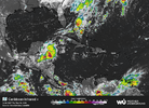
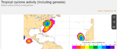
There are two AOI in the Atlantic being monitored by the NHC, Invest 90L just off Africa and a possible regenerating Fay:

Tropical Weather Outlook
NWS National Hurricane Center Miami FL
200 PM EDT Wed Sep 23 2026

For the North Atlantic...Caribbean Sea and the Gulf of America:

1. Far Eastern Tropical Atlantic (AL90):
An area of low pressure located a couple of hundred miles southwest
off the coast of western Africa is gradually becoming better
defined, and the associated shower and thunderstorm activity has
increased since yesterday. This system could become a short-lived
tropical depression on Thursday or Friday while it moves
northwestward to northward. However, strong upper-level winds
should end the opportunity for development by the weekend.
Interests in the Cabo Verde Islands should monitor the progress of
this system as gusty winds, areas of heavy rain and flash flooding
is possible there by Friday.
* Formation chance through 48 hours...medium...50 percent.
* Formation chance through 7 days...medium...50 percent.

2. Central Subtropical Atlantic (Former Tropical Storm Fay):
Showers and thunderstorms have increased with the remnants of
Fay located several hundred miles southwest of the Azores. While
environmental conditions are only marginally conducive for
development, this system could become a tropical depression again
today or tonight if the current thunderstorm activity persists.
The system is forecast to move westward during the next couple of
days, and by the weekend upper-level winds should inhibit formation
chances.
* Formation chance through 48 hours...high...70 percent.
* Formation chance through 7 days...high...70 percent.

Forecaster Blake
 
@GaWx it appears Fay is roaring back to life.

Thanks for your update.

12Z UKMET has Fay not only hanging around for at least 168 hrs but being its strongest at hour 168 as it slowly moves WSW!

TROPICAL CYCLONE DEVELOPED IN THE MODEL ANALYSIS AT POSITION : 30.2N 37.7W

LEAD CENTRAL MAXIMUM WIND
VERIFYING TIME TIME POSITION PRESSURE (MB) SPEED (KNOTS)
-------------- ---- -------- ------------- -------------
1200UTC 23.09.2026 0 30.2N 37.7W 1015 27
0000UTC 24.09.2026 12 29.8N 39.3W 1014 27
1200UTC 24.09.2026 24 30.1N 41.0W 1015 29
0000UTC 25.09.2026 36 30.5N 41.9W 1015 26
1200UTC 25.09.2026 48 30.7N 42.7W 1014 28
0000UTC 26.09.2026 60 30.6N 43.3W 1014 28
1200UTC 26.09.2026 72 30.6N 43.9W 1013 29
0000UTC 27.09.2026 84 30.5N 44.0W 1014 25
1200UTC 27.09.2026 96 30.3N 43.7W 1013 28
0000UTC 28.09.2026 108 29.5N 43.5W 1013 27
1200UTC 28.09.2026 120 28.4N 43.7W 1012 28
0000UTC 29.09.2026 132 27.4N 44.8W 1011 29
1200UTC 29.09.2026 144 26.5N 46.4W 1009 31
0000UTC 30.09.2026 156 25.7N 48.0W 1008 34
1200UTC 30.09.2026 168 25.0N 49.2W 1004 39
 
Thanks for your update.

12Z UKMET has Fay not only hanging around for at least 168 hrs but being its strongest at hour 168 as it slowly moves WSW!

TROPICAL CYCLONE DEVELOPED IN THE MODEL ANALYSIS AT POSITION : 30.2N 37.7W

LEAD CENTRAL MAXIMUM WIND
VERIFYING TIME TIME POSITION PRESSURE (MB) SPEED (KNOTS)
-------------- ---- -------- ------------- -------------
1200UTC 23.09.2026 0 30.2N 37.7W 1015 27
0000UTC 24.09.2026 12 29.8N 39.3W 1014 27
1200UTC 24.09.2026 24 30.1N 41.0W 1015 29
0000UTC 25.09.2026 36 30.5N 41.9W 1015 26
1200UTC 25.09.2026 48 30.7N 42.7W 1014 28
0000UTC 26.09.2026 60 30.6N 43.3W 1014 28
1200UTC 26.09.2026 72 30.6N 43.9W 1013 29
0000UTC 27.09.2026 84 30.5N 44.0W 1014 25
1200UTC 27.09.2026 96 30.3N 43.7W 1013 28
0000UTC 28.09.2026 108 29.5N 43.5W 1013 27
1200UTC 28.09.2026 120 28.4N 43.7W 1012 28
0000UTC 29.09.2026 132 27.4N 44.8W 1011 29
1200UTC 29.09.2026 144 26.5N 46.4W 1009 31
0000UTC 30.09.2026 156 25.7N 48.0W 1008 34
1200UTC 30.09.2026 168 25.0N 49.2W 1004 39
Florence 2.0 lol
 
0Z UKMET

1) is pretty similar to the 12Z with Fay with a move to past 50W although it does turn WNW late.

2) continues to keep Nolo
well S of Hawaii initially but like on 12Z it then turns NE toward big island of Hawaii late:

TROPICAL STORM NOLO ANALYSED POSITION : 14.5N 155.1W

ATCF IDENTIFIER : EP152026

LEAD CENTRAL MAXIMUM WIND
VERIFYING TIME TIME POSITION PRESSURE (MB) SPEED (KNOTS)
-------------- ---- -------- ------------- -------------
0000UTC 24.09.2026 0 14.5N 155.1W 1001 29
1200UTC 24.09.2026 12 14.7N 155.9W 998 36
0000UTC 25.09.2026 24 15.0N 156.2W 994 36
1200UTC 25.09.2026 36 15.5N 155.7W 992 41
0000UTC 26.09.2026 48 15.9N 155.4W 990 50
1200UTC 26.09.2026 60 15.9N 154.9W 988 51
0000UTC 27.09.2026 72 15.3N 155.2W 983 48
1200UTC 27.09.2026 84 14.1N 155.9W 986 46
0000UTC 28.09.2026 96 13.2N 157.0W 983 49
1200UTC 28.09.2026 108 12.9N 157.8W 981 55
0000UTC 29.09.2026 120 13.4N 158.1W 977 57
1200UTC 29.09.2026 132 14.2N 157.8W 983 52
0000UTC 30.09.2026 144 15.0N 157.1W 986 45
1200UTC 30.09.2026 156 15.7N 156.0W 990 42
0000UTC 01.10.2026 168 16.1N 154.7W 992 45
 
From NHC:

Resilient Fay has strengthened this morning. Deep convective
curved bands have developed both on the west and east sides of the
cyclone, and a small cold cloud top deep burst of convection is
persisting over the surface center. Based on the improved cloud
pattern and an increase in the Dvorak satellite intensity
estimated from TAFB, the initial intensity is raised to 45 kt.

Fay remains over warm ocean waters and a favorable upper-level wind
environment. Only a relatively stable, dry surrounding atmosphere
is preventing Fay from strengthening significantly. By the weekend,
deep-layer shear is expected to increase, which should induce a
weakening trend. Subsequently, Fay is forecast to degenerate into
a remnant low.

Fay's initial motion is estimated to be due west, or 270/5 kt.
This general motion should continue with a slight reduction
in forward speed through dissipation on Sunday. The NHC track
forecast is similar to the previous advisory and lies close to the
skilled HFIP HCCA and GDMI TC ensemble mean.

FORECAST POSITIONS AND MAX WINDS

INIT 24/1500Z 29.8N 41.2W 45 KT 50 MPH
12H 25/0000Z 29.8N 42.0W 50 KT 60 MPH
24H 25/1200Z 29.7N 42.9W 45 KT 50 MPH
36H 26/0000Z 29.6N 43.9W 40 KT 45 MPH
48H 26/1200Z 29.5N 45.2W 30 KT 35 MPH...POST-TROP/REMNT LOW
60H 27/0000Z 29.5N 46.0W 30 KT 35 MPH...POST-TROP/REMNT LOW
72H 27/1200Z...DISSIPATED

$$
Forecaster Roberts
 
So many systems to follow between the 3 in the Atlantic and the 3 in the E/C E Pacific!

This is for Nolo, which is a threat to the Big Island of Hawaii:

000
WTPA42 PHFO 241450
TCDCP2

Tropical Storm Nolo Discussion Number 16
NWS Central Pacific Hurricane Center Honolulu HI EP152026
Issued by NWS National Hurricane Center Miami FL
500 AM HST Thu Sep 24 2026

Satellite images indicate that Nolo is gradually becoming better
organized, with very deep convection in a curved band on the
southern and western side of the circulation. Additionally, a GPM
pass from overnight indicated that an inner core is forming,
although the eastern side is fragmented. Intensity estimates are
rising, and the current wind speed is set to 50 kt as a blend of
the lower subjective and higher objective values.

Nolo has not moved much during the last several hours but should
begin to move northward and north-northeastward later today due to
a mid-latitude trough dropping over the northwestern Hawaiian
Islands. The trough is forecast to move westward by Saturday with
a building ridge north of the main Hawaiian Islands, causing a
sharp westward turn this weekend. The big question is how close
does Nolo get before making that turn, with notable run-to-run
inconsistencies in much of the guidance. Similar to the last
cycle, the bulk of the models have shifted slightly northward, and
the new NHC forecast is moved in that direction. This remains a
more uncertain forecast than normal given the large unresolved
north-south spread, with other possible complicating terrain
influences of the Big Island (like we saw with Hurricane Lala last
month). Therefore, the long-range portion of the forecast is
essentially unchanged.

With the formation of an inner core, conditions appear to be coming
together for rapid intensification given the other conducive
environmental factors of warm SSTs, low shear and high mid-level
moisture. Nolo is likely to become a hurricane by tonight and
reach major hurricane strength as it nears the Big Island on
Saturday. The new forecast is raised from the previous one, just
below the HCCA aid, which has done well this year in these
strengthening episodes. Note that a track closer to the Big Island
could substantially increase the threat of damaging winds,
particularly over higher terrain, along exposed ridges, and in areas
downwind of the ridges.

FORECAST POSITIONS AND MAX WINDS

INIT 24/1500Z 14.9N 156.2W 50 KT 60 MPH
12H 25/0000Z 15.2N 156.2W 65 KT 75 MPH
24H 25/1200Z 16.1N 155.8W 80 KT 90 MPH
36H 26/0000Z 17.1N 155.4W 95 KT 110 MPH
48H 26/1200Z 17.8N 155.4W 100 KT 115 MPH
60H 27/0000Z 18.0N 156.4W 105 KT 120 MPH
72H 27/1200Z 18.1N 158.2W 105 KT 120 MPH
96H 28/1200Z 19.0N 162.0W 105 KT 120 MPH
120H 29/1200Z 21.6N 164.4W 90 KT 105 MPH

$$
Forecaster Blake
 
Check out the 12Z UKMET: gets her all the way to 23.7N, 56.4W and still moving WSW!

TROPICAL STORM FAY ANALYSED POSITION : 30.0N 41.2W

ATCF IDENTIFIER : AL062026

LEAD CENTRAL MAXIMUM WIND
VERIFYING TIME TIME POSITION PRESSURE (MB) SPEED (KNOTS)
-------------- ---- -------- ------------- -------------
1200UTC 24.09.2026 0 30.0N 41.2W 1014 28
0000UTC 25.09.2026 12 30.2N 42.1W 1015 25
1200UTC 25.09.2026 24 30.3N 43.1W 1015 27
0000UTC 26.09.2026 36 30.3N 43.7W 1015 25
1200UTC 26.09.2026 48 30.2N 44.4W 1014 26
0000UTC 27.09.2026 60 30.2N 44.8W 1016 21
1200UTC 27.09.2026 72 30.1N 44.8W 1015 22
0000UTC 28.09.2026 84 29.8N 44.6W 1016 20
1200UTC 28.09.2026 96 28.6N 44.9W 1016 22
0000UTC 29.09.2026 108 27.4N 46.0W 1014 23
1200UTC 29.09.2026 120 26.2N 47.6W 1013 24
0000UTC 30.09.2026 132 24.9N 49.6W 1012 26
1200UTC 30.09.2026 144 24.2N 52.0W 1011 29
0000UTC 01.10.2026 156 23.8N 54.3W 1011 27
1200UTC 01.10.2026 168 23.7N 56.4W 1012 27
 
BULLETIN
Tropical Storm Gonzalo Advisory Number 1
NWS National Hurricane Center Miami FL AL072026
200 AM CVT Fri Sep 25 2026

...TROPICAL STORM GONZALO FORMS SOUTH-SOUTHEAST OF THE CABO VERDE
ISLANDS...
...TROPICAL STORM WARNING ISSUED FOR THE CABO VERDE ISLANDS...


SUMMARY OF 200 AM CVT...0300 UTC...INFORMATION
----------------------------------------------
LOCATION...13.2N 22.1W
ABOUT 190 MI...305 KM SE OF THE SOUTHERNMOST CABO VERDE ISLANDS
MAXIMUM SUSTAINED WINDS...45 MPH...75 KM/H
PRESENT MOVEMENT...NNW OR 330 DEGREES AT 8 MPH...13 KM/H
MINIMUM CENTRAL PRESSURE...1004 MB...29.65 INCHES


WATCHES AND WARNINGS
--------------------
CHANGES WITH THIS ADVISORY:

The Government of the Cabo Verde Islands has issued a Tropical
Storm Warning for all of the Cabo Verde Islands.
 
0Z UKMET: Fay still around at 168 moving NW:

TROPICAL STORM FAY ANALYSED POSITION : 30.0N 41.9W

ATCF IDENTIFIER : AL062026

LEAD CENTRAL MAXIMUM WIND
VERIFYING TIME TIME POSITION PRESSURE (MB) SPEED (KNOTS)
-------------- ---- -------- ------------- -------------
0000UTC 25.09.2026 0 30.0N 41.9W 1014 26
1200UTC 25.09.2026 12 30.1N 42.8W 1014 31
0000UTC 26.09.2026 24 30.0N 43.8W 1014 30
1200UTC 26.09.2026 36 30.1N 44.6W 1014 27
0000UTC 27.09.2026 48 30.1N 44.8W 1015 23
1200UTC 27.09.2026 60 29.9N 44.9W 1015 23
0000UTC 28.09.2026 72 29.6N 44.9W 1016 22
1200UTC 28.09.2026 84 28.7N 45.3W 1015 22
0000UTC 29.09.2026 96 27.7N 46.1W 1014 22
1200UTC 29.09.2026 108 26.8N 47.2W 1012 24
0000UTC 30.09.2026 120 26.2N 48.5W 1012 26
1200UTC 30.09.2026 132 26.1N 50.1W 1011 26
0000UTC 01.10.2026 144 26.3N 51.5W 1012 29
1200UTC 01.10.2026 156 27.2N 52.3W 1011 30
0000UTC 02.10.2026 168 28.1N 52.9W 1010 32
 
0Z UKMET still stays significantly S of Big Island but 9/30+ again turns NE to not too far S of Big Island:

HURRICANE NOLO ANALYSED POSITION : 14.9N 156.1W

ATCF IDENTIFIER : EP152026

LEAD CENTRAL MAXIMUM WIND
VERIFYING TIME TIME POSITION PRESSURE (MB) SPEED (KNOTS)
-------------- ---- -------- ------------- -------------
0000UTC 25.09.2026 0 14.9N 156.1W 990 46
1200UTC 25.09.2026 12 15.6N 155.8W 985 57
0000UTC 26.09.2026 24 15.9N 155.0W 983 65
1200UTC 26.09.2026 36 15.9N 154.4W 985 55
0000UTC 27.09.2026 48 15.3N 154.7W 985 50
1200UTC 27.09.2026 60 14.2N 155.4W 988 42
0000UTC 28.09.2026 72 13.4N 156.4W 989 41
1200UTC 28.09.2026 84 13.5N 157.5W 988 43
0000UTC 29.09.2026 96 14.0N 158.6W 984 51
1200UTC 29.09.2026 108 14.7N 159.1W 982 56
0000UTC 30.09.2026 120 15.5N 158.6W 977 60
1200UTC 30.09.2026 132 16.1N 157.3W 975 61
0000UTC 01.10.2026 144 16.5N 155.8W 983 54
1200UTC 01.10.2026 156 17.0N 154.7W 989 52
0000UTC 02.10.2026 168 17.6N 154.3W 995 42
 
Back
Top