Have at it
-
Hello, please take a minute to check out our awesome content, contributed by the wonderful members of our community. We hope you'll add your own thoughts and opinions by making a free account!
You are using an out of date browser. It may not display this or other websites correctly.
You should upgrade or use an alternative browser.
You should upgrade or use an alternative browser.
Tropical 2025 Tropical Thread
- Thread starter SD
- Start date
LickWx
Member
The GOM needs a break, the Atlantic can take it this year !
lexxnchloe
Member
Brent
Member
Brent
Member
Er I know this is wrong because Dorian is gone
Dexter instead of Dorian
Discuss tropics not geographic names we removed the political threads for a reason. Tks
lexxnchloe
Member
weatherboyy
Member
The GOM needs a break, the Atlantic can take it this year !
Shaggy
Member
Vince was originally forecast to peak at around 90kts I'm gonna guess he is an overachiever when the next advisory comes out
IR Satellite Loop for Tropical Cyclone VINCE | Tropical Tidbits https://search.app/8GZiMPaot9WRL82W8
Edit: he jumped to 135kts this afternoon and should peak at 140kts
IR Satellite Loop for Tropical Cyclone VINCE | Tropical Tidbits https://search.app/8GZiMPaot9WRL82W8
Edit: he jumped to 135kts this afternoon and should peak at 140kts
Last edited:
Shaggy
Member
That's a pretty clean eye right there

 www.tropicaltidbits.com

IR Satellite Loop for Tropical Cyclone VINCE | Tropical Tidbits
Tropical Cyclone VINCE IR Satellite Loop
NCSNOW
Member
Tsunami warning caribean. 7.6 quake
NCSNOW
Member
Shallow Quake but strong. Slide instead of one plate dropping under the other. Means no tsumai thankfully
Shaggy
Member
Time sensitive as the sun set but these mesovortices in the eye are cool

 www.tropicaltidbits.com

Vis/SWIR Satellite Loop for Tropical Cyclone VINCE | Tropical Tidbits
Tropical Cyclone VINCE Vis/SWIR Satellite Loop
hit around caymen islands. Been there a few times on cruises. Cruising next month so hopefully no quakesTsunami warning caribean. 7.6 quake
lexxnchloe
Member
accu35
Member
- Joined
- Jan 5, 2017
- Messages
- 8,717
- Reaction score
- 10,961
Should be a busy year then
Shaggy
Member
Forecast to landfall on Australian with winds of 135kts

lexxnchloe
Member
Avalanche
Member
Idk, he’s pretty good. In fact he predicts snow every year in the NE, and they get it.Should be a busy year then
Should be a busy year then
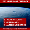
Actually, JB didn’t say 2025 wouldn’t be busy. He said it wouldn’t have the same level of impacts as 2024, which obviously wouldn’t be hard to do due to 2024’s extremely high level of impacts:
“Saffir-Simpson Hurricane Wind Scale Forecast
Named Storms: 15-19
Total Hurricanes: 7-9
Major Hurricanes: 2-3
ACE Index: 120-150
Impact Forecast
Tropical Storm Conditions: 5-7
Total Hurricanes: 3-4
Major Hurricanes: 1-2”
These numbers would mean very active with regard to impacts.
lexxnchloe
Member
lexxnchloe
Member
Brent
Member
Shaggy
Member
Been watching the Indian Ocean and there's been several over performers this season. Courtney was originally forecast to peak around 90kts but is now a cat 4

 www.tropicaltidbits.com

IR Satellite Loop for Tropical Cyclone COURTNEY | Tropical Tidbits
Tropical Cyclone COURTNEY IR Satellite Loop
Brent
Member
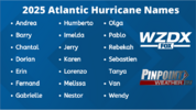
Beryl Helene and Milton retired
lexxnchloe
Member
lexxnchloe
Member
lexxnchloe
Member
Shaggy
Member
Interesting analogs with alot of EC hits between them.
96' Arthur, Bertha, Fran
99' Dennis, Floyd
06' Ernesto
08' Hannah
17' no hits
lexxnchloe
Member
From LC
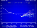
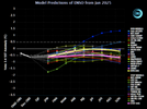
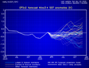
Note that the La Nina episode has largely translated into a negative/neutral ENSO register. If this signature holds through the coming summer, which I think likely, hot weather will emerge dominant in all but the Pacific Northwest and New England. Tropical cyclone potential will probably be a bit higher than last summer/fall. If the European model monthly forecasts are correct, this will be an active Gulf of Mexico scenario, first in the FL Panhandle, then the Mississippi Delta, and finally into Texas by Labor Day weekend. I suspect that the ECMWF idea of a weak El Nino, however, is incorrect. I favor a La Nina comeback (weak to moderate) in the ONDJF time frame before another trend toward warming and ENSO 3.4.
Note that the La Nina episode has largely translated into a negative/neutral ENSO register. If this signature holds through the coming summer, which I think likely, hot weather will emerge dominant in all but the Pacific Northwest and New England. Tropical cyclone potential will probably be a bit higher than last summer/fall. If the European model monthly forecasts are correct, this will be an active Gulf of Mexico scenario, first in the FL Panhandle, then the Mississippi Delta, and finally into Texas by Labor Day weekend. I suspect that the ECMWF idea of a weak El Nino, however, is incorrect. I favor a La Nina comeback (weak to moderate) in the ONDJF time frame before another trend toward warming and ENSO 3.4.
From LC
Note that the La Nina episode has largely translated into a negative/neutral ENSO register. If this signature holds through the coming summer, which I think likely, hot weather will emerge dominant in all but the Pacific Northwest and New England. Tropical cyclone potential will probably be a bit higher than last summer/fall. If the European model monthly forecasts are correct, this will be an active Gulf of Mexico scenario, first in the FL Panhandle, then the Mississippi Delta, and finally into Texas by Labor Day weekend. I suspect that the ECMWF idea of a weak El Nino, however, is incorrect. I favor a La Nina comeback (weak to moderate) in the ONDJF time frame before another trend toward warming and ENSO 3.4.
It’s hard to believe that the Gulf will have more activity than last year’s epic level of activity there though LC is not outrightly saying that. I hope not.
NoSnowATL
Member
Hurricane season has been slow in my parts since 2018.
lexxnchloe
Member
lexxnchloe
Member
NoSnowATL
Member
Oceans are warm. Gotcha
Shaggy
Member
Yet another big tine over performer. This was originally suppose to peak at 90kt but ramped up and is currently 125kt

 www.tropicaltidbits.com

IR Satellite Loop for Tropical Cyclone ERROL | Tropical Tidbits
Tropical Cyclone ERROL IR Satellite Loop
lexxnchloe
Member

