-
Hello, please take a minute to check out our awesome content, contributed by the wonderful members of our community. We hope you'll add your own thoughts and opinions by making a free account!
You are using an out of date browser. It may not display this or other websites correctly.
You should upgrade or use an alternative browser.
You should upgrade or use an alternative browser.
Wintry 12/4-6 Winter Weather Potential
- Thread starter SD
- Start date
SimeonNC
Member
I won't be surprised if CLT, especially the northern burbs get in on some ZR out of this, especially since the 18z Euro keeps a lot of wintry going on into the afternoon for the I-40 corridor.
- Joined
- Jan 23, 2021
- Messages
- 4,595
- Reaction score
- 15,183
- Location
- Lebanon Township, Durham County NC
See: January 5th last yearIt'll be interesting to see if we can get the initial thump of waa/fgen to over perform before the column warms significantly. Overall has the makings of a system to do it, you can see the hints on the models already
- Joined
- Jan 23, 2021
- Messages
- 4,595
- Reaction score
- 15,183
- Location
- Lebanon Township, Durham County NC
#5 analog on the CIPS guidance from hour 84 on the GFS is 11/19/2000.
Bigedd09
Member
#5 analog on the CIPS guidance from hour 84 on the GFS is 11/19/2000.
What are the first 4?
Sent from my iPhone using Tapatalk
I will say that system did see a general push of everything south in the modeling over the last 24 hours leading up to it.#5 analog on the CIPS guidance from hour 84 on the GFS is 11/19/2000.
Link? I can't find mine anymore.#5 analog on the CIPS guidance from hour 84 on the GFS is 11/19/2000.
And yes that is a decent analog here
iwantsouthernsnow123
Member
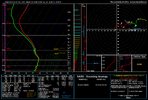
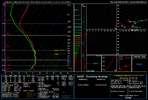
Yep until the next day when NAM takes it all away from us.I love how there's always one layer that's like a stove top. Take out the dookie layer and id boogie with this soundingView attachment 177781
Bigedd09
Member
Looks like the NAM is gonna be warm
Sent from my iPhone using Tapatalk
Sent from my iPhone using Tapatalk
Bigedd09
Member
NAM has precip moving in pretty early but all rain unless you’re in Virginia. Brutal
Sent from my iPhone using Tapatalk
Sent from my iPhone using Tapatalk
Nam is probably all snow/sleet along and north of 158. Classic Roxboro, Oxford, South Hill event
Blue_Ridge_Escarpment
Member
3k NAM noticeably cooler vs 12k NAM
In this area we have to hit the initial shot hard, soundings aren't bad. Half assing the onset with patchy returns or hours of virga will just allow the mid levels to bake. The analog that @BullCityWx mentioned is a great example of going hard at onset and you have a decent stripe of winter precip 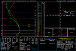

LukeBarrette
im north of 90% of people on here so yeah
Meteorology Student
Member
2024 Supporter
2017-2023 Supporter
Bigedd09
Member
Yeah icon warmer too
Sent from my iPhone using Tapatalk
Sent from my iPhone using Tapatalk
No need to sweat it . Monday into Tuesday gonna be the payday.Yeah icon warmer too
Sent from my iPhone using Tapatalk
iwantsouthernsnow123
Member
0z, 03z 09z 12z and 15z running tonight through tomorrow are going to be crucial runs as the vort has entered the US. We'll get OBS data. If these runs uptrend, then it's really worth looking into. But if you start to see downtrends after this. Many times it's time to pack it up. Only one way to find out what'll happen. Time
To me that looks like a much better overall set up than this Friday deal has ever shown, especially for areas south of I-40.No need to sweat it . Monday into Tuesday gonna be the payday.
Blue_Ridge_Escarpment
Member
Oh my, 0Z UK coming in much colder.
Webberweather53
Meteorologist
Bigedd09
Member
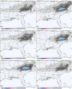
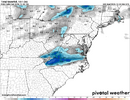
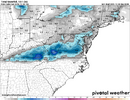
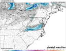
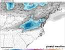
6z GFS
View attachment 177795
6z ICON
View attachment 177796
6z Ukmet
View attachment 177797
6Z ECMF-AIFS
View attachment 177798
6z RDPS
View attachment 177799
Then theres the 6z NAM
View attachment 177800
Well on to the next lol
Sent from my iPhone using Tapatalk
I filled you out a RX Prescription in the other thread. Take 2 and don't watch the models in 8 hours or your symptoms will come backWell on to the next lol
Sent from my iPhone using Tapatalk
Bigedd09
Member

Sent from my iPhone using Tapatalk
Bigedd09
Member

Sent from my iPhone using Tapatalk
All hail the GRAF
Sent from my iPhone using Tapatalk
Bigedd09
Member
Anyone have to 6z Euro?
Sent from my iPhone using Tapatalk
Sent from my iPhone using Tapatalk
Bigedd09
Member
Thanks. Congrats I40 north and Virginia
Sent from my iPhone using Tapatalk
Bigedd09
Member
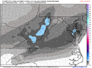
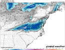
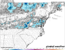
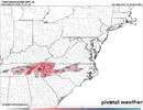
FWIW the 09z Rap had a solid burst of sleet for 85 north and solid burst of snow for I40 north
- Joined
- Jan 23, 2021
- Messages
- 4,595
- Reaction score
- 15,183
- Location
- Lebanon Township, Durham County NC
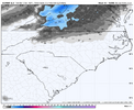
6z GFS showed how you make the absolute most of this scenario.
SnowNiner
Member
It does look like a solid VA advisory advent. Congrats @LukeBarrette. I think this will actually be a December to remember for you.
LukeBarrette
im north of 90% of people on here so yeah
Meteorology Student
Member
2024 Supporter
2017-2023 Supporter
Thanks man, I feeling confident right now for sure. Sometimes things work out but we will see!It does look like a solid VA advisory advent. Congrats @LukeBarrette. I think this will actually be a December to remember for you.
Bigedd09
Member
Man couldn't ask for better timing on Friday. 4am-7am precip arrival but still gonna be too warm for most of NC
Bigedd09
Member
HRRR also with a burst of sleet 85 north and snow 40 north
Blue_Ridge_Escarpment
Member
Looks identical to RAP. Same boundariesHRRR also with a burst of sleet 85 north and snow 40 north
BrickTamland
Member
Looks like a mix scenario here. Maybe just laying down the foundation for something bigger next Monday.
LukeBarrette
im north of 90% of people on here so yeah
Meteorology Student
Member
2024 Supporter
2017-2023 Supporter

