• Hello, please take a minute to check out our awesome content, contributed by the wonderful members of our community. We hope you'll add your own thoughts and opinions by making a free account!

Wintry 1/9-12 Winter Potential Great Dane or Yorkie

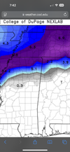
00z graphcast is fresh on the press and it still doesn't phase the cut off with the trough... produces a light event with very cold midlevel temps. Probably a good thing to keep it in the un-phased/surpressed column for now.

Edit: The 12z run actually did phase them and generate lots of precip/snow. So this was a step in the other direction.
 
That is well before the system begins to get going. 12 hours from there, we are all above 0c at every level.
Don't mean to nitpick here, but you said "The airmass out in front"... and the airmass out in front does matter for front end thumps. We can agree the airmass getting pulled up from the gulf from the waa is not cold.

If the surface low track is too far north, and waa is going to take you to from snow to rain... then you want as cold of an airmass as possible in place at the low to midlevels out ahead of it to capitalize on the front end before the change over.. and as depicted on the GFS, we have that here. That was my only point.
 
It's worth noting that the GEFS never actually ejects the Baja ULL. Nothing is clear-cut ATM other than a ULL will get buried in the SW rather than come eastward quickly.

It will take another day or two to get a good handle on what next weekend may bring.
1735998222417.png
1735998358390.png
 
Putting all emotions & crap the side.

I think we do need to get this first system out the way first. I also think our cold air feed can be better than modeled with what’s about to happen over the weekend to our North.
Yep, we have multiple ways to trend "colder" for this storm. Get rid of or weaken the great lakes low, or extend the 50/50 low extension further south and west out ahead of the storm, or do like the EURO AI and have the cold pressing down further from the northern stream as the storm arrives.

My hopium is we are pinging some of the warmest outcomes possible on the Euro/GFS right now.
 
Last edited:
although most models are now showing a decent winter storm over the midsouth it’s not good being in the bullseye five days away. I already know the end result of that. Congrats to the northern midsouth counties north of I40.
 

Attachments

  • IMG_7222.png
    IMG_7222.png
    1.6 MB · Views: 69
Don't mean to nitpick here, but you said "The airmass out in front"... and the airmass out in front does matter for front end thumps. We can agree the airmass getting pulled up from the gulf from the waa is not cold.

If the surface low track is too far north, and waa is going to take you to from snow to rain... then you want as cold of an airmass as possible in place at the low to midlevels out ahead of it to capitalize on the front end before the change over.. and as depicted on the GFS, we have that here. That was my only point.
Agreed…poor wording for the intentions of my point.
 
not a new opinion but more of a reminder: don’t think it’s worth punting this at all yet, with such high variance between both the individual models and their own run-to-run changes. We all wanna see some kind of agreement in the next couple days to either put us out of our misery or start reeling it in.

And of course, if it’s gonna miss right now, root for a miss south
 
I still feel that there will be give-and-take confusion until this Sunday-Monday system moves out. There's too much energy on the board to work anything out ATM.
It's fun (if frustrating) now, but when the slate is clean, we can really get down to business.
I’ve felt this for the last couple days. As you said, there is so much energy flying around, I think it’s very possible that we don’t really start seeing modeling come into better agreement until about Tuesday or Wednesday. Also I would point for that we are in a pattern where even an amped solution can certainly trend south over the 3 days leading to any storm. We are certainly see that right now with the Sunday/Monday system.
 
I don't believe nothing right now. I wont until there's model agreement and this thing gets within 4 days (not 5 or 6 as usual). But saying that, I did think the 6z euro AI was ok.

6hr QPF at day 7:
1736002552887.png

24hr:
1736002650992.png

850 temps at hour 162:
1736002856571.png

850 temps at hour 168:
1736002802985.png
Surface temps are very marginal (lots of 32/33 outside of elevation) but we'll see how that evolves if this setup occurs.
 
This is not in any way directed at anyone in particular. But I have heard over and over through the years that "we have to get the first system out of the way before models will know what to do with the second."

Can somebody tell me where that comes from? It sounds a lot like "When my gimp hip hurts, snow is on the way!"

It sounds illogical. I've never read any papers about it, and I haven't seen any meteorologist on TV or in an AFD talk about it, other than to say something like, 'We're focusing on system 1 before looking too closely at system 2."

It would make sense to me if the models calculated the atmosphere linearly, like looking down the barrel of a gun, seeing only one bullet at a time. But they don't work like that. Most of what we're looking at are global models. Does the first winter storm in the Midwest and Mid-Atlantic need to get out of the way before the models get a handle on the big rainstorm in Europe?
 
This is not in any way directed at anyone in particular. But I have heard over and over through the years that "we have to get the first system out of the way before models will know what to do with the second."

Can somebody tell me where that comes from? It sounds a lot like "When my gimp hip hurts, snow is on the way!

It sounds illogical. I've never read any papers about it, and I haven't seen any meteorologist on TV or in an AFD talk about it, other than to say something like, 'We're focusing on system 1 before looking too closely at system 2."

It would make sense to me if the models calculated the atmosphere linearly, like looking down the barrel of a gun, sewing only one bullet at a time. But they don't work like that. Most of what we're looking at are global models. Does the first winter storm in the Midwest and Mid-Atlantic need to get out of the way before the models get a handle on the big rainstorm in Europe?
Honestly, I say it purely off others saying it. Whether that’s people on here, I’ve seen veteran Mets saying it and etc. personally, it’s just me following the crowd on that specific topic. But always viewed the whole storm coming onshore data stuff the same way.
 
Honestly, I say it purely off others saying it. Whether that’s people on here, I’ve seen veteran Mets saying it and etc. personally, it’s just me following the crowd on that specific topic. But always viewed the whole storm coming onshore data stuff the same way.
Yeah, for sure. I've said it too. But I was just thinking about it recently and have been wondering what the actual science is behind it or if it even holds water at all.

I don't deny that one storm system can influence another, but the models should be taking all of that into account with their predictions.
 
This is not in any way directed at anyone in particular. But I have heard over and over through the years that "we have to get the first system out of the way before models will know what to do with the second."

Can somebody tell me where that comes from? It sounds a lot like "When my gimp hip hurts, snow is on the way!"

It sounds illogical. I've never read any papers about it, and I haven't seen any meteorologist on TV or in an AFD talk about it, other than to say something like, 'We're focusing on system 1 before looking too closely at system 2."

It would make sense to me if the models calculated the atmosphere linearly, like looking down the barrel of a gun, seeing only one bullet at a time. But they don't work like that. Most of what we're looking at are global models. Does the first winter storm in the Midwest and Mid-Atlantic need to get out of the way before the models get a handle on the big rainstorm in Europe?
My logic is that that models struggle with properly forecasting the cold air feed from snow cover. Getting through the first system helps fix that issue.
 
All comments regarding the need to kick tomorrow’s system out of the way are spot on. It’s always a grind down here with this stuff, even until all looks good but a special balloon release shows a warm layer @ 700mbs.


Social media madness is really going to crank up this week if the crap apps start posting nonsense like this. Both days can be drilled into and both show 2-3” for this particular location each day. This is how mass hysteria begins. IMG_3852.jpegIMG_3853.jpeg
 

Attachments

  • IMG_3852.jpeg
    IMG_3852.jpeg
    1.7 MB · Views: 20
This is not in any way directed at anyone in particular. But I have heard over and over through the years that "we have to get the first system out of the way before models will know what to do with the second."

Can somebody tell me where that comes from? It sounds a lot like "When my gimp hip hurts, snow is on the way!"

It sounds illogical. I've never read any papers about it, and I haven't seen any meteorologist on TV or in an AFD talk about it, other than to say something like, 'We're focusing on system 1 before looking too closely at system 2."

It would make sense to me if the models calculated the atmosphere linearly, like looking down the barrel of a gun, seeing only one bullet at a time. But they don't work like that. Most of what we're looking at are global models. Does the first winter storm in the Midwest and Mid-Atlantic need to get out of the way before the models get a handle on the big rainstorm in Europe?
I agree with you, but to throw something out there; I guess if there is a complex storm out front (1st) that could throw additional unknown variables into the calculations. Maybe...
 
My logic is that that models struggle with properly forecasting the cold air feed from snow cover. Getting through the first system helps fix that issue.
But is that more of a function of just working in closer to D0? Like if snow is already on the ground from 5 days ago and we're 5 days out from a potential storm, the models still struggle with temps and get better as we move toward D0.
 
This is not in any way directed at anyone in particular. But I have heard over and over through the years that "we have to get the first system out of the way before models will know what to do with the second."

Can somebody tell me where that comes from? It sounds a lot like "When my gimp hip hurts, snow is on the way!"

It sounds illogical. I've never read any papers about it, and I haven't seen any meteorologist on TV or in an AFD talk about it, other than to say something like, 'We're focusing on system 1 before looking too closely at system 2."

It would make sense to me if the models calculated the atmosphere linearly, like looking down the barrel of a gun, seeing only one bullet at a time. But they don't work like that. Most of what we're looking at are global models. Does the first winter storm in the Midwest and Mid-Atlantic need to get out of the way before the models get a handle on the big rainstorm in Europe?
Maybe this would be a thing if we were still trying to determine the strength of some sort of high pressure dropping in over snowpack. Not sure this would even apply here seeing that our high pressure chances have been replaced by a lakes low. This look can theoretically still work but it never checked the MSLP box for me which is the first thing I look at when scouting out snow chances over our way. We have the 50/50 low and the flow is indeed jammed but what we don’t have at the moment is high pressure funneling in up against it which is a bit of a red flag.
 
But is that more of a function of just working in closer to D0? Like if snow is already on the ground from 5 days ago and we're 5 days out from a potential storm, the models still struggle with temps and get better as we move toward D0.
I'm with you. Unless a particular model is not putting down snow and then suddenly begins to, this theory is completely bogus IMO. If the model has snow depth, it is already computing that. Nothing is going to change unless it puts down more (or less) snow specifically in that regard. There are other issues such as strength of a CAD wedge / high pressure (this is the main area where I think most get caught up in the models trend colder closer to verification).
 
This is not in any way directed at anyone in particular. But I have heard over and over through the years that "we have to get the first system out of the way before models will know what to do with the second."

Can somebody tell me where that comes from? It sounds a lot like "When my gimp hip hurts, snow is on the way!"

It sounds illogical. I've never read any papers about it, and I haven't seen any meteorologist on TV or in an AFD talk about it, other than to say something like, 'We're focusing on system 1 before looking too closely at system 2."

It would make sense to me if the models calculated the atmosphere linearly, like looking down the barrel of a gun, seeing only one bullet at a time. But they don't work like that. Most of what we're looking at are global models. Does the first winter storm in the Midwest and Mid-Atlantic need to get out of the way before the models get a handle on the big rainstorm in Europe?
I have always thought it was due to verification. If the first storm doesn’t verify, then can we trust the numbers and models on subsequent systems? But I am just a lay person.
 
This is not in any way directed at anyone in particular. But I have heard over and over through the years that "we have to get the first system out of the way before models will know what to do with the second."

Can somebody tell me where that comes from? It sounds a lot like "When my gimp hip hurts, snow is on the way!"

It sounds illogical. I've never read any papers about it, and I haven't seen any meteorologist on TV or in an AFD talk about it, other than to say something like, 'We're focusing on system 1 before looking too closely at system 2."

It would make sense to me if the models calculated the atmosphere linearly, like looking down the barrel of a gun, seeing only one bullet at a time. But they don't work like that. Most of what we're looking at are global models. Does the first winter storm in the Midwest and Mid-Atlantic need to get out of the way before the models get a handle on the big rainstorm in Europe?
There’s more uncertainty with an active pattern (ie shortwaves and mid latitude cyclones affecting the area) than with a zonal pattern.. and error is compounding, even with purely physics-based NWP (but especially with cascading ML-WX models).
 
Back
Top