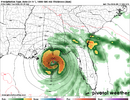
literal peak of season and can’t buy a swirl. sad!!!


literal peak of season and can’t buy a swirl. sad!!!
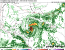
Gfs continues to be sloppy over the western A, Caribbean and GOM. Seems.it wants to spit out something again but too much going on all over the place. Wonder if the ukmet is picking up on one of those possibilities nowWhat’s this on the 12Z UKMET? For the first time, it has a TC (TD) in the C Gulf late in the run with it moving slowly WNW and strengthening:
NEW TROPICAL CYCLONE FORECAST TO DEVELOP AFTER 150 HOURS
FORECAST POSITION AT T+150 : 25.0N 90.7W
LEAD CENTRAL MAXIMUM WIND
VERIFYING TIME TIME POSITION PRESSURE (MB) SPEED (KNOTS)
-------------- ---- -------- ------------- -------------
0000UTC 22.09.2026 156 25.0N 90.4W 1008 23
1200UTC 22.09.2026 168 25.5N 91.7W 1005 31

What’s this on the 12Z UKMET? For the first time, it has a TC (TD) in the C Gulf late in the run with it moving slowly WNW and strengthening:
NEW TROPICAL CYCLONE FORECAST TO DEVELOP AFTER 150 HOURS
FORECAST POSITION AT T+150 : 25.0N 90.7W
LEAD CENTRAL MAXIMUM WIND
VERIFYING TIME TIME POSITION PRESSURE (MB) SPEED (KNOTS)
-------------- ---- -------- ------------- -------------
0000UTC 22.09.2026 156 25.0N 90.4W 1008 23
1200UTC 22.09.2026 168 25.5N 91.7W 1005 31

Certainly seeing a better signal from the euro now with a system lifting north in the fantasy range. Would say it makes its only slightly less likely that the gfs is still out to lunch.
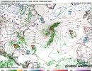
Certainly seeing a better signal from the euro now with a system lifting north in the fantasy range. Would say it makes its only slightly less likely that the gfs is still out to lunch.
Yeah they're sniffing out something don't know if it's going to actually be anything but there are certainly trying to sniff something outAnd ironically the crazy GFS has no Gulf TC on its 6Z for the 1st run since way back at 18Z of 9/14! It just has one moving just N of Cuba (not in Gulf) at 384.
Also, the wishy-washy 0Z UKMET had none.
Yeah they're sniffing out something don't know if it's going to actually be anything but there are certainly trying to sniff something out
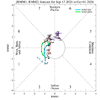
Yeah and even though the gfs OP dropped the GOM feature the ensemble is still showing strong signalsThe MJO is heading toward favorable phases for TCG at this time of year, which Joe Bastardi has been appropriately emphasizing in his call for activity:
View attachment 198117



NowQuestion: when can I visit Florida or the Caribbean when prices are low, crowds are light, and there is no chance of a hurricane for at least a week?
Answer: right now bro.
.


Projects like this are a sure sign that the 2026 Hurricane Season has been historically slow.I should probably put this in banter, but I hope we’re not spending a lot of money doing research on reclassifying TCs from 50 years ago while they were in the open Atlantic.
Fluff the numbers, not surprisingProjects like this are a sure sign that the 2026 Hurricane Season has been historically slow.
Looks like it will get a name. If it was moving westbound in the Atlantic we would ve watching it closely because it looks decent(for the year we are having)99L is now a cherry:
1. Eastern Subtropical Atlantic (AL99):
Showers and thunderstorms have changed little in organization since
this morning in association with an area of low pressure located
several hundred miles southwest of the Azores. However, just a small
increase in organization is likely to result in the formation of a
tropical depression as soon as later today. The system is expected
to move slowly over the next couple of days remaining southwest of
the Azores, followed by a turn to the southwest by early next week,
when environmental conditions are forecast to become less favorable
for additional development.
* Formation chance through 48 hours...high...70 percent.
* Formation chance through 7 days...high...70 percent.
Looks like it will get a name. If it was moving westbound in the Atlantic we would ve watching it closely because it looks decent(for the year we are having)