Brent
Member
Back in the old days haha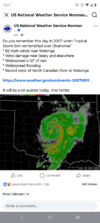



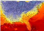
Maybe the GFS is showing the beginning of another ice age. The GFS is not the best forecast model in existence, even with all of the so called improvements, but it does have entertainment value sometimes.WHAT IN THE FROZEN FUCKNIPPLE FORECAST IS THE GFS DOING?!
Y’ALL… the GFS just rolled into August 29th and apparently decided summer has had enough ------- screen time.
This long range crackhead computer is dragging 50s DEEP SOUTH with 60s damn near sniffing the Gulf Coast.
HOW THE HELL WE GO FROM HUMIDITITTIES™ sweating through three bras and a lawn chair… to GLACIERGASM NIPNUGGETS hard enough to pick up FM radio?!
That ain’t a cold front. That’s a TITTYHIBERNATION EVENT.
Folks gonna walk outside expecting their usual 7AM Swamp Crotch Soufflé and get tittyslapped by a breeze fresh out the refrigerated section at Walmart.
BUT CALM THE F#%K DOWN.
This bastard is 270 HOURS OUT.
DO NOT drag the hoodies out.
DO NOT cook a 14 gallon pot of chili.
DO NOT summon Pumpkin Spice Patricia.
DO NOT post “FALL IS HEREwhile your damn AC is still fighting for workers’ comp.
At 270 hours, the GFS has the emotional stability of a gas station shopping cart rolling downhill during a hurricane.
This is ONE MODEL RUN, NOT A FORECAST. That cold air could shift, weaken, disappear, or wake up tomorrow and decide Nebraska is good enough.
But if this ---- actually verifies August 29th…
HUMIDITITTIES™GLACIERGASM NIPNUGGETS™
That transition deserves its own damn warning polygon.
Stay Petty AF.

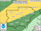
Now this is hilarious... But remember, this is in the morning.WHAT IN THE FROZEN FUCKNIPPLE FORECAST IS THE GFS DOING?!
Y’ALL… the GFS just rolled into August 29th and apparently decided summer has had enough ------- screen time.
This long range crackhead computer is dragging 50s DEEP SOUTH with 60s damn near sniffing the Gulf Coast.
HOW THE HELL WE GO FROM HUMIDITITTIES™ sweating through three bras and a lawn chair… to GLACIERGASM NIPNUGGETS hard enough to pick up FM radio?!
That ain’t a cold front. That’s a TITTYHIBERNATION EVENT.
Folks gonna walk outside expecting their usual 7AM Swamp Crotch Soufflé and get tittyslapped by a breeze fresh out the refrigerated section at Walmart.
BUT CALM THE F#%K DOWN.
This bastard is 270 HOURS OUT.
DO NOT drag the hoodies out.
DO NOT cook a 14 gallon pot of chili.
DO NOT summon Pumpkin Spice Patricia.
DO NOT post “FALL IS HEREwhile your damn AC is still fighting for workers’ comp.
At 270 hours, the GFS has the emotional stability of a gas station shopping cart rolling downhill during a hurricane.
This is ONE MODEL RUN, NOT A FORECAST. That cold air could shift, weaken, disappear, or wake up tomorrow and decide Nebraska is good enough.
But if this ---- actually verifies August 29th…
HUMIDITITTIES™GLACIERGASM NIPNUGGETS™
That transition deserves its own damn warning polygon.
Stay Petty AF.
welp, it is right that it is showing a cold front friday. gfs is showing it and some euro models. LFG front!Now this is hilarious... But remember, this is in the morning.


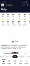
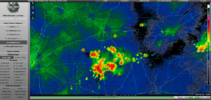
Glad someone is getting in on it. Can confirm between 540 and the beltline, I can hear it but zilch. Sun is out.I've been hearing a few rumbles of thunder at the office in Cary and looking at radar, it looks like a train of showers and thunderstorms is about to pass over my residence near Lake Wheeler. It's been dry for the past ten days so any rainfall at my house is appreciated. The grass in the yard was getting crunchy again.

It tried and failed, but at least the ground got wet here.Looks like another line is about to set up just north of the belt line
Sent from my iPhone using Tapatalk






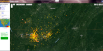
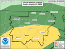


it was quite the light show. essentially constant for two+ hours.The best kind of nightlight is when the lightning printer goes brrrr
View attachment 197514
View attachment 197515


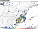
![soundings-[35.34,-79.02]-hrrr-refcmp-us_ma-2026082112-13.png](https://southernwx.nyc3.digitaloceanspaces.com/data/attachments/197/197537-02fde5a53e15737c121d9f4543ac7f98.jpg "soundings-[35.34,-79.02]-hrrr-refcmp-us_ma-2026082112-13.png")
It really was amazing, probably the most prolific lightning I've seen in a very long time. Out of curiosity I checked the Lightningtracker site and it logged over 20,000 flashes here, and you guys over in the Huntsville area went totally nuts with over 40,000 flashes.it was quite the light show. essentially constant for two+ hours.
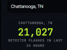
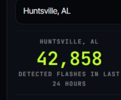

Wow. Yep, I was up from 10-12 because it was like the lights were on in my room. Somehow, my daughter's cat survived and was dry this morning. The wind blew a stop sign completely flat in the neighborhood. I need to check my roof when I get home in the daylight.It really was amazing, probably the most prolific lightning I've seen in a very long time. Out of curiosity I checked the Lightningtracker site and it logged over 20,000 flashes here, and you guys over in the Huntsville area went totally nuts with over 40,000 flashes.
View attachment 197525View attachment 197526
View attachment 197523View attachment 197524
Cooked beyond cooked. Heavy rain threat is REALLY bad. SVRs will be issued and Outages will occur.

I'll alert Harambe of this & see what we can do.View attachment 197523View attachment 197524
Cooked beyond cooked. Heavy rain threat is REALLY bad. SVRs will be issued and Outages will occur.

I got out of bed at 2am just to film the lightning. It was absolutely constant.It really was amazing, probably the most prolific lightning I've seen in a very long time. Out of curiosity I checked the Lightningtracker site and it logged over 20,000 flashes here, and you guys over in the Huntsville area went totally nuts with over 40,000 flashes.
View attachment 197525View attachment 197526
This storm in J- ville has a lot of lightningI got out of bed at 2am just to film the lightning. It was absolutely constant.
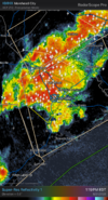

Not only that, but those storms were surprisingly massive and had a larger diameter than most coming through the region. Seemed more like a springtime mcs setup with stronger dynamics than a typical summer complex. Definitely a very cool sight to seeI got out of bed at 2am just to film the lightning. It was absolutely constant.