lexxnchloe
Member


Not really. The weather isnt linear. A pattern that produces a dead cane season might also be a pattern that increases insurance claims for other weather disasters.Boy insurance companies and saving billions in clams.
True but we haven’t had a major disaster all year.Not really. The weather isnt linear. A pattern that produces a dead cane season might also be a pattern that increases insurance claims for other weather disasters.

Indiana, Utah, Washington state have had it rough with historical flooding and Fire wx burning 100's structures down. Probably need to throw Nebraska in there as I swear they have Tornado warnings every other day this summer along with IllinoisTrue but we haven’t had a major disaster all year.

True, looks like 2026 is ranked in 7th on the number of $$$ disasters. The list goes back to 1980.Indiana, Utah, Washington state have had it rough with historical flooding and Fire wx burning 100's structures down. Probably need to throw Nebraska in there as I swear they have Tornado warnings every other day this summer along with Illinois
They all add up, big and smallTrue but we haven’t had a major disaster all year.
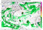
RIP sharks and jellyfishGFS says the euro is right about Sept/OCT being active
View attachment 197472
3 named storms at 1 time in the ATL
It will work out one of these timesNot "the Ridge over troubled waters" call shot!

Most models show a very early recurve and that's supported by the ensembles. That would make the ukmet a bit of an outlier.The 0Z UKMET has TCG 30 hours earlier than the 12Z and is back to having a TS. At 168, it is just E of the Leewards moving rapidly WNW:
NEW TROPICAL CYCLONE FORECAST TO DEVELOP AFTER 78 HOURS
FORECAST POSITION AT T+ 78 : 11.9N 29.3W
LEAD CENTRAL MAXIMUM WIND
VERIFYING TIME TIME POSITION PRESSURE (MB) SPEED (KNOTS)
-------------- ---- -------- ------------- -------------
1200UTC 26.08.2026 84 12.1N 30.6W 1009 28
0000UTC 27.08.2026 96 12.4N 34.7W 1007 32
1200UTC 27.08.2026 108 12.7N 38.6W 1004 35
0000UTC 28.08.2026 120 13.4N 42.8W 1005 38
1200UTC 28.08.2026 132 14.2N 47.1W 1004 43
0000UTC 29.08.2026 144 15.1N 51.8W 1006 39
1200UTC 29.08.2026 156 16.1N 56.4W 1007 41
0000UTC 30.08.2026 168 17.2N 60.9W 1008 36
Most models show a very early recurve and that's supported by the ensembles. That would make the ukmet a bit of an outlier.


How long we gotta wait for them out to sea curving Cape Verdes? We’re a week away from September!
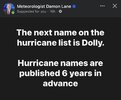
Sweet. @SD start the thread. Ready the AI graphics. We got thousands of miles for potential TC Dolly to gain intensity!The TW just off Africa is now Invest 96L and it’s up to 30%/60% in the TWO.

Sweet. @SD start the thread. Ready the AI graphics. We got thousands of miles for potential TC Dolly to gain intensity!
Seriously though, it's good to have something to track.
RIP Dolly

Wow! RIP Dolly.
The timing with the next named storm is crazy.

It is ironic that we were making Dolly Parton jokes in conjunction with what may become Dolly on the horizon and she passes away. She sang and wrote a lot of memorable songs and her persona was bigger than life.Wow! RIP Dolly.
The timing with the next named storm is crazy.
Coincidences are scary, make you wonderWow! RIP Dolly.
The timing with the next named storm is crazy.
It is ironic that we were making Dolly Parton jokes in conjunction with what may become Dolly on the horizon and she passes away. She sang and wrote a lot of memorable songs and her persona was bigger than life.
Naw we still got time to name thunderstorm complex’s or naked swirls.So far this hurricane season has been one of the least active in recent memory. I think the NWS was generous to classify the three storms that reached naming status and we should be sitting at a goose egg as far as activity. It is Cape Verde season and still have time to go before we reach the peak of hurricane season but with the shredder that is still operating over the Atlantic basin, it is hard to see anything with hurricane potential developing until conditions improve.

RIP Dolly