• Hello, please take a minute to check out our awesome content, contributed by the wonderful members of our community. We hope you'll add your own thoughts and opinions by making a free account!

Pattern July Fry

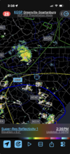
Story of the year here in Monroe - splitsville again around 4pm. Looked promising for 10 minutes and then splitsville over my house (per the usual expectation) - starting to support the JHS mentality. Not sure what it takes to have a gully washer these days - but I must not be living right. I had a 4" dbh red oak limb break and endless leaf debris scattered in the front yard with maybe 100 drops of rain.

Really starting to see the dehydration of essentially everything here in Monroe - and I know its not the whole county (Union) its Monroe & Unionville that stands out.

 
We e missed out the past 3 days while Charlotte been getting nailed. Can we screw this up?
8a86dc220e58104da85c953ae871645b.jpg


Sent from my iPhone using Tapatalk
 
It's raining a lot! Most of NC is in a slight risk for excessive rainfall tomorrow. All ensembles have finally eliminated (or greatly) reduced the lee side minimum over the next 2 weeks. Could be the beginning of thr end for the drought with super el nino kicking into gear. STJ will hopefully fire up in August.
 
Let's see if MBY can somehow manage to dodge meaningful rainfall again today. It's been amazing to watch storms dance around me for much of the summer. I even managed to pull off our annual July 4th gathering rain-free while areas just to my west were hammered.

A nearby T-storm brought some big wind gusts yesterday and brought down a huge branch that landed only a couple of feet from my dog as she was hanging out in her mud hole. She wouldn't leave my side for hours after that one!
 
3rd time in the last week where I have been split by the storms, and I'm currently under a severe thunderstorm warning for essentially nothing again.

It's actual comedy. That said, the greenery is still dark green outside and you can literally probably go a few miles to my north for there to have at least been an inch of rain.
 
3rd time in the last week where I have been split by the storms, and I'm currently under a severe thunderstorm warning for essentially nothing again.

It's actual comedy. That said, the greenery is still dark green outside and you can literally probably go a few miles to my north for there to have at least been an inch of rain.
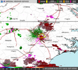
Same thing here! Split city, to my north, south and east. Same places seem to get it over and over.
 
1. Today it hit 100 for the high at KSAV for the 3rd day in a row, which hadn’t happened since that unforgettable record hot late May of 2019!

2. Although the chance wasn’t even mentioned since it was only 10%, the Savannah area had sudden evening pop-ups as a result of an outflow boundary coming S from earlier SC convection that collided with a W moving seabreeze per radar. It’s so cool to see these collisions!

At my home, I had a big temp. drop along with gusty winds and loud thunder. Several gusts to 43 mph were measured just off of Tybee.

I had two short periods of rain, but together they amounted to only ~0.01”. Other areas in the county like to the SW, to the S (Montgomery), and to the SE, especially Skidaway Island, had significant to heavy amounts. As a matter of fact:

PRELIMINARY LOCAL STORM REPORT
NATIONAL WEATHER SERVICE CHARLESTON SC
1042 PM EDT SAT JUL 11 2026

.TIME... ...EVENT... ...CITY LOCATION... ...LAT.LON

.DATE... ....MAG.... ..COUNTY LOCATION..ST.. ...SOURCE.

..REMARKS..

1015 PM RAIN 1 NE SKIDAWAY ISLAND 31.95N 81.04W
07/11/2026 M2.51 INCH CHATHAM GA MESONET

UGA34 REPORTS 2.51 INCHES OF RAIN FELL OVER THE PAST 3
HOURS.
 
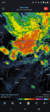
After church while Im scoffing down some Fried Chicken today. This is future radar at 1pm. Cluster leaving shettley and Jimmy moving sw to ne. Hopefully it verefies and gets us all throughout afternoon. Had another hit last night pushing the ole backyard over 2 inches past 7 days.

1783855778614.jpeg
 
First a disclaimer. You will notice that the climate average for temperature in the lower 48 states is essentially Central, East hot vs. cool/neutral West. The model and analog projections, of course, are the exact opposite of the list of projections for July. The massive heat wave that struck the eastern third of the USA in the first week of the month, which was correctly forecast, sets the table for the average, which in recent days has shifted leftward. All of the numerical models are showing an impressive, more inland +PNA/-AO signature at 500MB with a conjoined Sonoran +Arctic ridge structure, with emphasis on the strong heat ridge. Cold fronts of varying magnitude should suppress temperatures along and to the right of the Mississippi River.

What could break this pattern, which appears to continue in some way, shape, or form through the third week of September? A tropical system may arise between now and mid-August, when low-latitude westerlies common with an El Nino episode will lessen if not eradicate cyclone chances in the Atlantic Basin. If a weakness arises from the Gulf of Mexico or Florida into the Maritime Provinces, then perhaps a stronger tropical storm or hurricane could shake up the upper flow. The other issue is in the western/central Pacific Ocean, where the active impulse sequence could develop into a typhoon and flow into the polar westerlies. In that case, much cooler air would shift westward to the Continental Divide, leaving only the immediate West Coast to heat and dryness. Those scenarios seem somewhat unlikely, since a repeated theme in the model weeklies and monthlies is for the hottest air to be in an arc from California to Texas northward to the Dakotas and Montana. Which is the preferred case for the near term.

One more comment. The seasonal forecasts for the DJF semester are too far in advance to be useful. In fact the upper air projections of vigorous Canada-wide ridging and a broad semizonal flow across the lower 48 states would probably translate to a mild North vs. cool (not cold) South configuration similar to the 1983-84 or 1997-98 winters. We have entered a strong + ENSO 3.4 signature that most model guidance says will break down rapidly after mid-January, however, which might give some hopes for Americans wishing for cold along with ice and snow.

But don't get your hopes up just yet!


Prepared by Meteorologist LARRY COSGROVE on
Sunday, July 12, 2026 at 12:50 P.M. CT
 
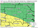
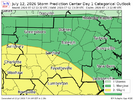
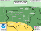
Slight risk has been shaved and moved out of my area, AGAIN!
1783859745948.png
 
Still haven't officially crossed 10" of year to date precipitation at the NOAA Myrtle Beach reporting station. 9.31" is the total after yesterday. Maybe we'll finally cross that mythical boundary today so we don't turn into west Texas.

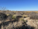
Places that get this little amount of rain usually look like this:

1783866465061.png
 
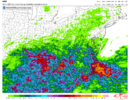
that is a pretty darn good signal for the foothills. a few models have caught onto the idea of some added oomph in the eastern high country with upslope flow as well

View attachment 196775
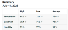
This map seems pretty accurate for my area. I've recorded about an inch and a half for the past couple of days. There have been some isolated storms around that have dropped extreme amounts though.
1783868880737.png
 
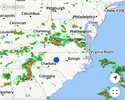
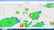
Radar is very quiet. This time yesterday it was already active. Cloud cover doing its thing.
 
Radar is very quiet. This time yesterday it was already active. Cloud cover doing its thing.
Noticed that too. Slight risk shaved even more. Possibly a good thing?!
 
May be famous last words, but I think today and tomorrow will be MUCH drier than forecast. Friday was the big day for this event and we missed.
 
I hit 100.9 at home at 2:24PM today and then 101.1 at 2:35PM, which are the hottest I’ve seen on my thermometer so far this summer!
The good news though is that I’ve already heard thunder and prospects for a much cooler late afternoon than the prior 3 days are very high due to outflow boundaries from nearby thunderstorms at the least, and probably also actual rainfall.

It has already dropped back quite a bit with 96.9 as of 2:51PM due to increased clouds and popups nearby.
 
Last edited:
I gotta say impressed with the inability for SPC or thunderstorms to find us/me. 4th day in a row. Likely a split. Again.

.18 total since Tuesday.
 

Attachments

  • Screenshot 2026-07-12 at 2.38.16 PM.png
    Screenshot 2026-07-12 at 2.38.16 PM.png
    1.7 MB · Views: 9
Thunderstorm incoming here.

7:10PM update: that gave me a very nice 1”+ over the last hour, heaviest rain since June 18th. This is already enough to allow me to stop the 3 times a week watering for now.

Only light rain now. But looks like there will be additional significant rains starting soon per radar.

Update 10:44 AM 7/13: I ended up with a very nice grand total of ~1.5” yesterday (7/12), which gets me to ~1.9” MTD.
 
Last edited:
that is a pretty darn good signal for the foothills. a few models have caught onto the idea of some added oomph in the eastern high country with upslope flow as well

View attachment 196775
This isn't going to come close to verifying. Much of upstate SC has not had 1 drop of rain today and with CAD building in tomorrow will be even drier than today. The drought marches on.
 
Back
Top