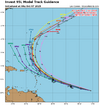
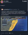
It's really hard to get a pure TC into the east coast much above 30N in October. Something to keep in mind about Hazel is it was MOVING and beginning extra-tropical transition as it made landfall. Westerlies and cooler water wait for no one.
-
Hello, please take a minute to check out our awesome content, contributed by the wonderful members of our community. We hope you'll add your own thoughts and opinions by making a free account!
You are using an out of date browser. It may not display this or other websites correctly.
You should upgrade or use an alternative browser.
You should upgrade or use an alternative browser.
Tropical 2025 Tropical Thread
- Thread starter SD
- Start date
The E MDR AOI is now Invest 95L:
Tropical Weather Outlook
NWS National Hurricane Center Miami FL
800 AM EDT Sun Oct 5 2025
For the North Atlantic...Caribbean Sea and the Gulf of America:
1. Tropical Atlantic (AL95):
A broad area of low pressure associated with a tropical wave
continues to produce a large area of disorganized showers and
thunderstorms several hundred miles south-southwest of the Cabo
Verde Islands. Environmental conditions appear conducive for
additional development of this system, and a tropical depression is
likely to form this week as the system moves quickly across the
central tropical Atlantic, approaching portions of the Leeward
Islands by the latter part of this week.
* Formation chance through 48 hours...medium...40 percent.
* Formation chance through 7 days...high...70 percent.
Shaggy
Member
Looks good on satellite and should make a new named storm. Sticking to the seasonal trend of early recurves so no worries with this one.The E MDR AOI is now Invest 95L:
Tropical Weather Outlook
NWS National Hurricane Center Miami FL
800 AM EDT Sun Oct 5 2025
For the North Atlantic...Caribbean Sea and the Gulf of America:
1. Tropical Atlantic (AL95):
A broad area of low pressure associated with a tropical wave
continues to produce a large area of disorganized showers and
thunderstorms several hundred miles south-southwest of the Cabo
Verde Islands. Environmental conditions appear conducive for
additional development of this system, and a tropical depression is
likely to form this week as the system moves quickly across the
central tropical Atlantic, approaching portions of the Leeward
Islands by the latter part of this week.
* Formation chance through 48 hours...medium...40 percent.
* Formation chance through 7 days...high...70 percent.
Looks good on satellite and should make a new named storm. Sticking to the seasonal trend of early recurves so no worries with this one.
The Conus looks safe from this assuming it becomes a TD well out in the MDR. But the Leewards to near PR could still be threatened late week.
Assuming this develops well before the Lesser Antilles, the only potential threats to the SE anytime soon would appear to be from home-brew/much closer formations.
Although TS Chantal and offshore H Erin had significant impacts on parts of NC that I don’t think should be downplayed, the Conus has yet to be impacted with hurricane conditions. Will the Conus get lucky in that regard this year? Only 20% of full seasons have had no H impacts. The last one was in 2015. Only 6 La Niña seasons have had none though fairly recent ones like 2010 and 2000 are among the six. Many more (15) were during El Niño, which of course is intuitive.
Last edited:
Regarding Invest 95L:
12Z UKMET: further SW than 0Z run as it goes WNW to Leewards and PR followed by NW and then NNW turn to near Erin’s position NE of Turks/Caicos (pretty weak and a little weaker than 0Z) with a safe recurve from the Conus as it is taken out by an upper trough:
NEW TROPICAL CYCLONE FORECAST TO DEVELOP AFTER 78 HOURS
FORECAST POSITION AT T+ 78 : 13.6N 53.2W
LEAD CENTRAL MAXIMUM WIND
VERIFYING TIME TIME POSITION PRESSURE (MB) SPEED (KNOTS)
-------------- ---- -------- ------------- -------------
0000UTC 09.10.2025 84 14.2N 55.1W 1009 36
1200UTC 09.10.2025 96 15.4N 58.6W 1009 37
0000UTC 10.10.2025 108 16.5N 61.9W 1008 33
1200UTC 10.10.2025 120 17.1N 64.7W 1009 34
0000UTC 11.10.2025 132 18.9N 67.3W 1008 33
1200UTC 11.10.2025 144 20.5N 69.1W 1008 38
0000UTC 12.10.2025 156 22.3N 70.6W 1007 34
1200UTC 12.10.2025 168 24.2N 71.4W 1006 33
—————
Edit: Does anyone know how to save an image from Pivotal if not a member without having to do a screenshot?

Last edited:
Shaggy
Member
Northern stream gets cranking on the 06z gfs. Nothing threatening in the long range but it would be time to watch the GOM for any development as it would most likely get yanked north quickly into the parade of troughs
CAG looks like it wants to crank.Northern stream gets cranking on the 06z gfs. Nothing threatening in the long range but it would be time to watch the GOM for any development as it would most likely get yanked north quickly into the parade of troughs
Tsappfrog20
Member
Hello Euro.. that’s a different solution
Sent from my iPhone using Tapatalk
Sent from my iPhone using Tapatalk
Downeastnc
Member
lexxnchloe
Member
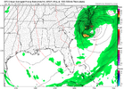
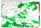
Not sure what to make of this...hybrid/sub tropical/noreaster....hangs out for awhile not optimal a week before deer season opens...the mosquito hatch will be epic given how dry it is.
View attachment 175380
Downeastnc
Member
95L probably a TD at the least and they could probably go ahead and just name it based on the overnight sat loop.
Brent
Member
Brent
Member
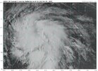
Lol not sure what the NHC is waiting forView attachment 175385
Per a well-known Houston tropical pro-met who often downplays:
Scatterometer hit (finally) at 0930Z indicated a closed circulation and some 35kt wind. Likely already a TS. Should recurve east of the islands.
Brent
Member
Going straight to Jerry it appears
AL, 10, 2025100712, , BEST, 0, 113N, 438W, 40, 1006, TS, 34, NEQ, 120, 90, 0, 0, 1012, 130, 20, 0, 0, L, 0, , 0, 0, JERRY, S, 0, , 0, 0, 0, 0, genesis-num, 029, TRANSITIONED, alB52025 to al102025,
AL, 10, 2025100712, , BEST, 0, 113N, 438W, 40, 1006, TS, 34, NEQ, 120, 90, 0, 0, 1012, 130, 20, 0, 0, L, 0, , 0, 0, JERRY, S, 0, , 0, 0, 0, 0, genesis-num, 029, TRANSITIONED, alB52025 to al102025,
Shaggy
Member
Woof
IR Satellite Loop for Typhoon HALONG | Tropical Tidbits https://www.tropicaltidbits.com/sat/satlooper.php?region=28W&product=ir
IR Satellite Loop for Typhoon HALONG | Tropical Tidbits https://www.tropicaltidbits.com/sat/satlooper.php?region=28W&product=ir
NoSnowATL
Member
That’s what a hurricane should look like.Woof
IR Satellite Loop for Typhoon HALONG | Tropical Tidbits https://www.tropicaltidbits.com/sat/satlooper.php?region=28W&product=ir
Shaggy
Member
Those mesovorticies
Visible Satellite Loop for Himawari-9 Meso Sector | Tropical Tidbits https://www.tropicaltidbits.com/sat/satlooper.php?region=himawari9-meso&product=vis
Visible Satellite Loop for Himawari-9 Meso Sector | Tropical Tidbits https://www.tropicaltidbits.com/sat/satlooper.php?region=himawari9-meso&product=vis
Invest 96L up near 45N NW of the Azores
is almost certainly going to get named (whether subtropical or tropical) imho based on this special TWO and Papin being in the house! 8PM TWO % will likely rise substantially from this:
Special Tropical Weather Outlook
NWS National Hurricane Center Miami FL
635 PM EDT Thu Oct 9 2025
For the North Atlantic...Caribbean Sea and the Gulf of America:
Special outlook issued to update information about the gale-force
low located several hundred miles northwest of the Azores.
Active Systems:
The National Hurricane Center is issuing advisories on Tropical
Storm Jerry, located just southeast of the northern Leeward Islands.
1. North Atlantic (AL96):
Updated: Showers and thunderstorms have become better organized
today in association with a gale-force area of low pressure located
several hundred miles to the northwest of the Azores. If these
development trends continue, a subtropical or tropical storm could
form as soon as tonight while the system moves slowly northwestward.
Over the weekend, the system is expected to move over even cooler
waters, ending its chances of further development. For more
information on this system, including gale warnings, see High Seas
Forecasts issued by the National Weather Service and Meteo France.
* Formation chance through 48 hours...medium...40 percent.
* Formation chance through 7 days...medium...40 percent.
High Seas Forecasts issued by the National Weather Service
can be found under AWIPS header NFDHSFAT1, WMO header FZNT01
KWBC, and online at ocean.weather.gov/shtml/NFDHSFAT1.php
High Seas Forecasts issued by Meteo France can be found under WMO
header FQNT50 LFPW and available on the web at
Forecaster Papin/Roberts
Brent
Member
Invest 96L up near 45N NW of the Azores
is almost certainly going to get named (whether subtropical or tropical) imho based on this special TWO and Papin being in the house! 8PM TWO % will likely rise substantially from this:
Special Tropical Weather Outlook
NWS National Hurricane Center Miami FL
635 PM EDT Thu Oct 9 2025
For the North Atlantic...Caribbean Sea and the Gulf of America:
Special outlook issued to update information about the gale-force
low located several hundred miles northwest of the Azores.
Active Systems:
The National Hurricane Center is issuing advisories on Tropical
Storm Jerry, located just southeast of the northern Leeward Islands.
1. North Atlantic (AL96):
Updated: Showers and thunderstorms have become better organized
today in association with a gale-force area of low pressure located
several hundred miles to the northwest of the Azores. If these
development trends continue, a subtropical or tropical storm could
form as soon as tonight while the system moves slowly northwestward.
Over the weekend, the system is expected to move over even cooler
waters, ending its chances of further development. For more
information on this system, including gale warnings, see High Seas
Forecasts issued by the National Weather Service and Meteo France.
* Formation chance through 48 hours...medium...40 percent.
* Formation chance through 7 days...medium...40 percent.
High Seas Forecasts issued by the National Weather Service
can be found under AWIPS header NFDHSFAT1, WMO header FZNT01
KWBC, and online at ocean.weather.gov/shtml/NFDHSFAT1.php
High Seas Forecasts issued by Meteo France can be found under WMO
header FQNT50 LFPW and available on the web at
Forecaster Papin/Roberts
Please become Karen so it goes away quickly
Please become Karen so it goes away quickly

Folks,
As weird as this season has been, it may get weirder!
A look just now at historical genesis locations on record tells me that Invest 96L, already way up near 44.5N, could easily become the furthest N genesis for either a TC or STC as the furthest N on record is 42N (unnamed storm in 1952)! And it figures this would be named Karen, which almost certainly means she’ll be back in 2031, consistent with her plan to get named that far N:

1952 Atlantic hurricane season - Wikipedia
Interesting that a named storm could (potentially) form that far north, while the SE coast nor'easter this weekend likely won't qualify.Folks,
As weird as this season has been, it may get weirder!
A look just now at historical genesis locations on record tells me that Invest 96L, already way up near 44.5N, could easily become the furthest N genesis for either a TC or STC as the furthest N on record is 42N (unnamed storm in 1952)! And it figures this would be named Karen, which almost certainly means she’ll be back in 2031, consistent with her plan to get named that far N:

1952 Atlantic hurricane season - Wikipedia
en.wikipedia.org
Like her or not, Karen, who complained to forecaster Papin about not being heard, looks to be coming, folks, with her chances up to 60%/60%!
Tropical Weather Outlook
NWS National Hurricane Center Miami FL
800 PM EDT Thu Oct 9 2025
For the North Atlantic...Caribbean Sea and the Gulf of America:
Active Systems:
The National Hurricane Center is issuing advisories on Tropical
Storm Jerry, located just southeast of the northern Leeward Islands.
1. North Atlantic (AL96):
Showers and thunderstorms continue to show signs of organization
with a small gale-force area of low pressure located several hundred
miles to the northwest of the Azores. Only a small increase in
organization could result in the formation of a subtropical
or tropical storm as soon as tonight, as the system moves slowly
northwestward. Over the weekend, the system is expected to move
over cooler waters, ending its chances of further development. For
more information on this system, including gale warnings, see High
Seas Forecasts issued by the National Weather Service and Meteo
France.
* Formation chance through 48 hours...medium...60 percent.
* Formation chance through 7 days...medium...60 percent.
Forecaster Papin

Last edited:
Brent
Member
And we have Karen
It'll be gone before the weekend
It'll be gone before the weekend
And we have Karen
It'll be gone before the weekend
Karen complained and got the notoriety she desired, the furthest N on record TS or STS genesis! The complainer sort of obliterated the old record of 42N set in 1952 with her 44.5! What a ham she is! Can she become a hurricane?
Karen: can I speak to your landmassAnd we have Karen
It'll be gone before the weekend
Karen: can I speak to your landmass
Karen is not surprisingly demanding her own thread but Shane may not let her have it. I wouldn’t blame him if he doesn’t. I’m tired of her always demanding she get her own way.
As recently as 635pm, Karen was given only a 40% total chance she would ever develop into a TC. Took her less than 5 hours later to make her debut. 
She literally had her fifteen minutes of fame becoming a tropical storm at that latitude.Karen is no more.
Brent
Member
Despite me now having fun with the Karen silliness because it really is ridiculously silly, I fully see Mike’s point. When I first started hearing about using the name “Karen” as an insult, a part of me immediately actually disliked it partially because I had known several Karens and they were fine people. But since then I lightened up about it and figured many people named Karen probably laugh along with the silliness.
Brent, if your name started to be used in a similar silly way, would you just laugh along with it? I’m guessing you’d think it was hilarious. In my case, I would laugh.
Yeah I mean I just assumed people already knew Karen gets a different kind of vibe... I mean people were talking about it being on the list before the season even started
JB isn’t happy:
Laughable NHC Antics
The naming of Karen in the North Atlantic as a subtropical storm is laughable to me, but it has now become a talking point for people pushing missives about climate change. This despite a season that has fallen short of the means of the last 5 seasons, and one of them with a strong el Niño.
It underscores what I have been trying to push for close to 2 decades. If you want to name these systems that develop a warmer core within the realm of a colder environment, then you need a 2 tier season. That you would have something like this, which has a nice structure but is a warmer feature within the colder environment and over water temps that are 2-4C °C degrees below the threshold of 26C we use for storms, is a joke to me.
In the meantime, look at this on Sept 16 from a storm that developed over the Gulf Stream did this to SE Va, along with causing the collapse of houses into the ocean on the Outer Banks
It was totally ignored by the National Hurricane Center. This has been going on since I can remember. I will watch storms get named in the middle of nowhere (we call them ham sandwiches at weatherbell.com), where no one can actually see what they do, but then we see features like this, which are enough to feed back and convert rapidly to at least subtropical systems and hit people, and no one says boo.
But a massive overhaul has to be done at the NHC. There is too much subjectivity and that shackles people relying on their expertise, which, btw is considerable, on these matters.
—————-
Any thoughts?
Brent
Member
JB isn’t happy:
Laughable NHC Antics
The naming of Karen in the North Atlantic as a subtropical storm is laughable to me, but it has now become a talking point for people pushing missives about climate change. This despite a season that has fallen short of the means of the last 5 seasons, and one of them with a strong el Niño.
It underscores what I have been trying to push for close to 2 decades. If you want to name these systems that develop a warmer core within the realm of a colder environment, then you need a 2 tier season. That you would have something like this, which has a nice structure but is a warmer feature within the colder environment and over water temps that are 2-4C °C degrees below the threshold of 26C we use for storms, is a joke to me.
In the meantime, look at this on Sept 16 from a storm that developed over the Gulf Stream did this to SE Va, along with causing the collapse of houses into the ocean on the Outer Banks
It was totally ignored by the National Hurricane Center. This has been going on since I can remember. I will watch storms get named in the middle of nowhere (we call them ham sandwiches at weatherbell.com), where no one can actually see what they do, but then we see features like this, which are enough to feed back and convert rapidly to at least subtropical systems and hit people, and no one says boo.
But a massive overhaul has to be done at the NHC. There is too much subjectivity and that shackles people relying on their expertise, which, btw is considerable, on these matters.
—————-
Any thoughts?
He's probably just unhappy the season has been boring from a landfall standpoint
He's probably just unhappy the season has been boring from a landfall standpoint


Imagine being mad about Karen. Isn’t it usually the other way around?
Brent
Member

