• Hello, please take a minute to check out our awesome content, contributed by the wonderful members of our community. We hope you'll add your own thoughts and opinions by making a free account!

Pattern Ninovember

12736314fccb0480622f68e417e7e40e.gif

cf20bb8bfdcbe3e6f639075f08a91f55.gif

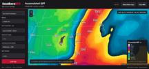
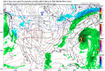
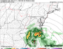
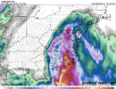
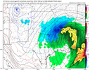
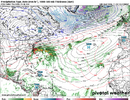
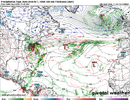
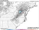
Physics based ECM has a stronger coastal low that moves along the Carolina coast (979mb south of Cape Lookout 4am Monday morning) bringing rain to central and eastern NC. The Euro AI brings the low inland over SC and moves northward over NC on Sunday/ very early Monday morning.


Sent from my iPhone using Tapatalk

3ef21c1e03867338d6f7087ae2e63871.gif

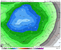
0z AI-ENS mean favors a more coastal hugger track.


Sent from my iPhone using Tapatalk
 
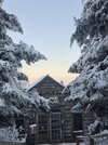
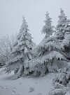
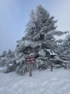
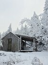
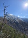
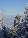
Meant to share pics of Leconte from the storm last weekend 😁 Seeing that inversion Sunday morning in person was unreal. Hiked Bullhead down and drifts were well over a foot in places thanks to the wind.
 

Attachments

  • 20261115_084025.jpg
    20261115_084025.jpg
    1.6 MB · Views: 42
  • 20261115_075256.jpg
    20261115_075256.jpg
    1.7 MB · Views: 40
  • 20261114_150052.jpg
    20261114_150052.jpg
    1.8 MB · Views: 42
  • 20261114_155400.jpg
    20261114_155400.jpg
    2 MB · Views: 41
  • 20261114_155434.jpg
    20261114_155434.jpg
    1.5 MB · Views: 39
  • 20261115_111523.jpg
    20261115_111523.jpg
    2.3 MB · Views: 38
  • 20261114_094509.jpg
    20261114_094509.jpg
    2.6 MB · Views: 37
  • 20261114_155602(1).jpg
    20261114_155602(1).jpg
    3.8 MB · Views: 39
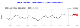
I’m giving it a 50% chance for a new record strong Nov +PNA in ‘26. The current highest back to 1950 is 1983’s +1.84. The record high for El Niño Nov is 1976’s +1.81. The record for a strong+ Nino is 1997’s +0.91, which will easily be exceeded. I don’t see more than a weak correlation between the PNA of Nov and the subsequent DJF. Regardless, models are suggesting a +PNA to dominate this winter, which has been the case for 8 of the 10 strong+ Nino DJFs. Keep in mind that the monthlies correlate roughly to 1.5 to 2 times the average of the dailies that these graphs show:

IMG_3670.png
 
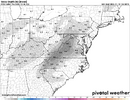
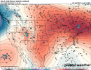
GFS & GFS AI really liking the idea for some WInter weather in the Southern Apps Next wednesday into Thanksgiving.
Definitely interesting setup. I like the cold/dry air feed being shown on the GFS.

1795023072511.png
That's teens and 20s from Virginia down into Ga.
 
GFS and Euro have 1040-1045 HP for Turkey day shennanigans. Obviously need the GFS suite timing and placement. Euro has him to far north for now
At this point, I would be happy to have a cool/cold rainy Thanksgiving Day; but maybe we can get more if we can get the cold air.
 
I certainly wouldn't completely poo poo some wintry weather for Thanksgiving, but i do have the litter box ready. It would take a pretty big lift to ACTUALLY get air cold enough down here for an outside-the-mountains winter storm. It's not impossible, but the GFS being much too cold 7 days out is much more probable, IMO.

The upper air pattern is not really the most impressive, IMO, even though the GFS's 1045 HP is. I don't think it will be that strong. Given that, the time of year, and the timing issues, I think we're probably OK.

I do think December will provide a legitimate shot or two for a lot more folks.
 
No, but i like to see all the factors effecting a possible storm in 1 picture
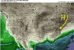
Great Britain doesn't really have much impact on our weather, but what happens on and around the west coast and north of Alaska certainly does.
 
Now that I've clearly moved to the ice capital of Brevard (2100 Feet) anyone got the RZ potential from Euro?

We are already pondering a generator from Costco. This forum helps all of us beat the masses to the panic buying punch (generators?) and I get a uneasy feeling about ice storm potential here this year.
 
Updated Snowfall Forecast for Thanksgiving Day Miller B Event:

Charlotte: 2-4"
Raleigh: 4-8"
Wilmington: .75-1" frz. rain
Biscoe: Dry slot (trace-12")
Greensboro: 10-14"
Boone: 24-30"
Winston-Salem: 12-16"
What even is this crap
 
Updated Snowfall Forecast for Thanksgiving Day Miller B Event:

Charlotte: 2-4"
Raleigh: 4-8"
Wilmington: .75-1" frz. rain
Biscoe: Dry slot (trace-12")
Greensboro: 10-14"
Boone: 24-30"
Winston-Salem: 12-16"
There's a lot to focus on here. But mad props on the random mention of Biscoe. (and the forecast of trace to a foot). 🤔

Also, that's a lot of accumulation for a Miller B..
 
Back
Top