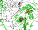
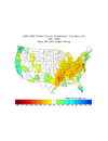
HO HO HO MERRY CHRISTMAS!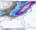



now that's a clown map!

Back in the day a certain poster would want a thread started if it was 800hrs out. No names tho.Definitely a clown map but I would take it!!
Sent from my iPhone using Tapatalk


You should definitely post this on social media. In fact, send it to James Spann.HO HO HO MERRY CHRISTMAS!View attachment 199731

You should also say DESTINED TO HAPPEN!You should definitely post this on social media. In fact, send it to James Spann.
Bro might blow a head gasketYou should also say DESTINED TO HAPPEN!

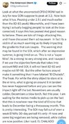
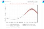
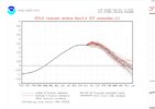
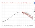
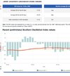
If this El Chahado brings a big dog board wide snowstorm I’ll call it El Chahado foreverScratch El Nino. We got El Chalado.
View attachment 199736
View attachment 199740
View attachment 199741
View attachment 199742
View attachment 199743

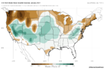
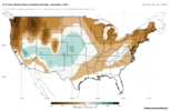
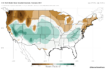

My call for Northeast TN this year was 12-18”. We average about 9. I’d say this lines up with that pretty well. Hoping I bust low tho.Massachusettswx has made a neat little site where you can explore some C3S plots of snowfall
Here’s what the ensemble mean looks like for DJF. In general, this seems about right to me. The place to be out east in years like this is the south-central Appalachians.
https://massachusettswx-weather.github.io/seasonal-graphics/snow.html?m=c3s-multi
View attachment 199737
View attachment 199738
View attachment 199739

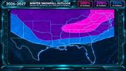

BOB?? DAT you
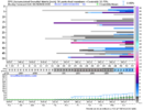
Gonna be a lot of cutters and apps runners this year. Hoping when we get the coastal runners I have some cold air to work with. Higher chance than normal to score a big dog this year for everyone. And your area to the ridge line should get nailed atleast once by a good 8-14 event. Tracks will be in your favor the most, no doubt. Already see it in the day 10-15 guidance as things get ready to start firing offMy call for Northeast TN this year was 12-18”. We average about 9. I’d say this lines up with that pretty well. Hoping I bust low tho.
Folks will scoff at this. But you are gonna nail it. Gonna be the year of go big or go home on multiple occasions. You end up on the west side of the track you win biggly and east side you eat crow


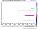

This may be a tad overdone and I think a slight eastward shift (perhaps 50-75 miles or a little more) is likely in the "300%" (more like 150%) total. As always in the South, timing and track are extremely critical

You and Webber are gonna have to take it outside

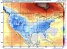


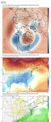
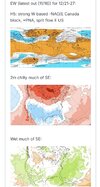

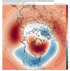
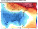
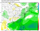
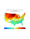
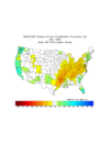
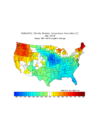
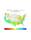


82-83 and 97-98 give us the 2 main options me thinks. Both big and way east ninos. Both high AAM fall into winter. This should mean hefty Gulf of Alaska low in Jan-Feb with split flow, healthy southern stream, and gulf lows.I think a big problem this winter that would cause issues for winter storm setups would be the east Canadian block being to far SE. in other ways it could be a helpful think if you get a trough with some Arctic roots to slide under > lift to our NE as the ridging above would help force surface high pressure behind it. The problem in recent years has been the opposite and TPVs being held back near the lakes. It’s just my concern I guess is the Canadian block tries to ridge bridge into the EC this winter or cold air gets trapped more so in the plains/southern plains and we just kinda get the stagnant airmass left over
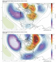
I do agree this is a valid concern. Hopefully notI think a big problem this winter that would cause issues for winter storm setups would be the east Canadian block being to far SE. in other ways it could be a helpful think if you get a trough with some Arctic roots to slide under > lift to our NE as the ridging above would help force surface high pressure behind it. The problem in recent years has been the opposite and TPVs being held back near the lakes. It’s just my concern I guess is the Canadian block tries to ridge bridge into the EC this winter or cold air gets trapped more so in the plains/southern plains and we just kinda get the stagnant airmass left over
There’s always a concern.I do agree this is a valid concern. Hopefully not
We toss!
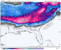 Another pre-Christmas miracle on the Euro control. This one comes just a few days before Christmas.
That one is even more of a clown map than the last one posted on the 16th. The mid south would never recover.View attachment 199835Another pre-Christmas miracle on the Euro control. This one comes just a few days before Christmas.

Looks like potential for a classic Southern Slider with overrunning.The latest 12 run CFS ens mean for Jan (not Feb) is the coldest yet for the SE US with 2-4F colder than the colder 1984-2009 climo mean (instead of 1991-2020 1F warmer mean) thanks to the strongest W based -NAO yet of any 12 run mean for Jan along with it being centered further E on the Canadian E coast rather than the not as cold for the SE S Hudson Bay:
View attachment 199783
2-4F colder than 1984-2009 climo mean, which would be 70-85 percentile cold for Jan for most meaning not just due to clouds/precip holding daytime highs down):
View attachment 199784
Strong ST jet making for AN to MAN rainfall for many/NN elsewhere (no overly dry area):
View attachment 199785
——————————
The best analog to this CFS 12 run mean is 1/1983 with 1/2010 2nd best:
Would be wetter version of 1/1983…
1983 temps similar:
View attachment 199786
1983 precip was drier:
View attachment 199788
—————————
Would be bit warmer version of 1/2010:
View attachment 199789
Would be roughly similar to 1/2010 precip overall:
View attachment 199790
I’m not sure how I feel about seeing these so early in the season. Usually takes till January to see good fantasy maps. On one hand I feel like this is hinting at a pretty good pattern in December but it’s so out of the norm that I’m scared for what comes after.View attachment 199835Another pre-Christmas miracle on the Euro control. This one comes just a few days before Christmas.

A white Christmas may be only 888 hours away! It's time to make sure you have bread and milk to go with that Christmas turkey.View attachment 199835Another pre-Christmas miracle on the Euro control. This one comes just a few days before Christmas.
That one is even more of a clown map than the last one posted on the 16th. The mid south would never recover.
Can anyone post the ensemble mean for the same date?
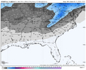
Thanks, that's not terrible at all for most of us for December if it came to fruition.