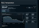
Yeah I wasn’t expecting to see sub 28 this morning. Those stars were out last night thoughDown to 26.6 right now. Pretty sure the forecast low was around 30.

Yeah I wasn’t expecting to see sub 28 this morning. Those stars were out last night thoughDown to 26.6 right now. Pretty sure the forecast low was around 30.

Doughnut Hole morning update.
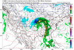
Pick your model of choice. All still mostly nada out through 360. Heres GFS out through Dec 1st
View attachment 199697

 RDU SENSOR WENT BELOW FREEZING!!!


RDU SENSOR WENT BELOW FREEZING!!!

Yep. It appears the wave train is starting. Just in time for winter. Hard not to be a little excitedView attachment 199703
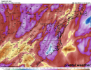
With the current drought conditions, the total rainfall off the 12Z GFS is about as exciting as a typical fantasy snow map for many folks. But even after 3+ systems, there is still a slight donut hole over portions of Eastern SC/NC extending to the north-northeast


BrotherFeel like that late Nov timeline offers up a first legit fall severe setup for somewhere in the SE


Brother
Feel like that late Nov timeline offers up a first legit fall severe setup for somewhere in the south

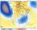
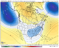
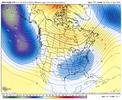
With the current drought conditions, the total rainfall off the 12Z GFS is about as exciting as a typical fantasy snow map for many folks. But even after 3+ systems, there is still a slight donut hole over portions of Eastern SC/NC extending to the north-northeast
I mean it’s the truth. Looks like something amplified down around that timeframe. Hard to avoid severe somewhere with that. Whether it’s just a low end type thing or a higher end type thing is tbd. But it’s far more fitting climo wise for the SE and somewhat typically proceeds a chillier pattern in the cool season. Jet looks juiced up around that timeframe and it’s pretty easy shorten wavelength and get a bowling ball with a shortwave ridge ahead. Far more realistic of a scenario around that timeframe then anything else, although NW flow proceeding is possible as any bigger system in the cool seasonBro I already muted Tennessee Storm now here you come with this

Tracker absolutely loathes severe talk during ‘winter’I mean it’s the truth. Looks like something amplified down around that timeframe. Hard to avoid severe somewhere with that. Whether it’s just a low end type thing or a higher end type thing is tbd. But it’s far more fitting climo wise for the SE and somewhat typically proceeds a chillier pattern in the cool season. Jet looks juiced up around that timeframe and it’s pretty easy shorten wavelength and get a bowling ball with a shortwave ridge ahead. Far more realistic of a scenario around that timeframe then anything else, although NW flow proceeding is possible as any bigger system in the cool season

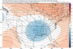

Geez I remember that 1989 outbreak, There were some rough storms that moved through the Carolinas that night while many of us were still recovering from Hurricane HugoChristmas 1982 and 2015 both had tornadoes around here even. Both super El ninos even!
Of course growing up in Alabama it happened a lot more than that... Today was the anniversary of Huntsville in 1989
It's just one of the disadvantages of living near the Gulf
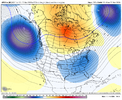
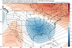
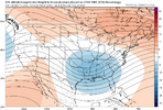
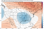
Yeah I noticed that when looking at the indices earlier today. The PNA is looking to stay positive through the end of the run and after coming up to around neutral the NAO goes well negative again while the AO falls off the cliffNobody here is talking about the amazing look at the end of the ensembles. By no means the best climatology, and we will struggle with cold air since the northeast snowpack is pretty weak. But a beautiful spatial pattern.
View attachment 199716View attachment 199718View attachment 199717View attachment 199719

Those 1989 tornado pictures always amaze me. Tracked right up airport road and up Garth mountain. I always thought tornadoes avoided mountains, but that’s clearly not always the case. I’m not a fan of severe weather.Christmas 1982 and 2015 both had tornadoes around here even. Both super El ninos even!
Of course growing up in Alabama it happened a lot more than that... Today was the anniversary of Huntsville in 1989
It's just one of the disadvantages of living near the Gulf
Some nut somewhere is already foaming at the mouth over a pivotal.com sounding for Little Rock out to 300 hours and has it locked and loaded in the chamber ready to post on X just to set me offTracker absolutely loathes severe talk during ‘winter’


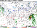
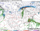
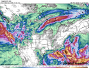
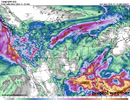

Not gonna get too excited just yet but things do seem to be pointing towards better precip chances as we head to end of month into Dec. Could we finally start to erase this drought?Maybe this is the start of an active pattern in the extended. Most of the south needs rain.
Sent from my iPhone using Tapatalk

Nobody here is talking about the amazing look at the end of the ensembles. By no means the best climatology, and we will struggle with cold air since the northeast snowpack is pretty weak. But a beautiful spatial pattern.
View attachment 199716View attachment 199718View attachment 199717View attachment 199719
In fact I’d watch this if I lived in southern parts of Dixie honestly. Been a while for sure. Limiting factor would be a prior shortwave limiting moisture return, and ridging ahead being more focused in SE Canada instead of in the subtropics forcing a more stable airmass but still, rather amplified/sharp look and signal already. For areas further north moisture return could be hard to come by. View attachment 199720View attachment 199721View attachment 199722View attachment 199723
No real cold air around. Would be shocked if it snowed anywhere outside the mountains. Likely going to be saying that a lot this winter. We may get an opportunity or two mid to late winter
We will need alot more luck and fortune this winter to see winter weather. Part of strong Niños. I am hopeful we will have one opportunity this winter in our area. We only avg 4-5 inches in winter anywaysThis has been my concern all along... I mean the last super El Nino I was in Dallas and I have zero memory of any winter at all... I think it maybe snowed twice here and even then only one day barely has accumulation and of course I have better climo than most here
I hope I'm wrong but even all this hype surrounding Thanksgiving here isn't looking like anything that interesting at this point. Even the rainfall is still lacking tbh for most even just east of here in Arkansas/SE Oklahoma. Saw it again yesterday very sharp cutoff once it got past OKC

I have a suspicion this years winter is gonna blow.What's the 6 billion hour CFS saying?
AsteroidWhat's the 6 billion hour CFS saying?
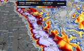

 RDU SENSOR WENT BELOW FREEZING!!!