• Hello, please take a minute to check out our awesome content, contributed by the wonderful members of our community. We hope you'll add your own thoughts and opinions by making a free account!

Pattern Ninovember

Special Weather Statement
National Weather Service Raleigh NC
949 AM EST Fri Nov 6 2026

NCZ008-024-025-027-040>042-076-077-061545-
Lee NC-Nash NC-Johnston NC-Chatham NC-Durham NC-Harnett NC-Wake NC-
Granville NC-Orange NC-
949 AM EST Fri Nov 6 2026

...STRONG THUNDERSTORMS WILL IMPACT SOUTHWESTERN NASH...SOUTHEASTERN
ORANGE...CENTRAL HARNETT...SOUTHWESTERN GRANVILLE...NORTHEASTERN
LEE...WAKE...NORTHWESTERN JOHNSTON...CHATHAM AND DURHAM COUNTIES
THROUGH 1045 AM EST...

At 948 AM EST, Doppler radar was tracking a cluster of strong
thunderstorms near Fuquay-Varina, or 12 miles southwest of Cary,
moving northeast at 35 mph.

HAZARD...Wind gusts up to 40 mph and pea size hail.

SOURCE...Radar indicated.

IMPACT...Gusty winds could knock down tree limbs and blow around
unsecured objects. Minor hail damage to vegetation is
possible.

Locations impacted include...
Raleigh, Durham, Cary, Chapel Hill, Creedmoor, Pittsboro, Lillington,
Wake Forest, Garner, and Carrboro.
 
This cold front is bringing the goods with the rain we have received. Rainfall totals will end up exceeding what was forecast easily. I don't think many of us in the Triangle will mind that. We could be looking at two to three inches in spots after things wrap up.
 
BULLETIN - EAS ACTIVATION REQUESTED
Flash Flood Warning
National Weather Service Raleigh NC
1031 AM EST Fri Nov 6 2026

The National Weather Service in Raleigh has issued a

* Flash Flood Warning for...
Northeastern Chatham County in central North Carolina...
Southern Durham County in central North Carolina...
Central Wake County in central North Carolina...

* Until 130 PM EST.

* At 1031 AM EST, Doppler radar indicated thunderstorms producing
heavy rain across the warned area. Between 1 and 2 inches of rain
have fallen. Additional rainfall amounts of 1 to 2 inches are
possible in the warned area. Flash flooding is ongoing or expected
to begin shortly.

HAZARD...Flash flooding caused by thunderstorms.

SOURCE...Radar indicated.

IMPACT...Flash flooding of small creeks and streams, urban areas,
highways, streets and underpasses as well as other poor
drainage and low-lying areas.

* Some locations that will experience flash flooding include...
Raleigh, Durham, Cary, Wake Forest, Garner, RDU International,
Apex, Morrisville, William B Umstead State Park, Research Triangle,
Bethesda, Carpenter, Rollingview Marina, Falls Lake Boat Ramp,
Parkwood, Falls Lake, Falls Lake State Rec Area, Gorman, Lake
Wheeler and Jordan Lake.
 
I guess hell has frozen over, after being the dry slot since spring we got a Molly whopper of a downpour this morning with a lightning strike in the back yard. Creeks are overflowing and take it!
 
Major power outages with this one. Widespread 15-25 mph wind gust. Can't rule out an isolated EF4-5 tornado. Hunker down brother.
The godly “Deacon” becomes the dickhead! Nice to see true colors! I get it it but at the same time I don’t. If everyone isn’t allow to contribute then what are we here for? Is it just for those with 100k followers at the moment?
 
Last edited:
The godly “Deacon” becomes the dickhead! Nice to see true colors! I get it it but at the same time I don’t. If everyone isn’t allow to contribute then what are we here for? Is it just for those with 100k followers at the moment!
Hey, I can be very sarcastic & you are right to call me out on it so respect for that. But at the same time, I am human & like to throw some humor into things.

As far as the other things you said, I never said anyone couldn't contribute. I don't have any say on that here. The 100k comment seems like a deep rooted issue with you. You act like I jumped on here & said my opinion is more valuable because of that.. you literally just made that up.

But anyways, I'll keep the sarcastic remarks out of it. @snowc my bad brother.
 
The latest first freeze at RDU was December 3, 1931. Some of the models are showing temperatures approaching the freezing mark towards the end of next week. I was worried that we might go into December without a freeze but next weekend might put those concerns to rest.
 
Hey, I can be very sarcastic & you are right to call me out on it so respect for that. But at the same time, I am human & like to throw some humor into things.

As far as the other things you said, I never said anyone couldn't contribute. I don't have any say on that here. The 100k comment seems like a deep rooted issue with you. You act like I jumped on here & said my opinion is more valuable because of that.. you literally just made that up.

But anyways, I'll keep the sarcastic remarks out of it. @snowc my bad brother.
Nothing deep rooted at all, I’m happy for you! You don’t know other peoples circumstances or what they are dealing with and that just came across as a cheap shot across the bow!
 
The latest first freeze at RDU was December 3, 1931. Some of the models are showing temperatures approaching the freezing mark towards the end of next week. I was worried that we might go into December without a freeze but next weekend might put those concerns to rest.
We still have the temp issue for the RDU station. I feel good that all of us around RDU can get to freezing, but the official reading at the airport is going to be harder.
 
Nothing deep rooted at all, I’m happy for you! You don’t know other peoples circumstances or what they are dealing with and that just came across as a cheap shot across the bow!
You're right. Thanks for the reminder.
 
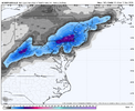
@Mitch West The 12Z GFS is a slight nod to the Euro AI guidance regarding this potential cold shot and eastern US snow next week. I saw your video this morning on it and I am just as invested on how interesting this setup looks, especially for high elevations and portions of the NE. I think WNC has a legit chance of at least seeing some marginal to moderate NW flow snow out of this, a good bit more than that light dusting from a few weeks ago.
1793982674932.png
 
@Mitch West The 12Z GFS is a slight nod to the Euro AI guidance regarding this potential cold shot and eastern US snow next week. I saw your video this morning on it and I am just as invested on how interesting this setup looks, especially for high elevations and portions of the NE. I think WNC has a legit chance of at least seeing some marginal to moderate NW flow snow out of this, a good bit more than that light dusting from a few weeks ago.
View attachment 199421
It definitely is getting CLOSE!!
gfs-deterministic-east-instant_ptype-1793966400-1794506400-1794808800-20.gif
 
Its just weather
Serious The Four GIF by Diddy
 
Flood advisory here. I heard some thunder earlier, too.
 
The latest first freeze at RDU was December 3, 1931. Some of the models are showing temperatures approaching the freezing mark towards the end of next week. I was worried that we might go into December without a freeze but next weekend might put those concerns to rest.
I'm kind of surprised the latest first freeze is that early. We've still got another month to go to make it happen, but like you said it's not a sure thing looking at the extended forecasted, especially at the sensor.
 
Allan’s forecast basically says that he thinks it will be a warmer December but probably cooler once we get into January and February. He does think that there could be an SSWE.


Sent from my iPhone using Tapatalk

I asked about snow potential this was his response. For our area, I would say normal. Not buying the snowier forecasts from the ECMWF Seasonal. With more mild air than cold, I think we will be wet but not cold enough. But a few chances will be there. The mountains, I could see getting above normal snowfall.


Sent from my iPhone using Tapatalk
 
Back
Top