NEGaweather
Member
Of course you do! Care to explain scientifically?
His response…,

Sent from my iPhone using Tapatalk

Of course you do! Care to explain scientifically?
Super El Niño. We have no clue what it will do but he’s glued to warm!His response…,
Sent from my iPhone using Tapatalk

I bet he doesn't agree with Brad. The early PV hit will repeat into winter and create plenty of chances for snow.Allan will be releasing his winter forest tomorrow. Will see what he has to say
Sent from my iPhone using Tapatalk
Brad is a wait until it has fallen to say anything, I get it, he has been burned. Good years go blank and bad years you get 9”. I’ll wait until March to have an opinion!I bet he doesn't agree with Brad. The early PV hit will repeat into winter and create plenty of chances for snow.

I bet he doesn't agree with Brad. The early PV hit will repeat into winter and create plenty of chances for snow.


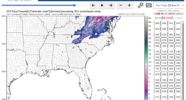
Euro seasonal snowfall for Atlanta reveals that most members perk up toward late Jan into FEB
Sent from my iPhone using Tapatalk

I hope we continue to trend towards 2009-2010! I had snow in Charleston in February of 2010.
Sent from my iPhone using Tapatalk

Can you generate one for KHSV (Huntsville?)
Here’s the Euro seasonal for Little Rock if anyone out that way is interested.
Sent from my iPhone using Tapatalk
Can you generate one for KHSV (Huntsville?)


Poor Canada
It’s still early Nov, but the last 10 runs of the CFSv2 are trending colder for the southern US for December.
Sent from my iPhone using Tapatalk
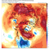
Don’t see how much cold air coming down when CanadaPoor Canada
 going be warm lol. But said all along February will be coldest month of winter

Not warm, just not average cold. Still plenty cold.Don’t see how much cold air comes down when Canada
Don’t see how much cold air coming down when Canada
Right, when your average temp is 10-15 and you see red on a model, that doesn’t mean 70’s. It means 13-18.Not warm, just not average cold. Still plenty cold.


OK. Who has the quantum model? It's my new favorite!
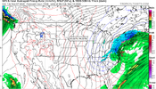

First Call Snowfall Totals for Next Weekend:
- Charlotte- Trace-1"
- Raleigh- 1-2"
- Greensboro- 2-4"
- Boone- 4-8"
- Westward Facing Slopes- 18-24"
- Wilmington- Rain/sleet mix, glaze of ice possible
- Mount Airy- 5-10"
Stay tuned for more updates!

April fools day has already happened brother.First Call Snowfall Totals for Next Weekend:
- Charlotte- Trace-1"
- Raleigh- 1-2"
- Greensboro- 2-4"
- Boone- 4-8"
- Westward Facing Slopes- 18-24"
- Wilmington- Rain/sleet mix, glaze of ice possible
- Mount Airy- 5-10"
Stay tuned for more updates!

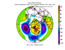
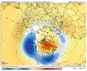 Euro seasonal looks like a blend of 97-98, 09-10, and 15-16
Just curious how 1982-83 compares to that. There’s been a number similarities so farView attachment 199456View attachment 199457Euro seasonal looks like a blend of 97-98, 09-10, and 15-16
Not a forecast, just an observation
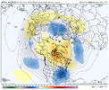 That is a cold open to December on the GEFS extended.

You are going out on a short limb on a tall tree to be calling for accumulating snow at RDU next weekend. That being said, it would be nice to see snow on the ground in November. I've always wanted to see snow on my birthday which is exactly two weeks from today. I'm 62 and have never seen that. Stranger things have happened before. Good luck!First Call Snowfall Totals for Next Weekend:
- Charlotte- Trace-1"
- Raleigh- 1-2"
- Greensboro- 2-4"
- Boone- 4-8"
- Westward Facing Slopes- 18-24"some eaa
- Wilmington- Rain/sleet mix, glaze of ice possible
- Mount Airy- 5-10"
Stay tuned for more updates!

He does this all the time, not sure if trolling, being funny, fake account or just the antithesis of Tennessee stormYou are going out on a short limb on a tall tree to be calling for accumulating snow at RDU next weekend. That being said, it would be nice to see snow on the ground in November. I've always wanted to see snow on my birthday which is exactly two weeks from today. I'm 62 and have never seen that. Stranger things have happened before. Good luck!


Oh, Canada!

Oh, Canada!


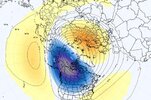
Because he’s BAM!Why are we putting any stock into singular long range CFS runs