
-
Hello, please take a minute to check out our awesome content, contributed by the wonderful members of our community. We hope you'll add your own thoughts and opinions by making a free account!
You are using an out of date browser. It may not display this or other websites correctly.
You should upgrade or use an alternative browser.
You should upgrade or use an alternative browser.
Pattern Octorchber
- Thread starter SD
- Start date

89F today at GSP. A new 10/15 daily record.
The earliest trace of snow on record is 10/20.
The earliest trace of snow on record is 10/20.

Carolina Fever
Member
Looks like the real fall arrives Saturday.

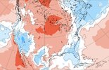
If this near E coast verifies and it meanders around for days, it will lead to cooler temps than were anticipated for next week due to a longer/very long period of cool NE to N winds on the back side of the low. Today’s Euro Weeklies reflect that cooling change for next week quite well:
Week of 10/19-25 released 3 days ago:
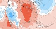
The same from today’s release:
Week of 10/19-25 released 3 days ago:
The same from today’s release:

East coast surfers likely watching this potential with excitement. May not even have to be in wet suits given the water temps. That wind/air temp would be chilly though.If this near E coast verifies and it meanders around for days, it will lead to cooler temps than were anticipated for next week due to a longer/very long period of cool NE to N winds on the back side of the low. Today’s Euro Weeklies reflect that cooling change for next week quite well:
Week of 10/19-25 released 3 days ago:
View attachment 198960
The same from today’s release:
View attachment 198961

Brent
Member
Fall has arrived... Finally. Highs tomorrow may not even be this warm 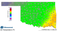
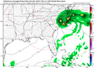
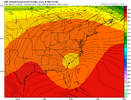

Front is currently from Cincy down to Louisville/ Nashville. You want be able to follow this one on radar, but heres a cool site you can follow, time up your windshift. My back yard its from 7-9pm ish.

 www.ventusky.com
Ventusky - Live Weather Forecast & Radar Maps
See the weather like never before – live weather maps powered by the most accurate models.
www.ventusky.com
Brent
Member
We have a wind chill!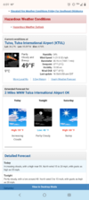
Hope you get to get outside and enjoy. Yall definitely deserve it out there after these last few monthsWe have a wind chill!View attachment 198965

CNCsnwfan1210
Member

6z Euro AI kicking the coastal low west along the OBX early next week. Looks like another round of bulldozing sand off HWY 12 again esp with the pressure gradient between HP to the north and coastal low.
Sent from my iPhone using Tapatalk

6z Euro AI kicking the coastal low west along the OBX early next week. Looks like another round of bulldozing sand off HWY 12 again esp with the pressure gradient between HP to the north and coastal low.
Sent from my iPhone using Tapatalk
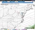
The 6Z UKMET brought it back way NW to within 300 miles of NC though not quite as close as the runs 0Z 10/14 through 6Z 10/15 that were only 200 miles SE of NC. That now means that for the first time that ALL of the latest runs of the major globals have it affecting parts of the E coast:
6Z 10/16 UKMET: back to within 300 miles SE of NC
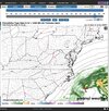
0Z 10/16 UKMET (similar to 12Z/18Z 10/15 runs having it way out to the SE)
CNCsnwfan1210
Member

6z GDM coastal low positions through next Thursday morning.
Sent from my iPhone using Tapatalk

Going to be a tough forecast, cut off from steering.
Going to be a tough forecast, cut off from steering.
Indeed!
By the way the 12Z Icon has it.

As does the baby Canadian. The NAM is, of course, all over the place, but it has a version too.Indeed!
By the way the 12Z Icon has it.
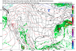
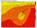
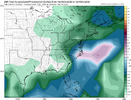

Broke the high temperature record three days in a row in Huntsville this week. 

StormStalker
Member
Finally, 66 degrees and not 90!

256wx
Member
79 degrees just 60 miles East of you. Bring it on, this is a good one!Finally, 66 degrees and not 90!
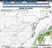

The Monday-Wednesday period with the ULL is when I am most interested, if its going to find it's way back west that seems to be the most likely time period to do so if it does.
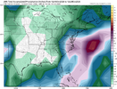
This east-west windshield wiping would be wild if this were winter.The 12Z Euro-AI has it close to NC but the regular Euro is actually further out than its recent runs and is near the 12Z UKMET:View attachment 198973
CNCsnwfan1210
Member
The Monday-Wednesday period with the ULL is when I am most interested, if its going to find it's way back west that seems to be the most likely time period to do so if it does.
I’m hoping the western solutions work out, need some rain in the worst way.
Sent from my iPhone using Tapatalk
This east-west windshield wiping would be wild if this were winter.
I view this as perfectly normal because it’s pretty typical this far out, especially for a complex setup. If there weren’t the variations from model to model and changes from run to run, forecasting discussions wouldn’t be interesting imho since the solutions would already be known/nothing to discuss forecast-wise. So, I’d actually prefer they never become all knowing this far out.
Last edited:
I'm not as optimistic as I was about it. Pattern is going to give it a way out to the north and north east and more models are going that way. If that misses though it should slide west then maybe maybe southwest before it dissolves. The good thing is the overnight rain into tomorrow could actually over perform especially if we can get some convective stuff overnight towards dawnI’m hoping the western solutions work out, need some rain in the worst way.
Sent from my iPhone using Tapatalk

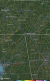
Nashville at 57 while Chattanooga is at 81 and Atlanta at 84. That’s a powerful front!

olhausen
Member
What a difference a day makes!
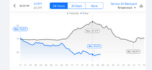
What kind of station is that from? Love the chartWhat a difference a day makes!
View attachment 198979

It’s 82 here but the dark clouds are rolling in and the breeze is picking up. I’m going to sit out on the deck and enjoy the passage.
It’s 82 here but the dark clouds are rolling in and the breeze is picking up. I’m going to sit out on the deck and enjoy the passage.
I enjoy simple but potent cold frontal passages, even if dry, about as much as many other wx events. The close observation of the wind shift/increase along with the dewpoint and temperature decline often gives me lots of enjoyment.

Iceagewhereartthou
Member
Feels like it's taking FOREVER for this front to move; been stuck in TN all day. Get here; please!!!

It’s one of life’s simple pleasures to a weather nerd. Already two degrees drop and the wind is noticeably higher.I enjoy simple but potent cold frontal passages, even if dry, about as much as many other wx events. The close observation of the wind shift/increase along with the dewpoint and temperature decline often gives me lots of enjoyment.
sackjalding
Member
This is a really good front. It’s loud out there in the trees.

Atlanta reported a wind gust of 46 around 11:15p! I hope it die down morning!This is a really good front. It’s loud out there in the trees.