• Hello, please take a minute to check out our awesome content, contributed by the wonderful members of our community. We hope you'll add your own thoughts and opinions by making a free account!

Pattern NC Only Thread

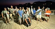
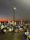
Guess I better hang up the fishing gear..

The Gale Watch over all waters has been upgraded to a Gale
Warning.

Confidence is high for 35-40 kt gusts
over the 0-20 NM coastal waters, and for 40-45 kt gusts over
the 20-60 NM waters. There is still plenty of uncertainty over
potential low pressure development offshore this weekend, but
regardless, a strong pressure gradient will persist through at
least early next week over the local waters between strong high
pressure inland and low pressure well offshore.


.CLIMATE...
Forecast/record highs for Friday, October 16:
- Wilmington, NC (KILM): 86F (87F in 2021, 2018, and 1975)
- North Myrtle Beach, SC (KCRE): 82F (88F in 1990)
- Florence, SC (KFLO): 88F (91F in 2021)
- Lumberton, NC (KLBT): 88F (92F in 1925)
 
From I40 north to the state line from Triangle back to Winston Salem, looks to be the inland sweetspot consensus looking at all the ops and shortrange stuff. Just for mby over 75-80% modeling gives me .75+. Think Ukmet and Icon are the driest with just a few tenths.

Euro op just cuts the ole coastal off and it makes for a cloudy and wet at times period eastern NC over the next 7-8 days.
 
The 06z gfs is a horrible scenario with long lasting beach erosion, huge surf, and coastal winds. Looks like it even works it into micro cane as it drops SW down the coast past cape fear. Takes almost 7 days to do this.
Yea seeing a lot of modeling runs now sugesting this gyro just sits out there for days on end causing sustained NE fetch. Not gonna be good, espeacilly for OBX
 
Who has some gust maps? Just curious to see what they are showing in eastern sections
Looks like a few chances at 30+ even around here over the next few days. Some 50+ on OBX oof
 
Last edited:
This is just a wee bit different than the forecast from this morning.....

Tonight
A chance of showers, mainly after 5am. Increasing clouds, with a low around 54. Southwest wind 10 to 13 mph becoming west after midnight. Winds could gust as high as 18 mph. Chance of precipitation is 30%. New precipitation amounts of less than a tenth of an inch possible.
Saturday
Showers, mainly before 4pm. Temperature falling to around 53 by 5pm. North wind 15 to 18 mph, with gusts as high as 29 mph. Chance of precipitation is 100%. New precipitation amounts between a half and three quarters of an inch possible.
Saturday Night
A chance of showers after 2am. Partly cloudy, with a low around 45. North wind around 18 mph, with gusts as high as 28 mph. Chance of precipitation is 40%. New precipitation amounts between a tenth and quarter of an inch possible.
Sunday
A chance of showers, mainly after 2pm. Partly sunny, with a high near 61. Breezy, with a north wind 18 to 20 mph, with gusts as high as 31 mph. Chance of precipitation is 30%. New precipitation amounts between a tenth and quarter of an inch possible.
Sunday Night
A chance of showers. Mostly cloudy, with a low around 50. Breezy, with a north wind 18 to 20 mph, with gusts as high as 30 mph. Chance of precipitation is 40%. New precipitation amounts between a tenth and quarter of an inch possible.
Monday
A chance of showers. Mostly cloudy, with a high near 63. Breezy. Chance of precipitation is 50%. New precipitation amounts between a tenth and quarter of an inch possible.
Monday Night
A chance of showers. Mostly cloudy, with a low around 52. Breezy. Chance of precipitation is 30%.
Tuesday
A chance of showers before 2pm. Mostly sunny, with a high near 67. Chance of precipitation is 30%.
Tuesday Night
Partly cloudy, with a low around 54. Breezy.
Wednesday
A chance of showers after 2pm. Mostly sunny, with a high near 69. Chance of precipitation is 30%.
Wednesday Night
A chance of showers. Mostly cloudy, with a low around 55. Chance of precipitation is 30%.
 
NWS Kilm AFD..
(Never mind the very Low Dewpoints & FALLING TEMPS!)


A strong cold front with a developing Nor`easter will bring
strong northerly winds to the area, leading to dangerous marine
conditions.

A strong cold front with a developing nor`easter
will bring strong northerly winds to the area, leading to
dangerous marine and surf conditions.
_________
Marine.. (MY AO)..

A Wind Advisory along the immediate coast
Saturday through Sunday as sustained winds may exceed 30 mph
and/or gusts possibly exceed 46 mph
.

The enhanced winds should also lead to dangerous surf conditions into early next week with
at least 6 ft breaking wave heights along east-facing beaches.

A developing nor`easter will move over the waters Saturday morning, bringing strong northerly winds to The area.
Gale force winds will be well established across the
waters by Saturday afternoon.
The nor`easter will linger to our east through the weekend, with a stronger surge of winds
impacting our SE NC offshore waters into Sunday, where storm
force gusts are possible.


.ILM WATCHES/WARNINGS/ADVISORIES...
NC...Beach Hazards Statement from 6 AM EDT Saturday through
Saturday evening for NCZ108.
SC...Beach Hazards Statement from 6 AM EDT Saturday through
Saturday evening for SCZ056.
MARINE...Gale Warning from noon Saturday to 11 AM EDT Monday for AMZ250-
252-254-256-284.
Gale Warning from noon Saturday to 8 AM EDT Sunday for AMZ280.
Storm Watch from Sunday morning through late Sunday night for
AMZ280.
 
PSA..
BREAKING: A mandatory evacuation for all visitors on Hatteras Island takes effect at 8 p.m. tonight (Friday, October 16). A state of emergency has also been issued for Hatteras Island.
The order applies to visitors in Rodanthe, Waves, Salvo, Avon, Buxton, Frisco and Hatteras Village. Residents of Hatteras Island and areas north of Oregon Inlet are not under an evacuation order per Dare County!
This is due to the increasing risk of significant ocean overwash and high winds from a developing Nor’easter. A prolonged period of NE winds 40-55MPH will lead to moderate to significant ocean overwash. It’ll bring clouds occasional rain and high winds. NE wind gusts of 40-55MPH+ Saturday night into Tuesday at least. High Surf of 12 ft plus, which would result in at least moderate to locally significant Coastal Flooding, especially along Hatteras and Ocracoke Island. Ferries would likely be suspended Saturday night onward, and Highway 12 on Pea Island and the north end of Ocracoke would likely flood during high tides, with increasing risk of being washed out.
 
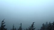
Same as @Shaggy , Lotsa "Misty/Heavy Rain(s) here.. great "soaking in Rain's".. Meanwhile at the Pier/beach..
(Temps have been dropping all afternoon).. from Mid~70's Early this morning too 52F now?

52°

Feels like 52°
NNE 10 mph
Gusts 21 mph
Humidity 89%
Pressure 30.31 in
Dew Point 50°
Rain Today 0.31" so far
 
Same as @Shaggy , Lotsa "Misty/Heavy Rain(s) here.. great "soaking in Rain's".. Meanwhile at the Pier/beach..
(Temps have been dropping all afternoon).. from Mid~70's Early this morning too 52F now?

52°

Feels like 52°
NNE 10 mph
Gusts 21 mph
Humidity 89%
Pressure 30.31 in
Dew Point 50°
Rain Today 0.31" so far
We are gusting low to mid 30s for sure. A few have rattled the roof but I'm in a wide open area. ILM has gusted to 36 I believe
 
Back
Top