
Oh no no you don't. It's gonna be 90 something isn't it? Just let me enjoy ignorance in bliss man.I hate to be that guy but...


Oh no no you don't. It's gonna be 90 something isn't it? Just let me enjoy ignorance in bliss man.I hate to be that guy but...

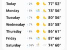
Most likely, these stale dry airmasses heat very efficiently when you stack ridges on them (see SD loathing summer cold front passages). The only thing that could save is getting a decent return flow so morning status and fog then afternoon cu keeps us in the upper 80s. Overall though Wednesday through Saturday are just blah. I'd the over on rain chances and totals late next weekend though.Oh no no you don't. It's gonna be 90 something isn't it? Just let me enjoy ignorance in bliss man.
Yea I had a feeling. Wanted to declare it Autumn this week instead of Pre-Autumn, but I knew my made up criteria didn’t support it.Most likely, these stale dry airmasses heat very efficiently when you stack ridges on them (see SD loathing summer cold front passages). The only thing that could save is getting a decent return flow so morning status and fog then afternoon cu keeps us in the upper 80s. Overall though Wednesday through Saturday are just blah. I'd the over on rain chances and totals late next weekend though.


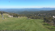
probably a controlled Burn over on Green Swamp RoadThere is a pretty sizeable smoke plume from some kind of fire visible Inland from Wilmington on such a clear day I wonder who else can see it
Sea breeze might get active Friday and saturday. Best chance of storms saturday is inland until after dark. Sunday oofHow’s the rain chances looking this weekend across the Old North State? Heading to the coast near the NC/SC border Sat. I can read models/trends a bit, but not as well as most of you.
but... dont look at the 12z gfs total qpf map..Things looking decent for some much needed rain this weekend and next week, but.....
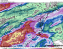
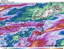
Icon scares me but the setup is legit. The wedge front imo is the wildcard. If it gets forced way into SC I'm Saturday we probably end up with a widespread decent event if it gets stuck or moves back north a bit +++++++ totals likelyThings looking decent for some much needed rain this weekend and next week, but.....
Yeah we've had some good setups that just didn't pan out but it's time for things to turn in our favorIcon scares me but the setup is legit. The wedge front imo is the wildcard. If it gets forced way into SC I'm Saturday we probably end up with a widespread decent event if it gets stuck or moves back north a bit +++++++ totals likely

One of the best afd writers out there, suckshttps://forecast.weather.gov/product.php?site=RAH&product=AFD&issuedby=RAH
There will be a open position at the NWS in Raleigh since the forecaster who wrote this discussion is retiring after 36 years on the job. I haven't seen a forecaster sign off in a weather discussion like that before. I wish him a happy retirement and offer my thanks for his service.
Eps is about 1.25 mean for gso and 1.6 for mby so definitely some lean to the right but more interesting the op is one of the lowest over your way but highest for me. The eps was actually a small increaseWe have only managed to get up to 79 today. Partly to mostly cloudy is the culprit. Feels pretty good outside. I thought yesterday felt way warmer than today and was expecting the opposite. Might be that low DP indian summer feel with the low sun angle that does this during the afternoons/ who knows.
Anyway I hate to post this, but hot off the press: Ugh
View attachment 198340

It's Gail Hartfield...as SD says, she is one of the very best in the business. We were lucky to have her in our region. Thanks for posting this.https://forecast.weather.gov/product.php?site=RAH&product=AFD&issuedby=RAH
There will be a open position at the NWS in Raleigh since the forecaster who wrote this discussion is retiring after 36 years on the job. I haven't seen a forecaster sign off in a forecast discussion like that before. I wish him a happy retirement and offer my thanks for his service.
My original post has been changed. Thank you for bringing this to my attention.It's Gail Hartfield...as SD says, she is one of the very best in the business. We were lucky to have her in our region. Thanks for posting this.
We have spent past couple decades with a lot of stellar forecasters at Rah/NWS, been spoiled. However the pool that has been replacing them just cant swing it with the same quality/ accuracy. Maybe after they get some experience they can improve. But from a poster who use to work there and pop up in here occasionally, kind of got the impression the newbies rely to much solely on technology and just kind of lazily go along with it, instead of incorporating it as a tool and using it that way, along with time tested methodology.One of the best afd writers out there, sucks


ATL area as well. Wore a hoodie this morning and around 11am everything burned off and now it's sunny andHeavy dense fog this morning in Youngsville into Raleigh
Sent from my iPhone using Tapatalk

Bet the seasonal trendEncouraging to see the models so far with the 6z euro and now the 12zs go back to the wetter side this weekend. Kind of sucks to see another pretty straight forward rain event get this muddy then again it's been hard to rain for over a year now so it's not surprising
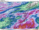
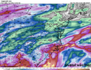
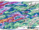
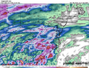
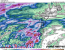
This couldn't be more perfect View attachment 198366
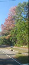
This is what we get for our weak Stratiform rain this summerYou don't have to look around the Wilmington area too hard to start noticing tree death all over the placeView attachment 198372
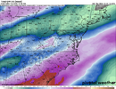
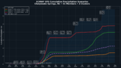
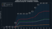
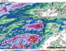
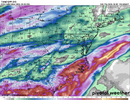
We're goodEPS with a small uptick in QPF, still looks like the wedge and how fast the trough passes are going to give the OPs fits on where the best axis of heavy rain sets up. Good to see the models backing off on the big wedge push Saturday, each time they are less aggressive with that rain totals increase. Living along or just north of the tmb will be the place to be for the heaviest rain, someone probably walks out of the weekend with their October average in the bucket while some are sitting with .0something.View attachment 198377

Although not a huge fan of how quickly the NAM blast the wedge in here. Hopefully it is too quickWe're good

Most likely died from beetles, tree that size generally don't die from lack of rain. Trees around it are fineThis is what we get for our weak Stratiform rain this summer

Drought stress made susceptible to pestsMost likely died from beetles, tree that size generally don't die from lack of rain. Trees around it are fine
Must be a lot of beetles aroundMost likely died from beetles, tree that size generally don't die from lack of rain. Trees around it are fine