• Hello, please take a minute to check out our awesome content, contributed by the wonderful members of our community. We hope you'll add your own thoughts and opinions by making a free account!

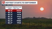
Pattern Sweatember

Duke is POSSIBLY scheduling rolling blackouts this weekend. GREAT ๐Ÿ™„๐Ÿ™„๐Ÿ™„๐Ÿ˜ ๐Ÿ˜ ๐Ÿ˜ ๐Ÿ˜ ๐Ÿ˜ญ๐Ÿ˜ญ๐Ÿ˜ญ๐Ÿ˜ฌ๐Ÿ˜ฌ
CHARLOTTE, N.C. โ€“ Unusually hot September weather is driving high electricity demand across parts of the Carolinas. Duke Energy is asking customers in North Carolina and South Carolina to voluntarily reduce electricity use from 2-8 p.m. today, Sept. 18, to help reduce demand on the power grid during the dayโ€™s peak period.

Customers can help by taking simple steps during this peak period:

  • Raise your thermostat to the highest comfortable setting.
  • Avoid using major appliances such as washing machines, clothes dryers and dishwashers.
  • Limit use of electric ranges and ovens, which can add heat to your home and increase air conditioning demand.
  • Electric vehicle owners: Charge overnight, when demand is lower.
โ€œAbove-average heat puts pressure on the system during peak hours,โ€ said Kendal Bowman, president of Duke Energyโ€™s utility operations in North Carolina. โ€œSmall actions during the late afternoon and early evening can help reduce strain on the grid and support reliable service for everyone.โ€

โ€œWe recognize it is inconvenient to reduce electric use, but it makes a real difference," said Tim Pearson, president of Duke Energyโ€™s utility operations in South Carolina. โ€œWeโ€™re using every available resource to meet demand so power keeps flowing to our communities.โ€

Duke Energy has approximately 3.9 million electric customers in North Carolina and more than 870,000 electric customers in South Carolina.

Duke Energy

Duke Energy (NYSE: DUK), a Fortune 150 company headquartered in Charlotte, N.C., is one of Americaโ€™s largest energy holding companies. The companyโ€™s electric utilities serve 8.7 million customers in North Carolina, South Carolina, Florida, Indiana, Ohio and Kentucky, and collectively own 55,700 megawatts of energy capacity. Its natural gas utilities serve 1.6 million customers in North Carolina, South Carolina, Ohio and Kentucky.

Duke Energy is executing an energy modernization strategy, keeping customer value at the forefront as it invests in electric grid upgrades and efficient generation resources to strengthen the system and serve growing energy needs.

More information is available at duke-energy.com. Follow Duke Energy on X, LinkedIn, Instagram, TikTok and Facebook for stories about the people and innovations powering its communities.

24-Hour: 800.559.3853
FULL ARTICLE HERE

Today is the 20th NOT the 18th.
 
One more day above ninety degrees to go at RDU then we will get a welcome respite from the record breaking high temperatures that many of us will be not be sad to see go away. The NWS map for the United States has no heat related advisories or warnings on it today which is the first time I've seen that in a while.
 
Last edited:
BOOM goes the ------- dynamite!
173
WUUS51 KRNK 211709
SVRRNK
VAC121-155-750-211800-
/O.NEW.KRNK.SV.W.0225.260921T1709Z-260921T1800Z/

BULLETIN - IMMEDIATE BROADCAST REQUESTED
Severe Thunderstorm Warning
National Weather Service BLACKSBURG VA
109 PM EDT Mon Sep 21 2026

The National Weather Service in BLACKSBURG has issued a

* Severe Thunderstorm Warning for...
Northeastern Pulaski County in southwestern Virginia...
The City of Radford in southwestern Virginia...
Southwestern Montgomery County in southwestern Virginia...

* Until 200 PM EDT.

* At 109 PM EDT, a severe thunderstorm was located over Dublin,
moving east at 10 mph.

HAZARD...60 mph wind gusts and quarter size hail.

SOURCE...Radar indicated.

IMPACT...Hail damage to vehicles is expected. Expect wind damage
to roofs, siding, and trees.

* Locations impacted include...
Christiansburg...
Radford...
Pulaski...
Dublin...
Pilot...
Claytor Dam...
and Fairlawn.

PRECAUTIONARY/PREPAREDNESS ACTIONS...

Prepare immediately for large hail and damaging winds. For your
safety, move to an interior room on the lowest floor of a sturdy
building. Stay away from windows.

When it is safe to do so, please send your reports of hail of any
size, as well as reports of any wind damage, including downed trees
or large limbs, to the National Weather Service by calling toll free
at 1...8 6 6...2 1 5...4 3 2 4. Reports and pictures can also be
shared on the National Weather Service Blacksburg Facebook page and
on X.
 
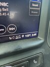
I'm surprised the kickoff for this game was not postponed to account for the extreme heat on the field. That's insane playing on a football field with 150 degree temperatures on the field. I can only imagine how the players felt wearing their equipment and running around in those conditions.
 
BULLETIN - IMMEDIATE BROADCAST REQUESTED
Severe Thunderstorm Warning
National Weather Service Raleigh NC
552 PM EDT Mon Sep 21 2026

The National Weather Service in Raleigh has issued a

* Severe Thunderstorm Warning for...
West central Wake County in central North Carolina...
Northeastern Chatham County in central North Carolina...

* Until 645 PM EDT.

* At 552 PM EDT, a severe thunderstorm was located 4 miles west
of Cary, moving south at 10 mph.

HAZARD...60 mph wind gusts and quarter size hail.

SOURCE...Radar indicated.

IMPACT...Hail damage to vehicles is expected. Expect wind damage to roofs, siding, and trees.

* Locations impacted include...
Cary, RDU International, Apex, Holly Springs, Morrisville,
Crosswinds Boating Center, Crosswinds Campground, New Hill, Jordan Lake, and Jordan Lake State Rec Area.

This includes the following highways...
Interstate 40 between Mile Markers 283 and 286.
US 1 between Mile Markers 83 and 84, and between Mile Markers 88 and 100.

PRECAUTIONARY/PREPAREDNESS ACTIONS...

Prepare immediately for large hail and damaging winds. People outside should move immediately to shelter inside a strong building. Stay away from windows.
 
If we get the remnants entrained into our area next week, it will be bad! And would almost guarantee the wettest month in Iowa , ever! I think Sept is already top 10 wettest month ever here in a lot of cities!
 
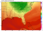
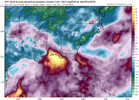
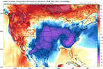
Latest LR Model watching for October. Looks warm as we roll into first 10 days of the new month. Eps keeps NC in 70's. You can see the decaying Death ridge is washing out / leaving some after taste. The decaying baggage looks to be shifting east toward the SE and away from the Miss River south central plains like it was depicting past couple of days. Euro Op total qpf map says Central TN , AL and central to west GA stay bone dry throughout. You can throw the Carolinas into that mix with the exception of the next 72 hours. Did notice on all the models Alaskan trof throughout. However the CFS starts to Ridge out that way as we roll into late OCT.
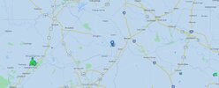
 
Latest LR Model watching for October. Looks warm as we roll into first 10 days of the new month. Eps keeps NC in 70's. You can see the decaying Death ridge is washing out / leaving some after taste. The decaying baggage looks to be shifting east toward the SE and away from the Miss River south central plains like it was depicting past couple of days. Euro Op total qpf map says Central TN , AL and central to west GA stay bone dry throughout. You can throw the Carolinas into that mix with the exception of the next 72 hours. Did notice on all the models Alaskan trof throughout. However the CFS starts to Ridge out that way as we roll into late OCT.


October is normally driest month of the year
 
What a summer it's been. I don't think many people will be sorry to see it go

Here's hoping October starts the wet pattern for more people. The globals are definitely hinting at some moisture from the Pacific hurricanes. Just impossible to tell where it would set up right now FB_IMG_1790074650150.jpg
 
Last edited:
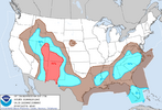
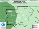
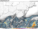
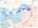
Rinse and repeat, AGAIN! LFG fropa, LFG rain! All roads lead to isolated tree damage at least for western parts of NC. WAD issued. The timing is right. We are WAY overdue for a power failure. Ironically the past two times it forecasted severe weather the day of the outage and cold rain the next day all lead to extended outages.
1790086043898.png
1790086058522.png
WEATHER ALERT DAY
1790086132438.png1790086146113.png1790086172047.png

1790086205786.png1790086222068.png
 

giphy.gif


Sent from my iPhone using Tapatalk
 
Me checking on those capes
1790093232221.png
1790093243219.png
1790093260072.png
1790093271037.png
1790093284360.png
1790093305382.png
1790093325155.png
ONE WORD. ๐Ÿซ ๐Ÿซ ๐Ÿซช๐Ÿซช๐Ÿซช๐Ÿซช๐Ÿซช๐Ÿซช๐Ÿคข๐Ÿคข๐Ÿคข๐Ÿคข๐Ÿคข๐Ÿซฉ๐Ÿซฉ๐Ÿซฉ๐Ÿซฉ UGLY. UGLY. UGLY!!!
 
A batch of heavy showers has popped up, which lead to mainly heavy rain starting at 12:50PM. It is continuing to rain at a moderate rate and this is adding up nicely. 1/2โ€++ has already fallen. The showers are moving SSW. Before today, I had received 2โ€ MTD. So, these are beneficial rains.

Edit: I estimate a total of ~0.55โ€ on Sep 22nd, which brings me to ~2.55โ€ MTD.
 
Last edited:
Back
Top