95 outside. 74 inside. Can it hold



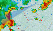

Missed us by a hair here.Holy split/miss again. Cant wait to move to the mountains. T-6 days until I go to the wettest county east of the Mississippi…
Sent from my iPhone using Tapatalk

Currently 103.3 here. Wth...This is freaking disgusting. Im officially filing a complaint and am demanding major snow reparations this winter on behalf of everyone

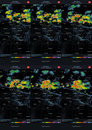
Just got hit with it, lost power and some fairly strong wind gusts, 40 mph on my weather station. Cooled down though which is nice I guess. Was 97, now 77.There is about to be a clash of OFB's just south of Atlanta. Looks really neat on radar.
View attachment 197887

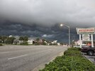
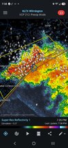


The complaints about the national weather pattern have been loud and numerous. When will the heat ridge in the south central states fall apart, or move out? If it is a "Super El Nino", why don't the rain and thunderstorms develop across the southern third of the country? And what is with the very quiet tropical Atlantic Basin?
A lot to sort out here. But I can tell you that all of the numerical model families are catching on to the scenario of a national pattern change in the last ten days of this month. A troublesome development is the prospect of a deep polar stream shortwave smashing through the Midwest, Great Lakes and the Northeast around September 14 - 16. This feature will have the effect of weakening the big subtropical high in the lower Great Plains, and bringing in cooler values through the Corn Belt and Mid-Atlantic regions by the first week in October. Another, less obvious area of concern is the "hurricane pipeline" off of the Pacific shoreline of Mexico. At some point, probably later than sooner, a storm will move inland into the Mexican mainland or through Baja California. That system should erode the ridge on its southwest flank, opening the door for a strong southern branch windfield common with a well-developed +ENSO signature. Curiously, the hydrothermal maximum at sector 3.4 has leveled off during the past two weeks. While the various forecast models keep trying to bring this episode intoo "historic" levels, in plain truth/terms of numbers, it is very much like the 1982-83, 1997-98, and 2015-2016 Pacific Basin El Ninos. But there are, of course, a couple of wrinkles to look at before the winter (DJFM) arrives.
The prime "x-factor" is the expected downturn (collapse) of water temperatures through the equatorial Pacific Ocean in late autumn. Remember that the sea surface anomalies have leveled off about 45 days before what was predicted by the climate models. The "plateau" will go into free-fall by New Year's Day, so much so that a negative-neutral marker is possible by April Fool's Day. I have seen sudden drop-offs like that expected this winter, and usually the trigger is a typhoon-injection element where a huge tropical cyclone translates poleward into a standing mAk vortex in the Aleutian Islands or Gulf of Alaska, merging with the gyre. That creates opportunities for massive warm advection along or either side of the West Coast (-EPO or +PNA) with the resultant blocking ridges involving Alaska and western/northern Canada. And cutting down on southern branch disturbances moving into California.
Note the equatorial moisture axis across the Pacific Ocean from below Hawaii to western Mexico. If that is maintained, and gives rise to a subtropical jet stream arc from Baja California Sur to the lower Rio Grande Valley, the abundance of mild winter forecasts in the lower 48 states would likely fail. A "typical El Nino" will see splitting of the polar westerlies, with one branch through the Desert Regions and eastward along the Gulf Coast, then off of the North Carolina shoreline, laden with some deep (but not overly cold) storms. The cold +ENSO seasons almost always have strong ridging in the West and Arctic areas, with a solid northern branch that constantly interacts with very low-latitude jet axes that keep winter weather lovers happy across the eastern half of the nation.
It is too early to make a winter forecast. But clues are piling up. In the meantime, watch the very hot first half of September give way to slow cooler transitions, and probably neutral-to-cool weather in much of the USA in October and November.
Prepared by Meteorologist LARRY COSGROVE on
Saturday, September 5, 2026 at 11:30 P.M. CT
I mentioned this the other day, but it’s eye opening how much similar this progression we’re seeing right now is to 1997-98. I also looked at 1982-83 and 2015-16 as well and while there are some similarities, the overall pattern so far in the second half of August and September is almost a carbon copy of 1997.think the heat and dryness is being caused by the super Nino , it’s going be so strong it’s having a reverse effect Winter is going be Interesting say the least .

I think we’ll probably have an another bout of heat during the first or second week of October with temps around 10 degrees above average. Of course by then our average high is down into the upper 70s so we’ll be talking about upper 80s and not upper 90sYou can actually breathe comfortable air outside today. No Heat or air qaulity advisories = no complaints. Got one more stretch to navigate late this week into next weekend. Then that should do it over this way mby. Looks like we will be flirting and dealing with potential 88-92 type stuff and not upper 90s to 100 garbage.
Trend is our friend. Warmest forecast high we have late this week is a 88.
However LR 0z Euro cooks us next Mon -Wed as ridge breaks down central plains passes us by on its way out. Then its Fall wx Thurs week. End is in sight should get there second half September.
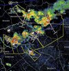


Didn't do me any good. Same ---- different day. Fringed with just a few drops. All summer long same ----complex T storms..oofView attachment 197902
Same!Didn't do me any good. Same ---- different day. Fringed with just a few drops. All summer long same ----
Brutal man. A few miles away Asheville hwy is flooded. I wish I could find the map with the last 30 days of precip. I bet I've had only half of what Spartanburg and Campobello and surrounding areas have had. Never ending here. Storms come from the NW and get areas to the north then I guess downslope and the outflow kicks them back off along and south of 85 completely skipping this area. A tale as old as timeSame!
Ridge will be back count on it. Going be factor all winter with this super NinoMore from LC
It is still calendar summer in North America, and many of the main atmospheric features that have controlled national weather since Memorial Day are still in play. It would be easy to give up and think that the vaunted heat ridge complex in the south central states will stick around into winter (incredibly, this is what is bouncing around social media now, in tandem with the Super El Nino trope...). But a change is easily recognizable, with an incremental alteration evident as soon as the third week of this month. The polar westerlies have embedded strong shortwaves that seem to be ejected by the large storm complex across the Aleutian Islands. One such impulse will target the northern tier of the nation in the near term. But it is the second, and likely stronger, storm and frontal structure that will dig a bit further south and affect communities as far south as an Interstate 70 line by late in the medium range. This feature will dent the big ridge complex, supplying a modest temperature and dewpoint drop from the Great Plains to Appalachia by September 16. The flattened heat ridge could retrogress with a portion drying and heating California, the Great Basin and the Desert Regions. But we will have to wait until September 21 or so for a final curtain call of the "Summer Of '26" heatwave.



I never thought a dewpoint of 65 could feel refreshingIt feels amazing this morning!!
Sent from my iPhone using Tapatalk