
make that 101 presentlyI agree with your main point that 100 at RDU in September is rare historically. We can do deep dives into the data going back to the early 1900's sure, but whether it's 5 times or 8 or 10 since then, that's still rare by most people's standards.

-
Hello, please take a minute to check out our awesome content, contributed by the wonderful members of our community. We hope you'll add your own thoughts and opinions by making a free account!
You are using an out of date browser. It may not display this or other websites correctly.
You should upgrade or use an alternative browser.
You should upgrade or use an alternative browser.
Pattern Sweatember
- Thread starter SD
- Start date

Well, that was good timing.make that 101 presently


does it show a pattern change?

no but at least the euro has this thing that doesn't actually help much at all:does it show a pattern change?
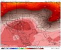
Better than a 700dm ridge over the SEno but at least the euro has this thing that doesn't actually help much at all:
View attachment 197852
that's later in the runBetter than a 700dm ridge over the SE
JHS
Member
GSP's Saturday thinking. It "might" be a big day.
Which brings us to Saturday. Seems like a lot of heat waves (if
that`s what you want to call the last several days) end with a
bang. The Day 3 Convective Outlook from the SPC shows a Slight Risk
across much of the fcst area, and that is certainly warranted. As
we come more under the cyclonic influence of the upper low over
the Canadian Maritimes, a cold front should drop down from the
northwest, possibly with ideal timing during peak heating. The 15Z
RAP looks compelling at 18Z Saturday, showing an environment with
upwards of 3500 J/kg of muCAPE and 20-30 kt of effective/deep
layer sheer to go along with an excellent trigger. Convection
moving past to the north may also leave behind an old outflow
or cloudy/clear boundary to be a focus for afternoon storms. The
event remains tantalizingly just outside the window of the CAMs, so
confidence is kept low, but we eagerly await later runs to provide
more clarity. Should be quiet after the front passes Saturday night.
Which brings us to Saturday. Seems like a lot of heat waves (if
that`s what you want to call the last several days) end with a
bang. The Day 3 Convective Outlook from the SPC shows a Slight Risk
across much of the fcst area, and that is certainly warranted. As
we come more under the cyclonic influence of the upper low over
the Canadian Maritimes, a cold front should drop down from the
northwest, possibly with ideal timing during peak heating. The 15Z
RAP looks compelling at 18Z Saturday, showing an environment with
upwards of 3500 J/kg of muCAPE and 20-30 kt of effective/deep
layer sheer to go along with an excellent trigger. Convection
moving past to the north may also leave behind an old outflow
or cloudy/clear boundary to be a focus for afternoon storms. The
event remains tantalizingly just outside the window of the CAMs, so
confidence is kept low, but we eagerly await later runs to provide
more clarity. Should be quiet after the front passes Saturday night.

Beat Goes On!
JHS
Member
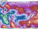
GSP is starting to pick up on it. They say the RAP gives us a rough day Saturday.Just a run of the mill 5454 sb cape nbd. Think people are sleeping on the severe potential
JHS
Member
I'll be keeping an eye on it. GSP beginning to bite on it.Especially the damaging wind potential. Probably some hail with the updraft pulses, but this could be a big wind bag day. 1.4K DCAPE is pretty ridiculous

- Joined
- Jul 28, 2024
- Messages
- 803
- Reaction score
- 418
Summary
September 3, 2026
| High | Low | Average | |
|---|---|---|---|
| Temperature | 100.2 °F | 69.0 °F | 95.6 °F |
| Dew Point | 78.6 °F | 51.6 °F | 73.4 °F |
| Humidity | 94 % | 42 % | 50 % |
| Precipitation | 0.04 in | -- | -- |

CHA hit 100 again today along with a max heat index of 108. Also the 31st consecutive day with a high of 90+ which ties 1954 for the 3rd longest 90+ streak on record.

Heat sensor making its return!!! 
Heat sensor making its return!!!
All these 100s at rdu but never on my tempest

Brent
Member
Everything is fine. Nothing to see here 
I was looking back at Septembers in strong El Niño and right now this is kinda playing out very similar to the fall of 1997. That year September and the first half of October was well above average and quite dry. KCLT had highs well into the 80s for the most part into mid October. Now once the STJ got going it really got going strong the second half of OctoberWhat if this el nino is so strong/ off charts. That it doesn't exactly behave like traditional el ninos and we end up with ridiculous dry wx instead of the usual STJ firehose? Maybe the firehose takes aim in another direction, not traditional sw-ne from Arizona to the Mid Atlantic.
On my mind as we should start seeing some evidence on these long range models late Sept into Oct. So far it’s all crickets with regard to the STJ. Now death ridge is another story. Constant.

I’m taking a forecasting class and everyone was predicting 0.00”. Go figure the only storm in the area sat at RDU and dropped half an inch. Now all our forecasts are busted.
Yep I've seen the same thing. Mainly hot September, probably a decent cool down near the 20th for a few days with a high precip event, hot first half of October, stj kicks in mid October, cool down and better precip chances. Interestingly the October pattern flip may coincide with a little bit of tropical activityI was looking back at Septembers in strong El Niño and right now this is kinda playing out very similar to the fall of 1997. That year September and the first half of October was well above average and quite dry. KCLT had highs well into the 80s for the most part into mid October. Now once the STJ got going it really got going strong the second half of October
Brent
Member
That seems to be the unanimous consensus here... No matter how and record setting September is the analogs are all super wet in October
And I do feel like the Pacific will get involved eventually. There's been hints of it here mid month already. Probably no hope from the Atlantic the way things are going(latest first hurricane in the satellite era is next week and there is nothing really showing up)
And I do feel like the Pacific will get involved eventually. There's been hints of it here mid month already. Probably no hope from the Atlantic the way things are going(latest first hurricane in the satellite era is next week and there is nothing really showing up)
This September is gonna have to end up as the warmest Sept on record if these models have half a clue:
Here's the latest GFS all the way out till Sept 18th. Look how far north the 100's are out in the plains. Never seen a more stubborn ridge anchor down and refuse to move for weeks on end.
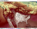
Here's the latest GFS all the way out till Sept 18th. Look how far north the 100's are out in the plains. Never seen a more stubborn ridge anchor down and refuse to move for weeks on end.

256wx
Member
Crazy. Was hotter at my place (and most of y'alls, as well,) at 3:00PM yesterday than it was in Las Vegas.
Miserable euro suite. I should switch careers
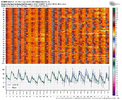
Dont mind the ridge retrograding west at and after d10. Overall hate the run at the sfc though but at least other than a few days the hot is low to maybe a mid 90 versus 100's printer go brrr
just realized there's all of THREE individual boxes on this chart that start with a 5

- Joined
- Jan 2, 2017
- Messages
- 1,570
- Reaction score
- 4,287
Thats just sickening!This September is gonna have to end up as the warmest Sept on record if these models have half a clue:
Here's the latest GFS all the way out till Sept 18th. Look how far north the 100's are out in the plains. Never seen a more stubborn ridge anchor down and refuse to move for weeks on end.
View attachment 197862
- Joined
- Jul 28, 2024
- Messages
- 803
- Reaction score
- 418
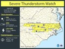
SEVERE THUNDERSTORM WATCH #654 IS IN EFFECT TILL 10PM TONIGHT


Stone Cold Heel
Member
Didn't expect a severe thunderstorm watch today.
NATIONAL WEATHER SERVICE RALEIGH NC
257 PM EDT FRI SEP 4 2026
THE NATIONAL WEATHER SERVICE HAS ISSUED SEVERE THUNDERSTORM WATCH 654 IN EFFECT UNTIL 10 PM EDT THIS EVENING FOR THE FOLLOWING AREAS
IN NORTH CAROLINA THIS WATCH INCLUDES 25 COUNTIES
IN CENTRAL NORTH CAROLINA
ALAMANCE CHATHAM DAVIDSON
DURHAM EDGECOMBE FORSYTH
FRANKLIN GRANVILLE GUILFORD
HALIFAX HARNETT JOHNSTON
LEE MONTGOMERY MOORE
NASH ORANGE PERSON
RANDOLPH STANLY VANCE
WAKE WARREN WAYNE
WILSON
NATIONAL WEATHER SERVICE RALEIGH NC
257 PM EDT FRI SEP 4 2026
THE NATIONAL WEATHER SERVICE HAS ISSUED SEVERE THUNDERSTORM WATCH 654 IN EFFECT UNTIL 10 PM EDT THIS EVENING FOR THE FOLLOWING AREAS
IN NORTH CAROLINA THIS WATCH INCLUDES 25 COUNTIES
IN CENTRAL NORTH CAROLINA
ALAMANCE CHATHAM DAVIDSON
DURHAM EDGECOMBE FORSYTH
FRANKLIN GRANVILLE GUILFORD
HALIFAX HARNETT JOHNSTON
LEE MONTGOMERY MOORE
NASH ORANGE PERSON
RANDOLPH STANLY VANCE
WAKE WARREN WAYNE
WILSON
Stone Cold Heel
Member
CHA hit 100 again, 3rd day in a row.
Getting into rare territory with this heat wave, as there are only 2 other Septembers going back to 1879 with at least 3 days of 100+ (1925 and 1954)
Getting into rare territory with this heat wave, as there are only 2 other Septembers going back to 1879 with at least 3 days of 100+ (1925 and 1954)
Those EPS R2R change maps should have a lot of blue on them at 12z 
tennessee storm
Member
Looks like no end sight here , leastCHA hit 100 again, 3rd day in a row.
Getting into rare territory with this heat wave, as there are only 2 other Septembers going back to 1879 with at least 3 days of 100+ (1925 and 1954)
Next 15 days . Had enough
Stone Cold Heel
Member
Looks like the storms are going to miss me again.
18z gfs vibin 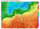

It be teasing.18z gfs vibin View attachment 197876
0z eps looks acceptable
Brent
Member
Got a TV forecast with mid 80s by the 15th. Accuweather doesn't get there til the 18th
Maybe just maybe something is changing though
Maybe just maybe something is changing though

Y’all say a lil prayer for my AC unit today. She’s on life support.
this pattern is going to snap. We’re going to go from 90’s to 60’s in a flash. I’m not sure how much in between weather we’re going to get this year
- Joined
- Jul 28, 2024
- Messages
- 803
- Reaction score
- 418
SEVERE THUNDERSTORM WATCH #656 WILL BE ISSUED UNTIL 9PM

