Belle Lechat
Member
- Joined
- Aug 29, 2021
- Messages
- 1,628
- Reaction score
- 1,278


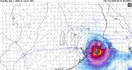
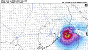
They now have it forecasted at 60 mph for peak intensityAt least the pressure went down.
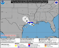
4:00 PM CDT Mon Aug 31
Location: 28.2°N 91.5°W
Moving: WNW at 6 mph
Min pressure: 1011 mb
Max sustained: 35 mph


Eduoard has made it's appearance. Will it last more than 24 hours is the question..

I thought it is forecasted to strengthen.Eduoard has made it's appearance. Will it last more than 24 hours is the question..
I thought it is forecasted to strengthen.
Okay. Looks like a lot of rain.It's forecast to be inland in 24 h.


Can’t believe TWC has crews on the ground for this.
Can’t believe TWC has crews on the ground for this.
DesperationCan’t believe TWC has crews on the ground for this.
The question is can they survive the 7 inch storm surgeI can because there may not be many more of these this year
It's a rough season for the chasers
Thing dried up in 3 hours. Basically naked now.
Thing dried up in 3 hours. Basically naked now.