NWMSGuy
Member
Interesting write-up for sure!If you read the National Hurricane's forecast discussion for Dolly check out the disclaimer at the end about how the storm got its name.

Interesting write-up for sure!If you read the National Hurricane's forecast discussion for Dolly check out the disclaimer at the end about how the storm got its name.

Not at all. It's weak and is almost certain to degrade into an open wave. I stand behind my post.Too late @Wild Weather Monger
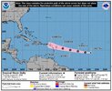
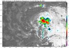
NHC will initiate advisories on Tropical Storm Dolly (formerly AL96) located in the central Tropical Atlantic, at 1100 AM EDT (1500 UTC).


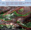
This is a great graphic, where did you get it from?
This is a great graphic, where did you get it from?

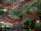
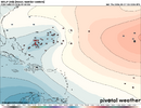
That is some strong wind shear Dolly will encounter! It is easy to see why the NHC is not too optimistic at this time about any significant development and its future in general. If it could get close to Cuba, even as a tropical wave, there is the chance it could redevelop as conditions there are more favorable. The trade winds are howling this hurricane season.
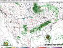
Looking at the numbers that might be close enough to cause some effects on the Southeast coast such as high tides and rip currents if Dolly is a little stronger than forecast.12Z UKMET: rapid WNW move in MDR with no strengthening followed by TS strength outside of MDR and change of move to NW well off the SE US at the end:
MET OFFICE TROPICAL CYCLONE GUIDANCE FOR NORTH-EAST PACIFIC AND ATLANTIC
GLOBAL MODEL DATA TIME 1200UTC 27.08.2026
TROPICAL STORM DOLLY ANALYSED POSITION : 13.6N 37.4W
ATCF IDENTIFIER : AL042026
LEAD CENTRAL MAXIMUM WIND
VERIFYING TIME TIME POSITION PRESSURE (MB) SPEED (KNOTS)
-------------- ---- -------- ------------- -------------
1200UTC 27.08.2026 0 13.6N 37.4W 1009 30
0000UTC 28.08.2026 12 14.0N 41.3W 1009 31
1200UTC 28.08.2026 24 14.5N 45.7W 1010 31
0000UTC 29.08.2026 36 15.3N 49.9W 1011 32
1200UTC 29.08.2026 48 16.3N 54.0W 1011 33
0000UTC 30.08.2026 60 17.3N 57.7W 1011 33
1200UTC 30.08.2026 72 18.7N 61.0W 1011 35
0000UTC 31.08.2026 84 19.7N 63.4W 1010 32
1200UTC 31.08.2026 96 20.4N 65.8W 1010 34
0000UTC 01.09.2026 108 21.0N 67.5W 1009 32
1200UTC 01.09.2026 120 21.5N 69.4W 1007 35
0000UTC 02.09.2026 132 21.8N 70.6W 1006 36
1200UTC 02.09.2026 144 22.8N 72.2W 1004 39
0000UTC 03.09.2026 156 23.7N 73.7W 997 42
1200UTC 03.09.2026 168 25.2N 75.3W 992 49


Dolly Parton died ironically this week, and this storm was named after her. HmmmHello, Dolly!
Dolly Parton died ironically this week, and this storm was named after her. Hmmm
These names are on a 6 year cycle.Dolly Parton died ironically this week, and this storm was named after her. Hmmm

I think they get paid per named storm.They need more rules on naming. When a supposed storm is forecast to fall apart as soon as its named, its in the middle of nowhere, and no recon, then wait at least 24 hours to see if it can persist. Just a name to up numbers. There was no hurry at all to name it.
They need more rules on naming. When a supposed storm is forecast to fall apart as soon as its named, its in the middle of nowhere, and no recon, then wait at least 24 hours to see if it can persist. Just a name to up numbers. There was no hurry at all to name it.
And now its an open wave still in the middle of nowhere.But 96L was pretty well organized for a good while before being designated TS Dolly. They could have called 96L a TD earlier.
Well shucks! I ,for one, am more concerned about these islands in the stream and how Dolly could affect them.Dolly Parton died ironically this week, and this storm was named after her. Hmmm
Best open wave I've seen in foreverAnd now its an open wave still in the middle of nowhere.

Think this is spot on. Bertha was at least 24 hrs (maybe 48 hrs?) The rest, lol.Have any of the 4 tropical storms so far this year lasted longer than 12 hours? I think maybe Bertha did.
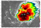
She does finally look like an open wave without much westerlies on her south side. Some Ensembles revive her or her energy albeit very weak later on.Someone should tell Dolly she's dead according to the NHC. I don't think she got the memo View attachment 197679
I think the system is more vigerous that many thought it would be atm. The chances of redevelopment once past Hispaniola have increased IMO. Dolly presents a threat to the SE and GOM and shouldn't be slept on.She does finally look like an open wave without much westerlies on her south side. Some Ensembles revive her or her energy albeit very weak later on.

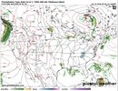
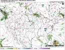
If X Dolly makes it to the GOM, all bets are off. It would be a threat all the way to Texas with this stout 500mb high over the Eastern US.Yeah, I'm just a layperson, but I'd probably go 20-30% on redevelopment for now in the 7 day outlook. The models petering this out have a good bit of land interaction, but this has taken enough of a jog north that it may not interact with Hispaniola much.
If dry air doesn't get her, she'll probably regenerate in that world, and it'll potentially be interesting to see how good conditions are near SE Bahama...though I'd still say a weak TS would probably be most likely.
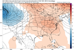
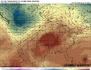
If X Dolly makes it to the GOM, all bets are off. It would be a threat all the way to Texas with this stout 500mb high over the Eastern US.
View attachment 197686
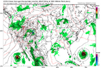

The euro ensembles at 12z try to give her a second chance though very weakGfs morphs dolly remnants into a trough and brings it the area in 10-11 days. Canadian brings it back to life and smokes nola