
This system has been very hit or miss it seems.


We got hit several times yesterday with probably a couple of inches (ants ate my Tempest again). About 5:30 we had a lighting strike hit the house or so near the house it tripped the GFIs on my covered back porch. I provide power via that GFI to the local internet provider (and get free internet) so I wouldn't have known until the kids complained. I'm just glad it didn't burn anything up.This system has been very hit or miss it seems.

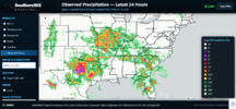
This is a hard product to find.I wish I could find a precip totals map for the last week. I bet it would show 99% of both Carolinas with 1-2 inch plus totals with one little area with less than .25 right where I am.
This is a hard product to find.
I wish I could find a precip totals map for the last week. I bet it would show 99% of both Carolinas with 1-2 inch plus totals with one little area with less than .25 right where I am.
We got hit several times yesterday with probably a couple of inches (ants ate my Tempest again). About 5:30 we had a lighting strike hit the house or so near the house it tripped the GFIs on my covered back porch. I provide power via that GFI to the local internet provider (and get free internet) so I wouldn't have known until the kids complained. I'm just glad it didn't burn anything up.
There used to be a great place to go, but I can't find it anymore. I believe it was a river forecasting site.This is a hard product to find.

There used to be a great place to go, but I can't find it anymore. I believe it was a river forecasting site.
I wish I could find a precip totals map for the last week. I bet it would show 99% of both Carolinas with 1-2 inch plus totals with one little area with less than .25 right where I am.
Some just popped thunderstorms in my area at 4PM moving slowly W.
CTG lightning strike very close!

When did you move to Iowa?? Currently 92, feels like 97I wish I could find a precip totals map for the last week. I bet it would show 99% of both Carolinas with 1-2 inch plus totals with one little area with less than .25 right where I am.

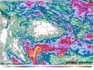


Here you go!I wish I could find a precip totals map for the last week. I bet it would show 99% of both Carolinas with 1-2 inch plus totals with one little area with less than .25 right where I am.
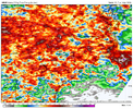
That looks about like I thought it would. I'm in that little blue dot near Spartanburg surrounded by those red areas.Here you go!
View attachment 196821


Here you go!
View attachment 196821

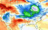

Relentless @Brent ridge on the 12z euro
I'll be in North Myrtle next week. Really hope the tropical system doesn't develop while I'm there.

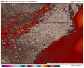

YOU HEARD IT HERE FIRST:We've had less than 10" worth of rain so far this year. We need every drop we can get.

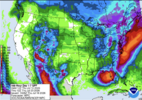

The NWS in Raleigh mentioned the trend you are referring to in their forecast discussion this morning. Let's see if we can keep pushing those heavier precipitation totals further west.It keeps inching west. Can the trend continue? View attachment 196843

Just not like the tropical system last July, please. I’d rather not deal with I-40 flooded over again!We've had less than 10" worth of rain so far this year. We need every drop we can get.
I need more forecasts like this in my lifeYOU HEARD IT HERE FIRST:
SD Bermuda Lawn will record 10.0+ double digit rainfall for the month of July 2026. Beleive he is sitting at 5.5 ish. He's gonna get 2-3 by this time next week. How? Rogue T storm over the weekend and the NE Gulf Gyro is gonna cough up another 1-2 from various dynamics next week.
Then all my forecasted call has to do to verify is get him under a strong T storm the last 5-6 days of July and whala!

Be aware, he never said inches, he probably prophesied in mm.I need more forecasts like this in my life

You about to get Culver’s??
