
Stone Cold Heel
Member
Ended up with a good storm coming through. Thunder and heavy rain.



UPDATE: some DUMBASS took out the damn power.Aaand we lost power, AGAIN! wont be back on till 3:45am

A driver crashed into a transmission tower Sunday night in Harnett County, leaving about 1,000 customers without power.
The tower is along Red Hill Church Road near Erwin. The crash happened around 9 p.m.
Duke Energy told WRAL News that a car struck the tower. Crews are installing a temporary power pole to restore service to customers.
The tower was seen leaning early Monday morning.
Crews estimated that power might not be restored until 10:45 a.m.
It is unclear whether anyone was injured.


they rock. it was 74 all day yesterday here getting 1.7 inches of raini had been wondering if/when we'd get our annual summer "wedge" day. probably will get one or two more in august

Maybe the next "wedge" day will be courtesy of a tropical system that dumps multiple inches of rain over many of us. I know the hurricane forecast is slim pickings for us with the strong shear over the Atlantic and Gulf due to El Nino but it just takes one tropical system in the right spot to bring the drought relief that many of us are looking for.i had been wondering if/when we'd get our annual summer "wedge" day. probably will get one or two more in august
Maybe the next "wedge" day will be courtesy of a tropical system that dumps multiple inches of rain over many of us. I know the hurricane forecast is slim pickings for us with the strong shear over the Atlantic and Gulf due to El Nino but it just takes one tropical system in the right spot to bring the drought relief that many of us are looking for.
It's up to 80 right now in Jonesville and of course no rain. All of that stuff last evening missed me.interesting to see the NAM MOS jump from predicting today's high to be 72 yesterday, now jumping to predicting 80 as of this morning. 80 would be a surprise to me at KGSP. also, we picked up 0.86" last night to jump us to 1.28" for the month and 17.83" for the year. KGSP is about 6.5" behind average with 19.60" for the year
by this time in 2020 we had 46.21"


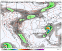
Watch the gulf coming up and then the incoming front. Rain +++++ potential
The AI did this yesterday. Still sorta does but much weakerIts getting interesting. It's a good pattern for it with the ridge bridging over the top
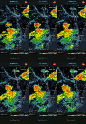

TWC says you have a 50% chance of rain tomorrow.It simply refuses to rain where I am and now no chance for 7-10 days plus. This event was a complete miss here.
anyways it’s 80 at GSPinteresting to see the NAM MOS jump from predicting today's high to be 72 yesterday, now jumping to predicting 80 as of this morning. 80 would be a surprise to me at KGSP. also, we picked up 0.86" last night to jump us to 1.28" for the month and 17.83" for the year. KGSP is about 6.5" behind average with 19.60" for the year
by this time in 2020 we had 46.21"
GSP is more realistic but still too high with 30%. Right now, storms are blowing up all around us, but none closer than 10 miles away. They are all over the tri county area but just refuse to get close to me. 2 clusters going and I'm dry slotted.TWC says you have a 50% chance of rain tomorrow.


Yep! 15 days of blue sky, corn sweats , no rain, barely a fair weather cumulus in the sky, and 90s! Boring and sucky to the nth degree! Currently 90, feels like 95!Probably more of a banter question but…is July the most boring month weather wise? I vote yes. Just a question of how hot we get. Isolated severe. Too early for tropical season for most. Yawn


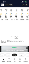




I wish I could find a precip totals map for the last week. I bet it would show 99% of both Carolinas with 1-2 inch plus totals with one little area with less than .25 right where I am.

