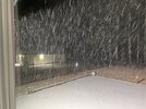
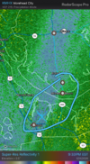
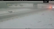
Since it’s currently dumping at my location in S. Charlotte from that band, I could probably check off my bucket list item of experiencing lake effect snow on a technicality if I really wanted to. I don’t think I will though…Think they have had it off Kerr lake a few times!
-
Hello, please take a minute to check out our awesome content, contributed by the wonderful members of our community. We hope you'll add your own thoughts and opinions by making a free account!
You are using an out of date browser. It may not display this or other websites correctly.
You should upgrade or use an alternative browser.
You should upgrade or use an alternative browser.
Wintry Machine Learning Mauler 1/30-2/1
- Thread starter SD
- Start date
I think the entirety of Wake County should have full permission to brag and boast about any heavy returns they’re now finally getting!!! Finally out of the long lasting snow holeI’m not trying to annoy anybody by continuing to share with you guys so I hope that’s OK. But I have 2 1/2 inches in 2 1/2 hours in Youngsville.
Sent from my iPhone using Tapatalk
Sctvman
Member
Nearly 3” in Port Royal while James Island might have 1/4”. Wild
Webberweather53
Meteorologist
Does anyone know how much Fayetteville, NC, has received? They were dry most of the day despite many model runs burying them and I haven’t seen any recent mention of that city.
Family there has reported about a 0.5" so far and the heavier snow is moving in.
Heelyes
Member
The hrrr was wrong here
JimBobs
Member
Surprisingly we have some more moderate snow falling here near SouthPark. Not really showing up on radar. I thought we had permanently gone over to flurries, but no.
CarolinaHighlander
Member
Another decent band coming through here
- Joined
- Jan 23, 2021
- Messages
- 4,596
- Reaction score
- 15,184
- Location
- Lebanon Township, Durham County NC
The FV3 was right all alongThe hrrr was wrong here
Looking at radar trends with the meso low slowly moving SE I think we're seeing the east "arm" of snow stop it's northward progression. This is what the HRRR was showing and potentially leading to some higher totals in Horry county SC and Brunswick county NC.
Heelyes
Member
Do I really have 3 more hrs?
Avalanche
Member
Pixie dust snow here in Wilmington. Dusting so far, might hit 2-3 before all is said and done. Not bad for the beach.
Check clt radar streamers over youSurprisingly we have some more moderate snow falling here near SouthPark. Not really showing up on radar. I thought we had permanently gone over to flurries, but no.
rambleon
Member
TmiThe heavier radar returns near Goldsboro and north west are moving northwest. I have been under the band for roughly 2 hours. Measured 1" over last hour with a total of 4" having started here ~ 1800. Any one else live under these training returns? I believe I recall seeing someone from Lucama on this thread. Going to end with more than I anticipated after being in the dry area most of the day.View attachment 193016View attachment 193017View attachment 193020
That band hit us just west of Thomson for about an hour and we picked up an inch from it. It was the heaviest we had all day. I assume the arctic air was ringing out every bit of moisture left for the end.Almost 6 inches in Grovetown. We had a little over 4 inches around 5 pm then that last band came through around 7:30 and we were at 5.5 inches by 8:50 and it’s still been dumping the last 30 minutes since I checked the depth.View attachment 193035
Tsappfrog20
Member
3 inches in Youngsville!

Sent from my iPhone using Tapatalk

Sent from my iPhone using Tapatalk
Probably forming too low to get picked up on radar.Surprisingly we have some more moderate snow falling here near SouthPark. Not really showing up on radar. I thought we had permanently gone over to flurries, but no.
Weatherheels
Member
Keep the obs coming. Take some pics and share. These don’t happen often.I’m not trying to annoy anybody by continuing to share with you guys so I hope that’s OK. But I have 2 1/2 inches in 2 1/2 hours in Youngsville.
Sent from my iPhone using Tapatalk
wow
Member
Back to nothing at all
Maybe you'll get a deform band in the morning. You are the thread starter! I started "The Big One" in Feb 2014 at Amwx. I was frickin' cocky that this was it. Thought I busted bad, but then woke up to Jesus Glory in the morning. Then that glory melted away in a few hours, lol. The life of an admin.
Tokenfreak
Member
Up to 1.5” here about 35 miles north of Charleston. This is looking like a big bust unfortunately…
MRKEVIN7575
Member
Congrats on everyone seeing snow this weekend. Definitely cold enough to stick this time lol. A friend i golf with sometimes once told me " sometimes your the bug and sometimes your the windshield wiper."
BrickTamland
Member
Really fine flakes here but looks like there is a lot of it still to come.
finally picking up some in ilm. delayed start
wow
Member
Clear off your condenser units !!! .. if you have a heat pump at least. If gas, nevermindOk, so apparently that last bit knocked me over 12”


Started snowing again but nothing on Radar….. now need 1/2” for the All Time personal record
Sent from my iPhone using Tapatalk
Avalanche
Member
It’s odd how fine this is. You’d think bombing coastal low it would be biggerReally fine flakes here but looks like there is a lot of it still to come.
Icestorm336
Member
Crazy storm still coming down at a moderate clip. Solid 8 inches outside possibly 9. 15 miles NE of Greensboro
Heelyes
Member
I don’t know how it’s snowing so hard
Btownheel
Member
Still cranking pretty darn hard in Gibsonville. Bigger flakes as well.
Sent from my iPhone using Tapatalk
Sent from my iPhone using Tapatalk
wow
Member
Stormsfury
Member
We might get pockets of better snow from now until 5am. Hoping for a hail Mary overnight. Pretty much disappointing 1.5" here.Up to 1.5” here about 35 miles north of Charleston. This is looking like a big bust unfortunately…
carolinachaos
Member
I’m at 9” in Tega Cay, SC, 1 mile south of the NC/SC state line and Charlotte.
Sent from my iPhone using Tapatalk
Sent from my iPhone using Tapatalk
North Wake. 10 miles NW of Wake Forest. Right on the Granville County line.
Where you at in Wake Co?
mx3gsr92
Member
I will never doubt the NWS again. EVERY television station Met dropped us to 1-2" around 3 o'clock today. . . NWS stayed steadfast in their forecast and left it at 7-11". We're at 4" and under a band that has us at 1" per hour min right now with radar filling back in. I expected a total bust but what a surprise! Those guys are the experts for a reason!
BrickTamland
Member
From RAH on Facebook.
Greatest snow accumulation report by county as of 915 pm...
Alamance County... Glen Raven 7.0 in
Davidson County... Thomasville 15.5 in
Durham County... Rougemont 4.5 in
Edgecombe County... Rocky Mount 7.0 in
Forsyth County... Winston-Salem 11.0 in
Franklin County... Purnell 2.5
Guilford County... High Point 12.8 in
Hoke County... Silver City 3.5
Johnston County... Clayton 4.0
Lee County... Sanford 5.0
Montgomery County... Norwood 6.0
Moore County... Southern Pines 4.3
Nash County... Rocky Mount 6.0
Person County... Roxboro 7.5
Randolph County... Trinity 12.6
Stanly County... Finger 7.0
Wake County... Wake Forest 3.0
Wayne County... Goldsboro 5.5
Wilson County... New Hope 6.0
diamonddave
Member
Yep this is by far the heaviest snow we had alsoThat band hit us just west of Thomson for about an hour and we picked up an inch from it. It was the heaviest we had all day. I assume the arctic air was ringing out every bit of moisture left for the end.
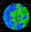
The streamers are impressive. Radar is starting to cave to the Low on the coast but these little streamers in and around CLT are amazing. Snow ratios have to be up in the western part of the state.Check clt radar streamers over you
For example. This is at the NC/SC border south of Charlotte. (9;39pm)

