NCPROGRAMMER
Member
Yup, this is looking like a bust for anyone not in the extreme eastern and western parts of the state. Enjoy it everyone.
Just brutal. This will be an all timer for us…eclipsing December 2000. Greensboro getting smoked…it looks like it will literally be just Raleigh that gets blanked when all said and done.Yup, this is looking like a bust for anyone not in the extreme eastern and western parts of the state. Enjoy it everyone.

We had a few shots this winter. We will go into 2027 likely almost a decade since the area has seen a good snow.Just brutal. This will be an all timer for us…eclipsing December 2000. Greensboro getting smoked…it looks like it will literally be just Raleigh that gets blanked when all said and done.
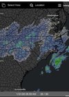
View attachment 192313
We wasted an all time great pattern. These don’t come along but once a decade and we blew it. Oh well…it’s just snow. It’s really funny if you think about it.We had a few shots this winter. We will go into 2027 likely almost a decade since the area has seen a good snow.
Um, this is the banter forum…Can the RDU folks please head to the banter forum. You can see where the next 12 hours snows are going to be set up.
View attachment 192318
This was an all timeCan the RDU folks please head to the banter forum. You can see where the next 12 hours snows are going to be set up.
View attachment 192318
He’s pouring over the new maps and data and preparing to share them with us shortly…Wellness Check on Brick?
Bam trolling
Appreciate that. I just woke up and looked out at my snow-less sky, checked the radar and felt a pang of disappointment. Snowing every which way around me but a blocking force field around the triangle.I’m truly sorry to you Raleigh area folks. I hope it defies odds and you guys get in on this in a big way.
Its coming down really good back this way. All my dry slot fear is gone. By late morning you and triangle will be going good, if not sooner. It bso cold, it really wrings every ounce an then some out of the atmosphere.Historic or generational bust?

I wanna trust in this optimism so very badly..
Its coming down really good back this way. All my dry slot fear is gone. By late morning you and triangle will be going good, if not sooner. It bso cold, it really wrings every ounce an then some out of the atmosphere.
So nice to watch it rip snow during daylight and not sweat temps, sun etc.
The model clown maps, without the big gaps, are gonna be the ones that verify. Saw gfs, icon, fv3 painting 5-10 across our state, sc. With heavier accums on coast. Thats whats gonna happen today. Over achieve, because of the rare phenomenon of that cold column all the way to the ground SQUEEZE PLAY. See this with upslope snow events occasionally in mtns.
I still say Johnson city, erwin TN , end up 12 -15 by late today.
I haven’t gone outside yet either but looks like there’s still some ice leftover from last weekend along with grass/mud.I haven’t gone outside just yet but I’m at least at an inch
From Reed Timmer
It’s a bi stormView attachment 192344
Hope you're right. Greg Fishel called for 4 to 7 inches last night. WRAL saying only 1 to 3. If the globals all end up busting and it ends up being nothing or just an inch of snow, then there's no sense in looking at them and coming here to talk about it it would just be a waste of time. Might as well not pay attention until the day before and just see what the local NWS office and local TV mets forecast..
Its coming down really good back this way. All my dry slot fear is gone. By late morning you and triangle will be going good, if not sooner. It bso cold, it really wrings every ounce an then some out of the atmosphere.
So nice to watch it rip snow during daylight and not sweat temps, sun etc.
The model clown maps, without the big gaps, are gonna be the ones that verify. Saw gfs, icon, fv3 painting 5-10 across our state, sc. With heavier accums on coast. Thats whats gonna happen today. Over achieve, because of the rare phenomenon of that cold column all the way to the ground SQUEEZE PLAY. See this with upslope snow events occasionally in mtns.
I still say Johnson city, erwin TN , end up 12 -15 by late today.
It is because I’m never following winter weather again. I won’t ever know it was supposed to snow only to have it fail. Back to severe / tropical storm chasing.The good news for us Raleigh folks...this ain't the worst bust we will ever have.
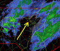
View attachment 192343
I’ve been at snowshoe and I haven’t paid much attention to this thing tbh, but the radar is null for north Georgia to this point. I don’t expect much more than maybe some flurries. When did they change WSW to 1” of snow for us? I swear it used to be 2+. Seems rather ridiculous.
Sorry for the slow response. B/c I don’t have a NC location on my profile, my nonsensical posts get moved to this thread when others can wax poetic about anything they want without consequence.
Things kind of escalated quickly yesterday. Most folks along & west of the extended corridor 400 corridor & points west woke up to a WWA with points east being under a WSW. As the day went on, FFC expanded the warning westward & also increased amounts.
Couple of bouts of flurries/light snow here.
Hard to imagine getting the 2-4” from the point forecast from FFC. We don’t have any returns over us right now.
Your worst (best) bust was expecting to get no snow on Jan 25, 2000 and ending up with 20".The good news for us Raleigh folks...this ain't the worst bust we will ever have.
View attachment 192343
