-
Hello, please take a minute to check out our awesome content, contributed by the wonderful members of our community. We hope you'll add your own thoughts and opinions by making a free account!
You are using an out of date browser. It may not display this or other websites correctly.
You should upgrade or use an alternative browser.
You should upgrade or use an alternative browser.
Wintry Machine Learning Mauler 1/30-2/1
- Thread starter SD
- Start date
Sctvman
Member

It's running now, looks unchanged from 12z to my eyes. I'll let someone else post the maps/gifs in a bit. I'm sure kylo or bouncy or grit will be along shortly with itWeathernext anyone?
packfan98
Moderator
I need some help. The energy has sharpened up on the hrrr over the past few runs instead of being broader and rounder. Is this a good thing?

I quickly looked and it’s been the same all 4 runs today.It's running now, looks unchanged from 12z to my eyes. I'll let someone else post the maps/gifs in a bit. I'm sure kylo or bouncy or grit will be along shortly with it


I'm good with whatever, never thought this would be big here, and still don't. I told my clients yesterday evening that this would be a 2-4 event, leaning towards the 2 more. I see no reason to change...  Good luck to everyone else.
Good luck to everyone else.
Sent from my SM-S156V using Tapatalk
Clutch explanation, thank you for posting.
No problemClutch explanation, thank you for posting.

Sent from my SM-S156V using Tapatalk

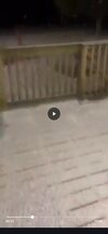
BTW- It's happening flurries in frostyland 28 degrees
rburrel2
Member
There’s a joke here, but I’m gonna leave it alone.I quickly looked and it’s been the same all 4 runs today.
View attachment 192148View attachment 192149
Screw it….
Charlotte gets the shaft.
iwantsouthernsnow123
Member
I would think it would result in a better tilt, but I could be mistaken, also can be a sign of a stronger ULL I believe. Little kinksI need some help. The energy has sharpened up on the hrrr over the past few runs instead of being broader and rounder. Is this a good thing?
View attachment 192147
Hrrr locked in on these death bands over clt

- Joined
- Jan 23, 2021
- Messages
- 4,603
- Reaction score
- 15,199
- Location
- Lebanon Township, Durham County NC
Roxboro reporting snow and some mPING reports around Rougemont
Clutch explanation, thank you for posting.
FWIW Wilmington isn’t proclaiming the same thing as loudly. Any dry slot would probably set up outside the CAE advisory area although I don’t necessarily disagree with what they’re saying.
I can’t even remember the last time areas around Columbia had real measurable snow so I understand their excitement over it since it seems to never snow in that part of the state.
NBAcentel
Member


Xlhunter3
Member


 I would think there will be more precipitation than what the HRRR is saying over Central NC with this 850 warm front.
Webberweather53
Meteorologist
Here's my final call map for this event.
I'm pretty convinced we're going to see at least some localized snow totals approach/exceed 1 foot near Charlotte.

I'm pretty convinced we're going to see at least some localized snow totals approach/exceed 1 foot near Charlotte.
Mpirone12
Member
Does anyone have an updated hrrr snow total?
Sent from my iPhone using Tapatalk
Sent from my iPhone using Tapatalk
What I can verify is I just drove home from University City to Concord and the sky was completely clear the entire drive.
HRRR cranks thru 21
Columbia playing with fire there
You should see something soon. The main band is moving east but it's building southward:Roxboro reporting snow and some mPING reports around Rougemont


Light snow now!
Sent from my iPhone using Tapatalk
That's already a better look for RDU.HRRR cranks thru 21View attachment 192160
Lordhelmit
Member

Y’all going 6+ easy don’t listen to @KyloG he ain’t getting burnt this time. Y’all getting more than meThat's already a better look for RDU.
Our NWS here is always been really good at explaining the details of how things work. Learned alot from them.That CAE video was great. Interesting how NWS is less in on the dryslot than local mets
Trying to decipher this statement from ILM regarding the Florence/Myrtle Beach/Wilmington areas:
First...a lower snowfall amount trend in between the higher totals
(see weather.gov/ilm/Jan2018snow). This seems reasonable considering
this analog and moisture/forcing being transferred to coastal areas.
It is worth noting any drying trend then reverting back to a more
moisture rich rendition may be expected. The storm last January
(weather.gov/ilm/WinterStormJan2025) did this.
Ron Burgundy
Member
That outer streamer is going to flirt with Athens. That would be a fun one
WxBlue
Meteorologist

Took a bit more aggressive approach because I feel pretty sure we're going to overperform with western half of this map. Early reports are looking great and most of short-range models are going crazy. I had a lot of issues with central NC and central SC... but ultimately, I weighted a bit on NWS totals as my "base" and I was very clear to my weather page followers that this is where I'm most likely to get it wrong with totals going in either direction. I also mentioned the South Carolina gradient as well because I honestly struggled a bit with Midlands and Pee Dee regions. Finally, with the eastern maxima, I am banking on short-range models zeroing in these zones plus support of NWS. I am less sure toward Wilmington, Myrtle Beach, and Florence... but I gotta draw somewhere with heavier totals for coastal plains. So yeah. What a PITA to forecast. I feel less confident with this one than I did with the ice storm and I also made that clear to my followers as well.
a_gilmore88
Member
Here's my final call map for this event.
I'm pretty convinced we're going to see at least some localized snow totals approach/exceed 1 foot near Charlotte.
View attachment 192157
One of the most beautiful maps I’ve ever seen. I have a shot at a foot of snow for the first time I can ever remember. Let’s go!

If that's a better look then we aren't getting snow until late Sat. afternoonThat's already a better look for RDU.
Webb I love it. But if we get less than 5” you’re getting sent some strongly worded messagesHere's my final call map for this event.
I'm pretty convinced we're going to see at least some localized snow totals approach/exceed 1 foot near Charlotte.
View attachment 192157


wow
Member
HRRR trend at 28.. a little further N with the precip shield.. W NC/SC is banking it

iGRXY
Member

NBAcentel
Member
