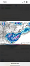
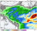
Yea it’s scary af for rdu folks, you can boom but you can bust big. I love where I’m at in clt a solid floorI think Raleigh will still see at least a few inches of snow but man I would be sweating if I lived there.
-
Hello, please take a minute to check out our awesome content, contributed by the wonderful members of our community. We hope you'll add your own thoughts and opinions by making a free account!
You are using an out of date browser. It may not display this or other websites correctly.
You should upgrade or use an alternative browser.
You should upgrade or use an alternative browser.
Misc General Banter Thread
- Thread starter Rain Cold
- Start date
snowc
Member
I am back from @snowc-alt yall. We are so back regarding snow! AND NO outages to worry about, so I am like Mr. Krabs... JACKPOT!

@SD Thanks for moving to banter.

@SD Thanks for moving to banter.
broken025
Member
Nice. I’m in Web’s hole.A strong upper low + mesolow is usually a winning combo for the Charlotte area down to about Spartanburg, SC and into the northern Midlands of SC.
View attachment 191197
View attachment 191199
If I was a snow weenie in the Carolinas right now, this is roughly where I’d want to be for this storm give/take based on what I currently see
View attachment 191201
snowc
Member
In other words, did I just hear we are getting a foot of snow?! 
snowc
Member
Thanks @packfan98 and @SD for telling me to look in other computers of mine to discover that the password was stored on my other computer.
Yes Senior Meteorologist Brick Tamland confirmed!In other words, did I just hear we are getting a foot of snow?!
Seems like you really can’t lose in the CLT area. You all deserve it, it’s been forever since you all got a good snowfall.Yea it’s scary af for rdu folks, you can boom but you can bust big. I love where I’m at in clt a solid floor
SamesNice. I’m in Web’s hole.
Cary_Snow95
Member
As has been the case recently, we will be fighting for moisture. The high amounts always back off
@broken025 when you’ve got a 1980 anal log on approach and Webb circles your house as the jackpot zone 

Please stop putting all your faith in a 48 hour NAM. You know that model isn’t accurate more than a day out. The dry slot potential is real but it slots in a straight line. Slots are usually in a circle 
BrickTamland
Member
Local mets trying to figure out their totals for the storm.


Thrasher Fan
Member
6z suite...


Cary_Snow95
Member
It may appear that way on a radar presentation because the beam is hitting different heights the further it goes out.. but it’s a dry “slot” for a reasonPlease stop putting all your faith in a 48 hour NAM. You know that model isn’t accurate more than a day out. The dry slot potential is real but it slots in a straight line. Slots are usually in a circle
LovingGulfLows
Member
- Joined
- Jan 5, 2017
- Messages
- 1,499
- Reaction score
- 4,100
6z suite...

Unfortunately for us, when you're on the fringe, slight adjustments means all the world in determining if we even see snow or not. I expect this to continue through verification.
Thrasher Fan
Member
Bigly agree. Last winter my location carried the weight for N GA and snow so I just assume this year is the gods evening things out, haha.Unfortunately for us, when you're on the fringe, slight adjustments means all the world in determining if we even see snow or not. I expect this to continue through verification.
Zactheplumber
Member
Yup, that’s meView attachment 191088
In reality this will be a dry slot stretching through the Triangle that gets TRACE-1”
Snowflowxxl
Member
Tough forecast for all. Big time feast or famine
Zactheplumber
Member
nothing ever is, let’s just scoreTo be honest, this is not really the most ideal set up for central NC. I am leaning more and more on what Web said on here. A snow hole in central NC with snow on both sides. His logic makes sense.
Brad P’s. Initial forecast is very conservative, he led with that. 2”-5” for the Charlotte area and for now is is concerned with dry pockets mixing in. He did say he would adjust as needed.
I’ve gotten so many texts today asking about dry slots and the graf. I guess the Mets are really screaming about it on social media
broken025
Member
GFS is better
broken025
Member
GFS is worse
LovingGulfLows
Member
- Joined
- Jan 5, 2017
- Messages
- 1,499
- Reaction score
- 4,100
I think people on the forum needs to remember. We're in a drought. Nearly all of the systems this winter have underperformed their QPF modeled forecasts. We're relying on a northern stream s/w(albeit a strong one that closes off) that are already infamous for being dry. Brent last week was modeled and forecasted for over a foot of snow in Tulsa and only got 5 inches or so because of how dry the arctic airmass was despite deep moisture transport from the Baja s/w. People really need to temper expectations here. "Expect nothing. Be surprised with something." should be the common motto here especially if you live in Georgia, less so in the Carolinas.
packfan98
Moderator
lusting4Adusting
Member
I don’t know @KyloG. Having this map with over 48hrs to go should be a lock for more precip up and down the 85 corridor for us. Hints that the coastal will be hugging in a little closer too maybe?
View attachment 191229
My house is literally under that precip min of .29-.33 in western Wake...
Luckily the stock market is imploding and my short is working...takes away this sting.
But...I'm just hoping for 2" of snow...so roughly need .15" of QPF. I don't feel great about that....I am ready for this pattern to collapse and head into spring.
mx3gsr92
Member
Patiently awaiting the NW trends/ticks to begin. .
You have a YouTube channel?Very minor changes in the strength, location, and tilt of that upper low have significant implications. Models are still all over the place with it.
I've mentioned this in my videos a couple of times. Right now, I'm not buying the Bahama low scenario. I think closer to the GS is the way to go. Still got a lot to figure out though.
These systems can be real heartbreakers, but they are really fun to watch evolve and see how all of the dynamics come together. They can also end up being really special.
blueheronNC
Member
So on successive weekends we have a Miller B and Miller A / ULL combo and neither will produce more than 1" of snow in Raleigh.
SimeonNC
Member
We're eating so good with this storm that people are whining about only getting 5 inches on the models instead of biblical amounts lol.
For the RDU people, calm down lol.
For the RDU people, calm down lol.
Yeah dog! I watch Mitch's video every day and then say what he says.You have a YouTube channel?
GeorgiaGirl
Member
I think people on the forum needs to remember. We're in a drought. Nearly all of the systems this winter have underperformed their QPF modeled forecasts. We're relying on a northern stream s/w(albeit a strong one that closes off) that are already infamous for being dry. Brent last week was modeled and forecasted for over a foot of snow in Tulsa and only got 5 inches or so because of how dry the arctic airmass was despite deep moisture transport from the Baja s/w. People really need to temper expectations here. "Expect nothing. Be surprised with something." should be the common motto here especially if you live in Georgia, less so in the Carolinas.
Heck with this supposed to be a cold snow again, I'm not overly confident in what we see pan out. I enjoyed late Jan last year, but it took a late band coming in to push me to warning criteria.
Whoever doesn't see the banding may struggle to get more than a dusting to an inch.
Cary_Snow95
Member
Trends are clear. Last weekend we down trended qpf until 0 hour. This is occurring again. Yes the GFS shows 5” but that is less than the run before that and the one before that and the one before that and the one before that lolWe're eating so good with this storm that people are whining about only getting 5 inches on the models instead of biblical amounts lol.
For the RDU people, calm down lol.
So your real name is David Schlontenhymen or however he spells it? You regurgitate others videos?Yeah dog! I watch Mitch's video every day and then say what he says.
I don’t know @KyloG. Having this map with over 48hrs to go should be a lock for more precip up and down the 85 corridor for us. Hints that the coastal will be hugging in a little closer too maybe?
View attachment 191229
Right now I think, at least for Raleigh...objectively
10% chance of blanked
20% chance of 1" or less
40% chance of 1-2"
20% chance of 3-5"
10% chance of 6"+
If I had to put something out...
Raleigh - 2-3"
GSO - 3-5"
CLT - 6-8"
GSP - 6-8"
CAE - 4-6"
Eastern NC - 6-8"
beanskip
Member
I went a whole day ... that's a record for me .... ;-)
never heard of someone reporting a user for showing a dry slot lol


