• Hello, please take a minute to check out our awesome content, contributed by the wonderful members of our community. We hope you'll add your own thoughts and opinions by making a free account!

Wintry Machine Learning Mauler 1/30-2/1

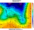
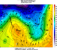
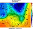
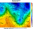
My question for you today is, how anomalous just is this event, heights, 850mb temps, freezing temps down to Miami, when was the last time ? View attachment 190835View attachment 190836View attachment 190837

Fro and others,
Fantastic and important questions to help in the forecasting of this event!

1. 850s:
In SAV-CHS area, the coldest 850 mb temp I could find from the 0Z/12Z daily maps that go back to 1948 was at 12Z on 1/28/1986 with -16C to -17C here and -17C to -18C at CHS:
IMG_7678.gif

A number of runs have been close to this at 6Z on Feb 1st with -14 to -16. So, suffice it to say, we’re looking at a shot of at least being within 1–2 of the coldest 850s on record in this corridor!

In ATL, the coldest is ~-21. So, that won’t be approached. NC has had <-20C in most of it. So, NC is safe.

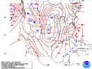
In FL, the models are showing the potential to be have at least near the coldest on record 850s for much of the peninsula. Anytime Miami gets below 0C, that’s at/near the coldest. I saw a CMC run with -5 to -6 there. And the GFS you posted has -4, which would appear to at least tie the Miami record. The coldest ever at Miami appears to be ~-3 to -4, set at 12Z on 1/19/1977, the only day it has ever snowed there:
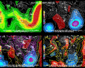
IMG_5537.gif

I’m seeing the 0C line just get down into inland WC Cuba on many models, which I think would be a first with as cold as -1C! Coldest on record I’ve been able to find is ~+1 to +2 set again at 12Z on 1/19/1977.

In summary, the coldest 850s on record may at least be approached in much of the area from CHS/SAV south to Cuba!

2. H5:
Lowest I can find in CLT/GSP (in dm) is 509/512 (1/27-28/1986). Those and ATL look safe.

In CHS/SAV/MCN/JAX the lowest I saw is ~520/522/524/527 set at 12Z on 1/19/1977 (see 2nd image I posted above). The 18Z Euro would break MCN’s record with ~521 and would at least tie SAV/JAX 522/527 at 0Z-3Z on 2/1/2026.
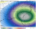
IMG_7687.png

For Miami, the lowest I’ve found is ~553, set at 12Z on 1/19/1977 (again see 2nd image I posted above). The lowest I’ve seen modeled is ~562. So, that’s safe.

In summary, the area between MCN, SAV, CHS, and JAX (central and SE GA, SE SC, and NE FL) could flirt with record low H5 if the 18Z Euro were to verify well.
 

Attachments

  • IMG_7678.gif
    IMG_7678.gif
    102.6 KB · Views: 43
Last edited:
Fro and others,
Fantastic and important questions to help in the forecasting of this event!

1. 850s:
In SAV-CHS area, the coldest 850 mb temp I could find from the 0Z/12Z daily maps that go back to 1948 was at 12Z on 1/28/1986 with -16C here and -17C at CHS:
View attachment 190962

A number of runs have been close to this at 6Z on Feb 1st with -14 to -16. So, suffice it to say, we’re looking at a shot of at least being within 1–2 of the coldest 850s on record in this corridor!

In ATL, the coldest is ~-21. So, that won’t be approached. NC has had <-20C in most of it. So, NC is safe.

In FL, the models are showing the potential to be have at least near the coldest on record 850s for much of the peninsula. Anytime Miami gets below 0C, that’s at/near the coldest. I saw a CMC run with -5 to -6 there. And the GFS you posted has -4, which would appear to at least tie the Miami record. The coldest ever at Miami appears to be ~-3 to -4, set at 12Z on 1/19/1977, the only day it has ever snowed there:
View attachment 190906

I’m seeing the 0C line just get down into inland WC Cuba on many models, which I think would be a first with as cold as -1C! Coldest on record I’ve been able to find is ~+1 to +2 set again at 12Z on 1/19/1977.

In summary, the coldest 850s on record may at least be approached in much of the area from CHS/SAV south to Cuba!

2. H5:
Lowest I can find in CLT/GSP (in dm) is 509/512 (1/27-28/1986). Those and ATL look safe.

In CHS/SAV/MCN/JAX the lowest I saw is ~520/522/524/527 set at 12Z on 1/19/1977 (see 2nd image I posted above). The 18Z Euro would break MCN’s record with ~521 and would at least tie SAV/JAX 522/527 at 0Z-3Z on 2/1/2026.
View attachment 190922

For Miami, the lowest I’ve found is ~553, set at 12Z on 1/19/1977 (again see 2nd image I posted above). The lowest I’ve seen modeled is ~562. So, that’s safe.

In summary, the area between MCN, SAV, CHS, and JAX (central and SE GA, SE SC, and NE FL) could flirt with record low H5 if the 18Z Euro were to verify well.
GSP was mentioning this in their discussion this afternoon about all-time record low heights for the southeast
 
What the heck is RGEM seeing that shes other models aren't? (ATL)

View attachment 190965
It can do really really with northern stream, in fact can do exceptional, can recall it dogging setups (last weekend was consistent on the TPV pinch) and also that northern stream involved setup in 2022, I wonder why it does well with setups involving northern stream energy
 
It can do really really with northern stream, in fact can do exceptional, can recall it dogging setups (last weekend was consistent on the TPV pinch) and also that northern stream involved setup in 2022, I wonder why it does well with setups involving northern stream energy
If I remember correctly it nailed that first storm in January 2022 from 72 hrs out while the globals were having wild swings on LP placement and track.
 
That's what we're wanting to see. The farther back west the longer we stay in the snow. I'm thinking those bands on the east of the mountains are going to hammer us. I can't wait. It's been way to long.
Yeah everyone in GA to Carolina should be pulling for a initial longer swing of the N/S it builds up that bowling ball gives GA some lover before hammering Carolinas
 
Fro and others,
Fantastic and important questions to help in the forecasting of this event!

1. 850s:
In SAV-CHS area, the coldest 850 mb temp I could find from the 0Z/12Z daily maps that go back to 1948 was at 12Z on 1/28/1986 with -16C to -17C here and -17C to -18C at CHS:
View attachment 190962

A number of runs have been close to this at 6Z on Feb 1st with -14 to -16. So, suffice it to say, we’re looking at a shot of at least being within 1–2 of the coldest 850s on record in this corridor!

In ATL, the coldest is ~-21. So, that won’t be approached. NC has had <-20C in most of it. So, NC is safe.

In FL, the models are showing the potential to be have at least near the coldest on record 850s for much of the peninsula. Anytime Miami gets below 0C, that’s at/near the coldest. I saw a CMC run with -5 to -6 there. And the GFS you posted has -4, which would appear to at least tie the Miami record. The coldest ever at Miami appears to be ~-3 to -4, set at 12Z on 1/19/1977, the only day it has ever snowed there:
View attachment 190906

I’m seeing the 0C line just get down into inland WC Cuba on many models, which I think would be a first with as cold as -1C! Coldest on record I’ve been able to find is ~+1 to +2 set again at 12Z on 1/19/1977.

In summary, the coldest 850s on record may at least be approached in much of the area from CHS/SAV south to Cuba!

2. H5:
Lowest I can find in CLT/GSP (in dm) is 509/512 (1/27-28/1986). Those and ATL look safe.

In CHS/SAV/MCN/JAX the lowest I saw is ~520/522/524/527 set at 12Z on 1/19/1977 (see 2nd image I posted above). The 18Z Euro would break MCN’s record with ~521 and would at least tie SAV/JAX 522/527 at 0Z-3Z on 2/1/2026.
View attachment 190922

For Miami, the lowest I’ve found is ~553, set at 12Z on 1/19/1977 (again see 2nd image I posted above). The lowest I’ve seen modeled is ~562. So, that’s safe.

In summary, the area between MCN, SAV, CHS, and JAX (central and SE GA, SE SC, and NE FL) could flirt with record low H5 if the 18Z Euro were to verify well.
this is great stuff. I've always been fascinated by cold in deep south florida and beyond. I knew it had to be close to records.
 
I can’t call the RGEM solution wonky because it’s H5 look is right there with the GFS/CMC/EURO/AIGFS/AIFS right now. And based on the snowfall and precip maps of the weather nxt, likely it too.
Correct me if I’m wrong but doesnt the RGEM run at a higher resolution than the globals?
 
Yeah everyone in GA to Carolina should be pulling for a initial longer swing of the N/S it builds up that bowling ball gives GA some lover before hammering Carolinas
I was in Marietta from 91-96 and it always worked out if the Atl area had snow, RDU didn’t. That has held true as far as I know. I’ve seen Atl get snow and RDU get ice. 93 rings a bell. But this, has a real chance of breaking that.

Edit: Second attempt at editing this. Lol! I looked this up and I was wrong. There have been a couple of occasions. Carry on.
 
Last edited:
It can do really really with northern stream, in fact can do exceptional, can recall it dogging setups (last weekend was consistent on the TPV pinch) and also that northern stream involved setup in 2022, I wonder why it does well with setups involving northern stream energy
My guess would be that since this is a Canadian model where their weather is basically all driven by the N/S that it likely gets some additional data and maybe a more refined setup than the American models that would have to wait for vorts to get closer to th US. Just a guess
 
I was in Marietta from 91-96 and it always worked out if the Atl area had snow, RDU didn’t. That has held true as far as I know. I’ve seen Atl get snow and RDU get ice. 93 rings a bell. But this, has a real chance of breaking that.
There’s been a number of times both RDU and ATL both got snow from the same storm since then … Off the top of my head… February 2010, Christmas 2010, January 2014 and February 2014. I’m sure there’s more if I looked it up
 
Ok so what are our real analogs for this one? I know March '80 was thrown around but it wasn't as strong as this on a 500mb level, only around 534. It started more as a conventional GOM low from a southern wave. This is a really deep one.
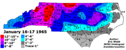
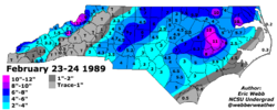
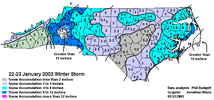
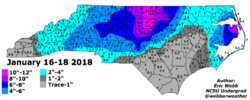
Yeah with analogs I like to look at 500mb the most in terms of how it evolves for a storm. The 4 best Manitoba Maulers that I know of are: Jan 1965, Feb 1989, Jan 2003, and Jan 2018

Jan 2003 didn't have this sort of teardrop wave we are seeing now, but as you know, it brought a lot of cold air aloft with it, which we will have here. And it had a strong jet streak drop down with it....so it was a bit unique.

Feb 1989 has maybe the closest look at 500mb. The 18z Euro is stronger / deeper than Feb 1989, but that one had better tilt. Jan 1965 is pretty close looking to the Euro, but not as strong with the wave. Jan 2018 was weakest with the wave, but produced a lot of snow

Jan 2023 and Jan 1965 had the snow focused more to the west, Feb 1989 had it focused more to the east. Jan 2018 had it focused in central NC.

In the end, I think this will be a combination of all 4. I think the full state has a chance to do well.

Feb 1989:
Jan 28 Feb 89 4.gif


Jan 1965:
Jan 28 Jan 65.gif

Jan 2018
Jan 28 Jan 18.gif


18z Euro:
Jan 28 Euro 2026.gif


Jan 28 Jan 65 S.png

Jan 28 Jan 89 S.png

Jan 28 Jan 03 S.gif


Jan 28 Jan 18 S.png


Of note, I think the lee side folks in NC should take some solace in knowing that 3 of the 4 storms produced there, and went big with 2 of them.

Bottom line though - it looks like this one may be stronger aloft with the wave compared to the 3 I posted....and also, it's coming down cold and steep from Ontario......more of an Ontario Obliterator than Manitoba Mauler.
 
Last edited:
There’s been a number of times both RDU and ATL both got snow from the same storm since then … Off the top of my head… February 2010, Christmas 2010, January 2014 and February 2014. I’m sure there’s more if I looked it up
I was just asking ChatGPT this very thing. Lol! I’m getting some dates to look up but you’re correct. There are times.
 
Fro and others,
Fantastic and important questions to help in the forecasting of this event!

1. 850s:
In SAV-CHS area, the coldest 850 mb temp I could find from the 0Z/12Z daily maps that go back to 1948 was at 12Z on 1/28/1986 with -16C to -17C here and -17C to -18C at CHS:
View attachment 190962

A number of runs have been close to this at 6Z on Feb 1st with -14 to -16. So, suffice it to say, we’re looking at a shot of at least being within 1–2 of the coldest 850s on record in this corridor!

In ATL, the coldest is ~-21. So, that won’t be approached. NC has had <-20C in most of it. So, NC is safe.

In FL, the models are showing the potential to be have at least near the coldest on record 850s for much of the peninsula. Anytime Miami gets below 0C, that’s at/near the coldest. I saw a CMC run with -5 to -6 there. And the GFS you posted has -4, which would appear to at least tie the Miami record. The coldest ever at Miami appears to be ~-3 to -4, set at 12Z on 1/19/1977, the only day it has ever snowed there:
View attachment 190906

I’m seeing the 0C line just get down into inland WC Cuba on many models, which I think would be a first with as cold as -1C! Coldest on record I’ve been able to find is ~+1 to +2 set again at 12Z on 1/19/1977.

In summary, the coldest 850s on record may at least be approached in much of the area from CHS/SAV south to Cuba!

2. H5:
Lowest I can find in CLT/GSP (in dm) is 509/512 (1/27-28/1986). Those and ATL look safe.

In CHS/SAV/MCN/JAX the lowest I saw is ~520/522/524/527 set at 12Z on 1/19/1977 (see 2nd image I posted above). The 18Z Euro would break MCN’s record with ~521 and would at least tie SAV/JAX 522/527 at 0Z-3Z on 2/1/2026.
View attachment 190922

For Miami, the lowest I’ve found is ~553, set at 12Z on 1/19/1977 (again see 2nd image I posted above). The lowest I’ve seen modeled is ~562. So, that’s safe.

In summary, the area between MCN, SAV, CHS, and JAX (central and SE GA, SE SC, and NE FL) could flirt with record low H5 if the 18Z Euro were to verify well.
Very interesting. There are so many great posters here who bring such high quality information. Thanks @GaWx for the quality you bring to this board! And I can name several others as well. We are fortunate to have a quality forum.
 
I was just asking ChatGPT this very thing. Lol! I’m getting some dates to look up but you’re correct. There are times.
No problem. Now I do remember a couple times that Atlanta got hit while CLT was left blanked. January 1992 stands out the most. Also the March 1993 was a much bigger deal for ATL than it was for CLT metro itself.
 
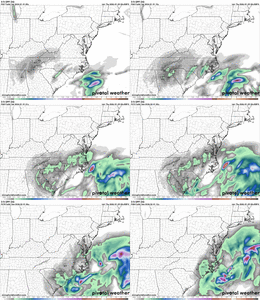
Granted, I'm hugging the RGEM like a newlywed. But if looking at what can reasonably be considered a realistic range, 60 hours, the model's consistency has been better than most. Of course, it may be consistently wrong, but given the trickiness of this system, that's impressive nevertheless.
rgem_z500_vort_us_fh60_trend (2).gif
 
Any chance we can get rid of these ridiculous looking double barrel low pressure centers showing up on most of the models before go time? Seems like we would do better with a more consolidated area of low pressure bombing off the coast instead of wasting precious time waiting for these low pressure centers to merge.

This really isn't a bad look for us along and east of I-95 or US1. If there was ever a "benchmark" lat/lon for us that's it.

1769658273192.png
 
Yeah with analogs I like to look at 500mb the most in terms of how it evolves for a storm. The 4 best Manitoba Maulers that I know of are: Jan 1965, Feb 1989, Jan 2003, and Jan 2018

Jan 2003 didn't have this sort of teardrop wave we are seeing now, but as you know, it brought a lot of cold air aloft with it, which we will have here. And it had a strong jet streak drop down with it....so it was a bit unique.

Feb 1989 has maybe the closest look at 500mb. The 18z Euro is stronger / deeper than Feb 1989, but that one had better tilt. Jan 1965 is pretty close looking to the Euro, but not as strong with the wave. Jan 2018 was weakest with the wave, but produced a lot of snow

Jan 2023 and Jan 1965 had the snow focused more to the west, Feb 1989 had it focused more to the east. Jan 2018 had it focused in central NC.

In the end, I think this will be a combination of all 4. I think the full state has a chance to do well.

Feb 1989:
View attachment 190951


Jan 1965:
View attachment 190956

Jan 2018
View attachment 190968


18z Euro:
View attachment 190952


View attachment 190960

View attachment 190961

View attachment 190963


View attachment 190970


Of note, I think the lee side folks in NC should take some solace in knowing that 3 of the 4 storms produced there, and went big with 2 of them.

Bottom line though - it looks like this one may be stronger aloft with the wave compared to the 3 I posted....and also, it's coming down cold and steep from Ontario......more of an Ontario Obliterator than Manitoba Mauler.
Grit, do you recall how closely the ULL bowling ball March 2nd, 2009 storm compares to this one? I recall the ULL may have closed off earlier, and that one had a strong 850 low in middle Ga.
 
You have 2 distinct areas of forcing here generating your snow/precip over NC.

1) Upstate SC Mesolow + Upper low forcing to the west doing most of the lifting (figuratively and literally) from about Charlotte-Greensboro and points west

2) The big coastal low cranking out most of the snow near to east of the I-95 corridor.

It's totally conceivable you get a dry slot with enhance subsidence in between these two primary areas of forcing for ascent as noted yesterday (below). I don't feel all warm and fuzzy at the moment that this will simply go away, but we'll need to see what the high-res models look like tomorrow at this time before we can possibly try to confidently hone in on where any potential screw zones/subsidence could be.

Hard to get into details or specific scenarios yet but one of those possibilities is a potential upper low to coastal transfer.

Those kind of setups can get real tricky sometimes for central NC especially. Oftentimes when you have one of these transfer, you will get 2 maximums in snowfall in NC. One over the western Piedmont and the other over the east-central coastal plain, with a dry slot in between over the eastern Piedmont (think Jan 2003 or Jan 3-4 2018). The globals almost never sniff out these details either.

It’s too early to have much confidence in something like this happening of course, but it’s something else to just keep in the back of your mind when you’re looking at the models the next few days.
 
Back
Top