-
Hello, please take a minute to check out our awesome content, contributed by the wonderful members of our community. We hope you'll add your own thoughts and opinions by making a free account!
You are using an out of date browser. It may not display this or other websites correctly.
You should upgrade or use an alternative browser.
You should upgrade or use an alternative browser.
Wintry Machine Learning Mauler 1/30-2/1
- Thread starter SD
- Start date
SnowNiner
Member
euro camp is a real bummer. it is nice to have the bomb camp occupied by a diverse set of models but that doesn't really give me decision making confidence
Only thing saving us I think in the group of rag tag leftovers showing a significant storm is the Ukmet. GFS and Canadian don't matter in my opinion. We were always winning this by the skin of our teeth yesterday, and a few ticks later and now we're on life support in the west.
I did note the AIFS ticked south, but the last run it also ticked west with the vort max (not precip). Maybe that west tick keeps going today and we improve, I hope.
trackersacker
Member
i think that if you're looking for a real ray of hope, it is that the ai euro stopped the bleedingOnly thing saving us I think in the group of rag tag leftovers showing a significant storm is the Ukmet. GFS and Canadian don't matter in my opinion. We were always winning this by the skin of our teeth yesterday, and a few ticks later and now we're on life support in the west.
I did note the AIFS ticked south, but the last run it also ticked west with the vort max (not precip). Maybe that west tick keeps going today and we improve, I hope.
It's the Rubber Match we asked for. Physics Verse AI. I think Webber hit the nail right on the head. This will take atleast the next 3 models cycles to resolve. You would think off just using the physics models, that by the time we are inside 72 hours at tomorrows 12 z Cycle, we will have a pretty good idea. I say this based off us just using our old way of thinking analogies/ methods with physics models only. Putting all the AI stuff to the side.
Good news is we get another sample of AI performance. The synoptics off all at h5 , tell you there is a very good chance to light the fuse with this thing. But we all know it has to line up and time just right. So time and exactly what happens Saturday will be the jury. I feel really good about our chances with this. I also want be completely sold on anything good/bad for a couple of days.
Good news is we get another sample of AI performance. The synoptics off all at h5 , tell you there is a very good chance to light the fuse with this thing. But we all know it has to line up and time just right. So time and exactly what happens Saturday will be the jury. I feel really good about our chances with this. I also want be completely sold on anything good/bad for a couple of days.
Who has access or site where you can view the spire model? I saw a big hit off it last night. Does it run once a day or 4x a day. Have any value/ accuracy?
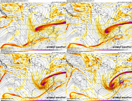
As we await the 12Z globals, what I'm looking for on the regionals and then the globals at 84 hours is not only how far west the tail end of the TPV extension, but also for a little higher height along the NE Atlantic coast, and for the pivot to have just begun to take on a wsw-ene orientation at that time stamp. The models that were furthest SW with the closed UUL began the pivot at this point.
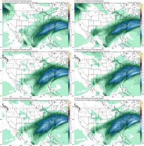
euro ai for the last storm. heaviest precip axis shifted about 300 miles north in the medium range. perhaps not the best comparison because this is because of heights raising out east... the axis stays anchored in baton rouge for example. but the ai is capable of prolonged trends and this one was caused by a slower, west-er, diggier trough out west which is kind of what we need right now.
that's your copium before the 12z suite kills us
Cary_Snow95
Member
It also seems this is a scenario where the 50/50 over the NE exiting slightly faster would help and prevent the NS from flattening/stretching too much. Give it a little breathing room. We typically see this trend occur
RollTide18
Member
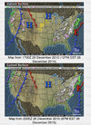
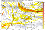
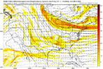
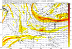
View attachment 189930View attachment 189931View attachment 189932View attachment 189933View attachment 189934
Some nuggets I found from the December 2010 storm
Sorry if banter but I remember that storm vividly, we got snow the night before on Christmas and was not expecting snow the day after at all but it snowed off and on all day with the sun peaking out in between like a summer day, didn’t accumulate but was still cool nonetheless.
So in regards to the anchoring of the trough axis, it seems in the above graphic the birther region kept ticking more wet. In this setup, if their is one, the Carolinas appear to be the birther region. We good. There’s my copium. GL everybody let’s keep this one alive a little longerView attachment 189935
euro ai for the last storm. heaviest precip axis shifted about 300 miles north in the medium range. perhaps not the best comparison because this is because of heights raising out east... the axis stays anchored in baton rouge for example. but the ai is capable of prolonged trends and this one was caused by a slower, west-er, diggier trough out west which is kind of what we need right now.
that's your copium before the 12z suite kills us
Cary_Snow95
Member
i don't think it's apples to apples since that was overrunning a cold dome and this is relying on vort advection/ull black magicSo in regards to the anchoring of the trough axis, it seems in the above graphic the birther region kept ticking more wet. In this setup, if their is one, the Carolinas appear to be the birther region. We good. There’s my copium. GL everybody let’s keep this one alive a little longer
Our own @EFisherWX has a great site where you can toggle the google runs. Def an easy trend since yesterday morning but nothing we can’t fix.
Beep boop Nam was about to go ape **** 84 hour Nam extrapolation complete 
Brandon10
Member
Yeah NAM def was headed toward GFS solution
Cary_Snow95
Member
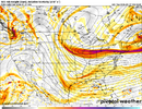
End of the NAM run. Has a little light precip associated with the weak SLP over the GOM and weak shortwave streaking across the south. The TPV extension was a little further east and is still oriented E-W at the timestamp we want the pivot to begin. Not optimal, but then again, it's the NAM and mainly used for curiosity at this range. 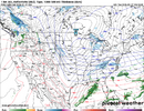


Cary_Snow95
Member
Every time we are tracking these types of storms the models always begin to struggle with feedback issues with the energy just in front of the base of the trough. You get those “bubbles” of vorticity that seemingly are impossible to predict and tug on the troughs orientationEnd of the NAM run. Has a little light precip associated with the weak SLP over the GOM and weak shortwave streaking across the south. The TPV extension was a little further east and is still oriented E-W at the timestamp we want the pivot to begin. Not optimal, but then again, it's the NAM and mainly used for curiosity at this range. View attachment 189941View attachment 189942
CNCsnwfan1210
Member

12z NAM
Sent from my iPhone using Tapatalk
As grain of salt, I think NAM was about to create a Miller A in my opinion.
12z NAM
Sent from my iPhone using Tapatalk
At some point in time. Maybe it's this one, maybe its latter on. But the Rubber band has to snap back on these snow droughts. Just a thought.
This one is sitting on the tee and Hank Arron is in the batter box. Don't get to swing at the fences like this, but once every couple of seasons. Hopefully we don't whiff.
This one is sitting on the tee and Hank Arron is in the batter box. Don't get to swing at the fences like this, but once every couple of seasons. Hopefully we don't whiff.
That’s typically what happens at this rangeWonder if we are going to see some of the more extreme forecasts and the drier ones meet in the middle next few days.
Stormsfury
Member
Webberweather53
Meteorologist

12z NAM
Sent from my iPhone using Tapatalk
It’s crazy we’re almost getting into range of the extended NAM for this weekend’s potential storm and I honestly still don’t feel great about what will happen.
LongRanger
Member
So the upstates snow would come from the ULL not the coastal low?
SnowNiner
Member
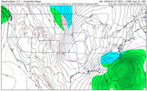
Yeah, we're down to waiting for a very last second "scoop" of an ULL immediately to our south and west, the Miller A coastal storm doesn't even seem like it's having an effect in WNC.
I think Cary made a good point though, NW trend is still possible in that the 50/50 could shift north, allowing this thing to amp later. 50/50 shifting north is what allowed last weekends heights to rise.
I think Cary made a good point though, NW trend is still possible in that the 50/50 could shift north, allowing this thing to amp later. 50/50 shifting north is what allowed last weekends heights to rise.

icon looks fine so far. a tick west.
Yep, if the results of this coming weekend are anchored in the strength and location of the 50/50 that gives me hope. Because that thing never stopped retreating last week leading up to this past weekends winter stormYeah, we're down to waiting for a very last second "scoop" of an ULL immediately to our south and west, the Miller A coastal storm doesn't even seem like it's having an effect in WNC.
I think Cary made a good point though, NW trend is still possible in that the 50/50 could shift north, allowing this thing to amp later. 50/50 shifting north is what allowed last weekends heights to rise.
View attachment 189946
Stormsfury
Member
From WPC early morning discussion
...Significant East Coastal Winter Storm Threat this weekend...
...Central to Eastern U.S. Hazardous Cold Threat into next week...
...Guidance/Predictability Assessment...
Recent model guidance remains generally agreeable overall across
the lower 48 and specifically with regards to impactful coastal
storm development along the East Coast this weekend. The notable
recent trend across the GFS, ECMWF, and CMC is towards a stronger
upper-low/much deeper coastal low, with the increasing potential of
wintry precipitation and wind/wave impacts for the East Coast. The
ECMWF AIFS and AI guidance support this solution. However, despite
the notable agreement on the intensifying system, subtle
differences in the track off the coast not surprisingly lead to a
lot more uncertainty with respect to the potential impacts. For
now, the greatest consensus amongst the guidance is for coastal
areas and possibly further inland across the Carolinas and southern
New England, with more uncertainty through the Mid-Atlantic.
Elsewhere, while there is increasing uncertainty with the timing
and path of upstream Pacific system(s) approaching the Pacific
Northwest through the weekend and into next week, southwesterly
flow west of the upper-ridge favor moderate moisture/precipitation
in an initially favorable Atmospheric River pattern. The guidance
is also in generally good agreement on an additional clipper-like
system late weekend/early next week.
Overall, the WPC forecast suite was mainly derived from a
composite model/ensemble solution most in line with the ECENS
mean along with WPC continuity and the National Blend of Models.
...Weather/Hazards Highlights...
The ongoing settling of cold surface high pressure and additional
surges in the wake of the historic winter storm will maintain
dangerously cold temperatures for the central and eastern U.S. well
into next week as per the Climate Prediction Center. The airmass
may be more prolonged in areas with widespread snow/ice coverage
and enhanced radiational cooling. Amplified mean troughing aloft
will meanwhile bring rounds of weak to moderate clipper system
snows from the north-central U.S. to the Great Lakes.
In this anomalously cold pattern, there is potential for wintry
precipitation into the Gulf Coast states late week as upper trough
translation leads into northern Gulf frontal wave genesis. Wave
progression downstream and trough/closed low development aloft is
now increasingly likely to set the environment to produce a
significant Eastern Seaboard Coastal Winter storm expected to
rapidly deepen while lifting over the western Atlantic off the
Southeast Saturday and Mid-Atlantic/New England Sunday. Uncertainty
has improved but remains with the exact track of the low which
impacts the onshore wintry precipitation focus and footprint.
However,
the growing consensus at this time is for heavy snow potential
from the eastern Carolinas/Mid-Atlantic through coastal southern
New England. The forecast strength of the deep low suggests high
winds/waves and coastal flooding would also be expected.
Meanwhile, lingering southerly Pacific moisture fetch riding the
western periphery of an amplified West Coast mean upper ridge
favors a wet pattern for the Pacific Northwest this period, but no
Excessive Rainfall Outlook threat areas remain in place due to a
lowering guidance signal over time. Snow levels will rise with the
influx of warmer, moist air, with heavier snows possible for the
higher elevations of the Cascades. Energy spillng over the ridge
may fuel modest snow chances to the north-central Rockies/Plains.
Brandon10
Member
Anyone have the most recent Spire?
Yep precip a bit west at 84 vs 6zicon looks fine so far. a tick west.
NBAcentel
Member
Few things before we go to 12z
-not as much time left as you'd like but arguably not as much shifting needed to make something happen
-stop the bleeding today please
-ensembles are closer together on QPF than I realized
-higher ratios mean an extra tenth or two can make a big difference
-not as much time left as you'd like but arguably not as much shifting needed to make something happen
-stop the bleeding today please
-ensembles are closer together on QPF than I realized
-higher ratios mean an extra tenth or two can make a big difference
Bigedd09
Member
icon is definitely steadily improving. gotta get euro and weathernext back on board
Stormsfury
Member
Baja Low shoved away, kink over Northern Mexico. Hmmm
Cary_Snow95
Member
Better with the northern stream but kind of offset by a stronger 50/50. Let’s see where it goes

