• Hello, please take a minute to check out our awesome content, contributed by the wonderful members of our community. We hope you'll add your own thoughts and opinions by making a free account!

Wintry Jan 23-27 Winter Storm Obs

33.8/29 here in ATL… and the first heavier band out of Alabama should wet bulb me down to 31.5ish… and there’s a hell of a lot more coming behind that. Scary scary stuff, wasn’t in the models, iirc

What part of ATL? Always curious to compare temps close by lol.


Sent from my iPhone using Tapatalk
 
Is anyone worried that much of ATL doesn’t warm back above 32 between the expected two rounds of precip tomorrow?
I wouldn't call it worried. I prefer hopeful. But yes, I think it may if I max out with temps here of 26-27 or so.
 
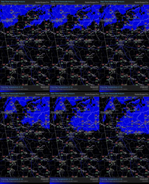
I wonder how low temps in ATL will get tonight. Right now, areas upstream over the GSP area are generally around 23 degrees in the immediate vicinity (according to Wundermap), and the 18Z HRRR for hour 05Z was further north with the freezing line and had that area generally around 26-27 degrees, so we are already seeing the overperformance (which is not a surprise) in that area. This may have big implications down the line for: 1. Ice accretion efficiency/road icing potential and 2. Duration of sub freezing temps.
 
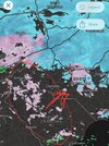
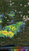
Racing quickly towards I-20. If that get there with this band of precip coming through gonna be a mess from the southern to the northern burbs of Atlanta.
Seems like it prolly will. Unfortunately. Don’t think we’ll be so lucky as to get sleet. And definitely no shattered magic fairy dust.
 
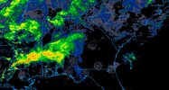
absolutely legit pure moderate ZR. Not a pinger or snowflake. I haven’t gone back outside to look at the car but it’s the perfect accrual rate coming down. Hard enough to actually add up but not hard enough there will be runoff. Also, that large plume in Alabama and Mississippi that’s head straight up 85 is not apart of the big band. That right there if it holds up will drop some serious precip.
 
Back
Top