It has been extremely consistent and models have generally shifted towards what it has been showing. If the solution it’s been showing comes to fruition, it will just demonstrate truly how good that model is.We’re gonna wind up right where the weathernext model has been for a few days. Shocker
-
Hello, please take a minute to check out our awesome content, contributed by the wonderful members of our community. We hope you'll add your own thoughts and opinions by making a free account!
You are using an out of date browser. It may not display this or other websites correctly.
You should upgrade or use an alternative browser.
You should upgrade or use an alternative browser.
Wintry January 23rd-27th 2026
- Thread starter SD
- Start date
Tsappfrog20
Member
Allan just put a new update out


Sent from my iPhone using Tapatalk


Sent from my iPhone using Tapatalk
what solution is it showing again?It has been extremely consistent and models have generally shifted towards what it has been showing. If the solution it’s been showing comes to fruition, it will just demonstrate truly how good that model is.

Blue_Ridge_Escarpment
Member
Yep, slower
NCWeatherNow
Member
Dryer
It’s not publicly available right? Any way for us to get access?It has been extremely consistent and models have generally shifted towards what it has been showing. If the solution it’s been showing comes to fruition, it will just demonstrate truly how good that model is.
Snowflowxxl
Member
The freezing mist/fog is gonna be legit
Precip orientation changing too it looks like. Juicier over extreme NGA/TN at same timeNAM...staying consistent with that trend
NAM with a bit stronger warm nose means earlier ZR onset for many in the Carolinas this run
I have never seen where NW GA It's the ZR first. They are usually out of the CAD zone. This js a strong wedge.
NCWeatherNow
Member
Would i be incorrect in saying that this event seems to be downtrending when it comes to major icing.
It is not publicly available except it is on stormvista but I’m not sure if stormvista is violating Google’s TOS or if they got a special commercial contract with Google.It’s not publicly available right? Any way for us to get access?
The data was provided to select researchers for research uses, so that’s why I have access.
Would i be incorrect in saying that this event seems to be downtrending when it comes to major icing.

I'm not saying the NAM is wrong and very well could be right, but I struggle going with NAM on qpf as it has burned me too many times. High side and low side. I do like using the NAM thermal profile as I find it to be useful in the short range. I'm paying attention to the stronger warm nose it's showing on the 12z. The qpf could be correct with other AI models showing it but the NAM has nammed me too much in the past..LOL
NAM is a nice little event for Raleigh...about .3" of precip with mostly sleet and then it's over by lunch. Now will see if the band that swings through is rain or not.


What’s hard about this I think is that even if the insane totals are cut significantly (and thats still somewhat of an if cause I’m in the sneaky moisture camp) it still gives a really impactful storm. Again, NEGA shutdown for a week we had .33-.65 of ice a decade ago, so slashing our 1.0 totals by 2/3 still doesn’t get people out of the woods necessarily.
But, when people hear that the models are trending drier or less ice I’m afraid they will hear “threat is over” and I don’t think that’s gonna be the case. (Talking specifically for NE GA).
But, when people hear that the models are trending drier or less ice I’m afraid they will hear “threat is over” and I don’t think that’s gonna be the case. (Talking specifically for NE GA).
Tsappfrog20
Member
So I’m not doubting the there could be less moisture or a dry slot however when I took this sounding it still says that freezing rain is falling even with none on the radar.


Sent from my iPhone using Tapatalk


Sent from my iPhone using Tapatalk

Would be hilarious if the temps are there for a major ice storm in Atlanta but then there’s no precip  3K NAM kinda shows that scenario
3K NAM kinda shows that scenariorburrel2
Member
Fv3 still has the gulf convection and thus way more qpf for us. It’s also frigid at the surface.
The 12z NAM drastically cuts back on snow totals in Ohio to less precip. Pretty big differences compared to prior runs, seems like a weaker system in general with regards to liquid equivalent. With the “first leg” of the storm, I’m not even sure it’s warning criteria for some in central NC.
NAM 12 with dry pockets and sleet in p-type depictions while soundings look like this in the Upstate and NC Foothills. Cmon man

Snowflowxxl
Member
Who would have ever thought the NAM would be the driest model 
Can't trust NAM right now with it still being 48 hours out from the major ice event here in Central NC. I'll trust it more tomorrow
You know though, I have seen this before in the past though. Cold is locked by wedge i mean 30ndegrees too, but only mist or drizzle nothing serious at all. Happened to me in high school, 30 degrees, mist and drizzle... keep comes the school bus, everyone is laughing on the bus and I am internally panicking because how did the Mets miss this minor icing event.Would be hilarious if the temps are there for a major ice storm in Atlanta but then there’s no precip
Mostly rain on the NAM as that band swings through...NAM would be nice, escape the worst case that could have been for Raleigh.
Still over towards 85 corridor looks like a block of ice.

Still over towards 85 corridor looks like a block of ice.
Brandon10
Member
So a cold front passage in NC with freeing rain?
How this changed from a few days ago.
How this changed from a few days ago.
WolfpackHomer91
Member
Inside 48, NAM Thermals are goated in CADCan't trust NAM right now with it still being 48 hours out from the major ice event here in Central NC. I'll trust it more tomorrow
Take this route at your own risk if you mean temp wise.
UNDER 48 -
NAM therms / Global avg for QPF / Avg the two most consistent extremes for your track. JMO ...... NAM thermals and Canadian/UK/GFS mix on Track for now. If EURO comes back inline a tad bit south again IMO the win goes to that threesome listed above due to the erratic and outlandish 300 mile swing the EURO had
Webberweather53
Meteorologist
Now we’re just trading all of our heavier precip for freezing drizzle and light zr. Great


Why do we always take so much stock into the one model who shows a decrease in event?
First euro for temps
Now nam for qpf
First euro for temps
Now nam for qpf
I am getting pretty damn worried for some of these higher end totals in Upstate/NC FH. Reading up on accrual rates and how all that worksNow we’re just trading all of our heavier precip for freezing drizzle and light zr. Great
LovingGulfLows
Member
- Joined
- Jan 5, 2017
- Messages
- 1,499
- Reaction score
- 4,100
Would be hilarious if the temps are there for a major ice storm in Atlanta but then there’s no precip
The issue is the freezing drizzle that we would still most likely have and because it's light, it will accumulate efficiently. All of a sudden .25-.3 QPF is truly a .20-.25 inch of ice accretion....still better than the .5-1 inch accumulation potential, but would still cause a bit of problems.
Webberweather53
Meteorologist
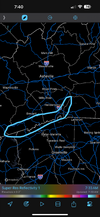
The area is definitely be most concerned about in NC seeing those big time ZR totals is the blue ridge escarpment along the NC-SC border.
Here, you have orographic help to wring out more precip and your higher elevation also means you have less cold nose protecting you from the warm nose aloft, so more likely to flip sooner to ZR here as well
Here, you have orographic help to wring out more precip and your higher elevation also means you have less cold nose protecting you from the warm nose aloft, so more likely to flip sooner to ZR here as well
Attachments
will see...I have hopes to avoid that. Still a nasty sleet/frzn event in Raleigh. Could have been much worse. GSO to CLT looks rough.Now we’re just trading all of our heavier precip for freezing drizzle and light zr. Great
WEATHERBOYROY
Member
The NAM is coming in a little warmer tham actual with our arctic air! at 14z the actual temps down into northern Iowa are actually -17 to -20 degrees.
west central to northern Wisc. is from -25 to -30 degrees. northern Misou. is -7 to -10. single digits down to the northern suburbs of St louis. It was -33 in international falls Min. Super cold air headed our way. 50 miles of cold makes a lot of difference in precip type!
west central to northern Wisc. is from -25 to -30 degrees. northern Misou. is -7 to -10. single digits down to the northern suburbs of St louis. It was -33 in international falls Min. Super cold air headed our way. 50 miles of cold makes a lot of difference in precip type!
The FV3 paints quite a different picture than the NAMs. A battle of the CAMs has joined the global battle. And, this model is much colder with temps in the mid-twenties all the way into the NE Atlanta burbs.


Looks like GSP just changed for WSW to Ice Storm Warning.