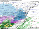
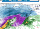
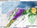
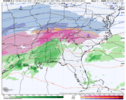
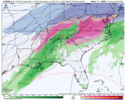
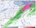
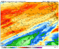
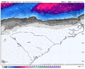
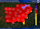
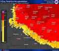
much better to get that sleet then have the QPF go to freezing rain instead...
No way GSO gets over an inch QPF of sleet. We’ll be shut down for weeks haha
Sent from my iPhone using Tapatalk
-
Hello, please take a minute to check out our awesome content, contributed by the wonderful members of our community. We hope you'll add your own thoughts and opinions by making a free account!
You are using an out of date browser. It may not display this or other websites correctly.
You should upgrade or use an alternative browser.
You should upgrade or use an alternative browser.
Wintry January 23rd-27th 2026
- Thread starter SD
- Start date
Mpirone12
Member
much better to get that sleet then have the QPF go to freezing rain instead...
I doubt we get above freezing. I’m sure that rain would for freezing rain at the end.
Sent from my iPhone using Tapatalk
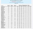
Ray has been doing this for longer than most of you have been alive. He’s seen countless big ones. You can feel the fear of what’s coming for his region in that last sentence.Ray has only pulled out the Big Snowmanometer due to the severity of what’s coming. Not sure I’ve ever seen him do that before. View attachment 187839
Snowflowxxl
Member
Severe threat
From generational ice storm to everyday thunderstorm in the span of 4 days fmlSevere threat
dsaur
Member
I don't remember the wind being high like this, but I do remember quaking all night when I heard the tree tops rattling as what I would describe as a breeze blew thur. That was the most terrifing because when you hear the wind you got the cracks and whamps, as limbs and trees fell and the explosions from the transformers lighting up the night. Over an inch in 15 to 20 mile winds would have me in the basement with a hard hat on.Not sure if this part is on people’s radars or not. Assuming sleet doesn’t take a chunk out of the large potential for 0.4”+ ZR in NC/SC/GA, we are set up for a pretty breezy (20-30mph gusts) Monday across the area. Eastern NC escarpment has both the highest ZR and highest wind potential as well
Iconic, CBS46 said more sleet than Freezing rain and then it could be thunderstormsFrom generational ice storm to everyday thunderstorm in the span of 4 days fml
Btownheel
Member

No way GSO gets over an inch QPF of sleet. We’ll be shut down for weeks haha
Sent from my iPhone using Tapatalk
I think that’s precisely what’s coming. Said it many times this week. I’ll own it if I’m wrong, but you don’t get zr when it’s 21 degrees at surface. That’s sleet all day.
Sent from my iPhone using Tapatalk
dsaur
Member
How many of us will get snow as the bitter cold moves in and scours out the moisture?I hadn't considered the changing wind direction. Pines with excess ice loading on the east-facing side, then 20-30mph winds from the NW can't be a good recipe. Particularly for hill tops.
The reinforcing Arctic airmass from the NW comes into the Georgia area overnight Sunday into Monday morning. Areas that don't manage to melt off accumulations in the brief, slightly above period Sunday afternoon and evening (if that even occurs) will have a harrowing night.
lusting4Adusting
Member
@NBAcentel had some gifs of similar looks earlier today, but these are some big temp adjustments from the HRRR back in the Texas region.
@NBAcentel had some gifs of similar looks earlier today, but these are some big temp adjustments from the HRRR back in the Texas region.
Yep. Blue Norther. That's the Texas version of a cad. The shallow Arctic air push is often underestimated.
BufordWX
Member
Looking forward to the squall line of thunder freezing rain at the end of this one.  It seems impossible and yet it shows up on most models.
Having to watch vorticity on RadarScope while it looks like the South Pole outside your window is vileLooking forward to the squall line of thunder freezing rain at the end of this one.It seems impossible and yet it shows up on most models.
GoDuke
Member
It’s a 300+ hour solution that made it to reality no doubt about that.Looking forward to the squall line of thunder freezing rain at the end of this one.It seems impossible and yet it shows up on most models.
Euro?
DylanWx
Member
Just now coming outEuro?
Good hopefully it ends the miseryJust now coming out
But it is doing it on all the runs though. This is sooo weird.And the CAD just melts into rain on the 00z Euro. Take it for what it is worth.
View attachment 187862
Thrasher Fan
Member
The differences between the GFS and EURO are wild at this timeframe.
Example...72h 2m temp for Augusta, GA: GFS...37° EURO...61°

Example...72h 2m temp for Augusta, GA: GFS...37° EURO...61°
The 00z Euro is generally a tick colder at the surface it looks to me.
BufordWX
Member
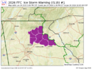
GSP upgraded their NE Georgia counties to an Ice Storm Warning. Probably will see FFC issue one soon as well
00z AI Euro also got wetter, but is still on the drier side of guidance. RDU went from 0.70" to 0.85", GSO from 0.90" to 1.04", GSP from 0.95" to 1.14", etc. It didn't go as far north with the initial thump. The "snow" line also came south around a county's worth on the AI Euro, as well.00z Euro significant increase in QPF. RDU goes from 1.03” to 1.36”. GSO 1.13” to 1.50”. For GSO it’s all frozen, for RDU it may realistically be although the final little bit could verbatim be rain. In general the precip axis sagged south some.
View attachment 187865
BufordWX
Member
GSP upgraded their NE Georgia counties to an Ice Storm Warning. Probably will see FFC issue one soon as well
Dawson-Lumpkin-White-Forsyth-Hall-Banks-Jackson-Madison-
Including the cities of Dawsonville, Homer, Comer, Dahlonega,
Cleveland, Cumming, Gainesville, and Commerce
114 AM EST Fri Jan 23 2026
...ICE STORM WARNING IN EFFECT FROM 1 PM SATURDAY TO 10 AM EST
MONDAY...
* WHAT...Significant icing expected. Total ice accumulations between
a quarter of an inch and one inch are expected. Winds gusting as
high as 30 mph.
* WHERE...Portions of north central and northeast Georgia.
* WHEN...From 1 PM Saturday to 10 AM EST Monday.
Thrasher Fan
Member
Winter Storm Watch was also extended to Monday at 10AM by KFCC.
URGENT - WINTER WEATHER MESSAGE
National Weather Service Peachtree City GA
114 AM EST Fri Jan 23 2026
GAZ030>034-041>051-053>062-072>076-231415-
/O.CON.KFFC.WS.A.0001.260124T1800Z-260126T1500Z/
Polk-Paulding-Cobb-North Fulton-Gwinnett-Haralson-Carroll-Douglas-
South Fulton-DeKalb-Rockdale-Walton-Newton-Morgan-Greene-
Taliaferro-Coweta-Fayette-Clayton-Spalding-Henry-Butts-Jasper-Putnam-
Hancock-Warren-Jones-Baldwin-Washington-Glascock-Jefferson-
Including the cities of Douglasville, Atlanta, Madison, Gray,
Covington, Monroe, Newnan, Cedartown, Jackson, Lawrenceville, Dallas,
Sparta, Griffin, Crawfordville, Carrollton, Conyers, East Point,
Greensboro, Bremen, Decatur, Eatonton, Louisville, Warrenton,
Sandersville, Peachtree City, GIbson, Monticello, Stockbridge,
Riverdale, Milledgeville, and Marietta
114 AM EST Fri Jan 23 2026
...WINTER STORM WATCH REMAINS IN EFFECT FROM SATURDAY AFTERNOON
THROUGH MONDAY MORNING...
* WHAT...Heavy mixed precipitation possible. Total ice accumulations
between a tenth of an inch and three quarters of an inch are
possible. Winds could gust as high as 30 mph.
* WHERE...Portions of central, east central, north central,
northwest, and west central Georgia.
* WHEN...From Saturday afternoon through Monday morning.
* IMPACTS...Power outages and tree damage are likely due to the ice.
Travel could be nearly impossible. The hazardous conditions could
impact the Monday morning commute.
PRECAUTIONARY/PREPAREDNESS ACTIONS...
Monitor the latest forecasts for updates on this situation.
Persons should consider delaying all travel. If travel is absolutely
necessary, drive with extreme caution. Consider taking a winter storm
kit along with you, including such items as tire chains, booster
cables, flashlight, shovel, blankets and extra clothing. Also take
water, a first aid kit, and anything else that would help you survive
in case you become stranded.
RecklessApple
Member
Giant sigh of relief. I’m cutting bait (like I fish? Pffft.. gross!). And going to bed on a win.Dawson-Lumpkin-White-Forsyth-Hall-Banks-Jackson-Madison-
Including the cities of Dawsonville, Homer, Comer, Dahlonega,
Cleveland, Cumming, Gainesville, and Commerce
114 AM EST Fri Jan 23 2026
...ICE STORM WARNING IN EFFECT FROM 1 PM SATURDAY TO 10 AM EST
MONDAY...
* WHAT...Significant icing expected. Total ice accumulations between
a quarter of an inch and one inch are expected. Winds gusting as
high as 30 mph.
* WHERE...Portions of north central and northeast Georgia.
* WHEN...From 1 PM Saturday to 10 AM EST Monday.
View attachment 187868
Reel in next weekend! A big honking snow for everyone but the mid Atlantic and Indiana! Oh, and that one nameless extreme wx experience person.
I’m in South Forsyth for this one. First time I’ve ever been in an Ice Storm Warning. Saddens me that there is property loss coming, but the weather geek in me is fascinated by it all. Hope everyone seats safe and there is no loss of life!Dawson-Lumpkin-White-Forsyth-Hall-Banks-Jackson-Madison-
Including the cities of Dawsonville, Homer, Comer, Dahlonega,
Cleveland, Cumming, Gainesville, and Commerce
114 AM EST Fri Jan 23 2026
...ICE STORM WARNING IN EFFECT FROM 1 PM SATURDAY TO 10 AM EST
MONDAY...
* WHAT...Significant icing expected. Total ice accumulations between
a quarter of an inch and one inch are expected. Winds gusting as
high as 30 mph.
* WHERE...Portions of north central and northeast Georgia.
* WHEN...From 1 PM Saturday to 10 AM EST Monday.
View attachment 187868
Ugh...do not like this at all, though it isn't the apocalyptic scenario many have been suggesting for AtlantaNew FFC map
View attachment 187871
FFC discussion - https://mesonet.agron.iastate.edu/wx/afos/p.php?pil=AFDFFC&e=202601230727
snippet
LONG TERM...
(Saturday night through Thursday)
Issued at 138 AM EST Fri Jan 23 2026
Ice Storm Overview
The primary change to the forecast overnight was the issuance of
an Ice Storm Warning for several counties in northeast Georgia.
The portion of the Winter Storm Watch upgraded to the Ice Storm
Warning represents the area were we are most confident in
major/prolonged impacts from ice accumulation. This area may
experience widespread power outages and treacherous travel
conditions by Sunday morning. Confidence in the timing and degree
of icing in Atlanta, along Interstate 75 north of Atlanta, and
Interstate 20 east of Atlanta was lower. Thus these areas and
their surrounding counties were left in a Winter Storm Watch for
now. We will reevaluate the current Watches and Warnings later
this morning and provide updates by early this afternoon. An
expansion to the Ice Storm Warning is probable at some point.
Ugh...do not like this at all, though it isn't the apocalyptic scenario many have been suggesting for Atlanta
If those #s were to verify, they might not be historic. However, that would still be the worst icestorm by a good margin since 2005 for downtown, Dunwoody, Alpharetta, Marietta, Stone Mtn, and Lawrenceville and would be enough to cause widespread tree damage and outages.


