• Hello, please take a minute to check out our awesome content, contributed by the wonderful members of our community. We hope you'll add your own thoughts and opinions by making a free account!

Wintry January 23rd-27th 2026

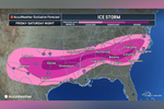
Interesting. The NWS is still leaning toward an ice event for Atlanta NE.
I think they have seen this quite a handful of times and already know the CAD is likely going to be somewhat undermodeled for portions of northern and NE GA. South of ATL is definitely a question mark that could be cold rain with only brief ice, but as it stands now, parts of the immediate metro area and up to the north and east could definitely see some icing here, maybe getting close to Winter Storm criteria depending on how long the cold air hangs on.
 
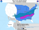
Alan Huffman’s thoughts for now subject to change he says.
0134738fed3188f7ec81603572da4f11.jpg


Sent from my iPhone using Tapatalk
As someone who is barely in A, I truly believe A should be farther north by a few counties. Hope I'm wrong! @Ross thoughts?
 
As someone who is barely in A, I truly believe A should be farther north by a few counties. Hope I'm wrong! @Ross thoughts?
I think after 1:15am tonight you will be feeling fine with his drawing. Im expecting an adjustment, pushing things back toward yesterday morning on physics modeling. Not all the way, but noticeable. Just my 2 cents.
 
Very good sign....it won't take much more movement like this to end up back where we were yesterday morning. Remember, VERY subtle changes in this setup can lead to MASSIVE changes downstream.
you can basically think of it like a seesaw

texas/ok are the fulcrum which is why they're basically guaranteed a big one

the further you get away from that the more intense changes you could see
 
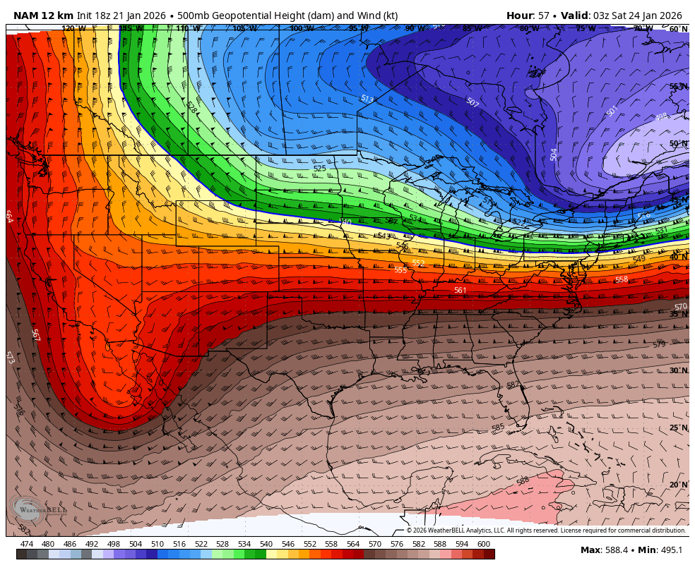
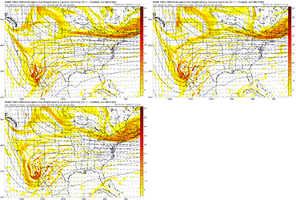
Ok, time for one of my infamous dumb questions for a met -- on the 18z NAM, as the Montana energy trends east, it looks like it not only stays away from the Baja low, but is interacting with the energy across the Great Lakes. Heights appear to drop there -- is that coincidence or an added benefit of that energy not diving toward the Baja low so much?
 
Ok, time for one of my infamous dumb questions for a met -- on the 18z NAM, as the Montana energy trends east, it looks like it not only stays away from the Baja low, but is interacting with the energy across the Great Lakes. Heights appear to drop there -- is that coincidence or an added benefit of that energy not diving toward the Baja low so much?
It’s a benefit, the closer they are, the more intact they will stay and slower the TPV moves east into SE Canada while adding more confluence
 
Ok, time for one of my infamous dumb questions for a met -- on the 18z NAM, as the Montana energy trends east, it looks like it not only stays away from the Baja low, but is interacting with the energy across the Great Lakes. Heights appear to drop there -- is that coincidence or an added benefit of that energy not diving toward the Baja low so much?
I would tend to think its better. Keeping it separate from the Baja Low flattens the heights downstream plus keeps the positive tilt back west and less chance of a phase.
 
So I’m trying to find somewhere to evacuate to out of catastrophic ice to hopefully snow and or sleet. Is East Tennessee getting the ice storm too??
There are many others on here more qualified to answer this question. But probably be less of an ice storm in eastern Tennessee, except NE, Tennessee It will probably be pretty bad. But don't go by my assessment. lol
 
Yeah think the northeast burbs are in the best chance to see significant icing. Whether it extends into the city remains to be seen. We’re talking a 1-3 degree shift here
What about far NE GA - Clarkesville area? I have a hard time seeing how we can stay the same type as 75 miles south of us but everything has shown us getting blasted with ZR to this point
 
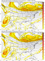
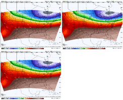
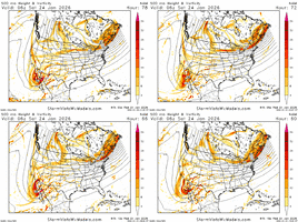
The NAM looks better in all ways so far. Height field is more suppressed, SW Canada vort is pulled back some, Baja blast more to the south, the hrrr made a similar move as well View attachment 187066

Bro, we tick that for another day, I bet we Miller A/B hybrid and get back to classic 85 storm with a front end thump. Word of the week: Front end thump.

Just got to get the AIs to catch on.
 
If there is anything I have learned from the early versions of a NAMming, its that the storm gets amped way more than it is in reality. Using that logic here, there is probably going to be a substantial shift southward with the precip transition zones and shield overall this run.
I have a question about this... in this case, the more amped solution should make it warmer, correct? ....My question to help clarify would be to does NAM have an "AMP" bias... or a "COLD" bias?
 
What about far NE GA - Clarkesville area? I have a hard time seeing how we can stay the same type as 75 miles south of us but everything has shown us getting blasted with ZR to this point
Generally in CAD setups of this strength we at least get some sort of precip besides freezing rain whether it be snow or sleet. Lived here my whole life, I'm literally a town over from you, sure you probably know.
 
I have a question about this... in this case, the more amped solution should make it warmer, correct? ....My question to help clarify would be to does NAM have an "AMP" bias... or a "COLD" bias?
This isn’t necessarily true at the surface in CAD areas. Because a stronger/more amped trough can increase the confluence over the northeast and lead to a stronger and/or better positioned high pressure for CAD. So you wind up with warmer mid levels, but potentially colder low levels. But it all depends on the details
 
I have a question about this... in this case, the more amped solution should make it warmer, correct? ....My question to help clarify would be to does NAM have an "AMP" bias... or a "COLD" bias?
In this specific case, that would be my thinking. Usually, the typical amped solutions on the long-range runs of the NAM result in substantially more precipitation over a more expansive field, which is basically the same thing as the storm having more energy to produce this much moisture. Then when it corrects, there is typically a trend further south. I do think the model has a cold bias, but in terms of these larger systems, a typical NAMming would bring the storm further inland and much larger, therefore increasing temps further south. The last storm was a good example as the precip shield started off way too far northwest of where it actually ended up being, but I also think 1/10/25 was another good example as early runs of the NAM wanted places like the I-20 corridor to see mainly freezing rain with the snow confined to the north, and as the event grew nearer, it adjusted to what the other short range (like the HRRR) were showing with a front end thumping of heavy snow, and that did end up verifying across the region when just days in advance, the NAM would have brought that precip band 50-100 miles north in TN and would have only resulted in freezing rain/rain further south.
 
Back
Top