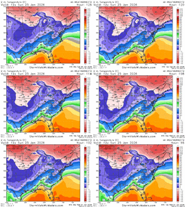
WCNC’s Chris Mulcahy has an awesome breakdown on YouTube! He’s been my fav met in CLT for years now.. Sorry --.
-
Hello, please take a minute to check out our awesome content, contributed by the wonderful members of our community. We hope you'll add your own thoughts and opinions by making a free account!
You are using an out of date browser. It may not display this or other websites correctly.
You should upgrade or use an alternative browser.
You should upgrade or use an alternative browser.
Wintry January 23rd-27th 2026
- Thread starter SD
- Start date
SnowNiner
Member
Sent from my SM-S156V using Tapatalk
Uh, it seems to have shifted north to me. GFS stays pretty south though, but it's the only one. The rest run up the Apps tail pipe before transferring.
I used to follow this guy but I can't understand alot of what he says.
NBAcentel
Member
SnowNiner
Member
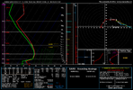
The AIFS really still isn’t far from snowing at the front end, we really need some help from the confluence hammer on top. this is probably a south/more smooshed vortex trend away from front end snow again. It’s still close. Sounding from cabarrus co north of Charlotte View attachment 187041
Since we stopped the bleeding north, and amping, perhaps we can tick back slower and stronger wedge to keep the classic front end thump in play. Still a long way to go and room for more ticks if they get going. Hoping this morning starts the trend back.
FranklinRude
Member
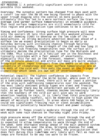
Nashville discussion in last few hours...
An Arctic front will be racing southward on Friday setting the stage
for the weekend storm. Temperatures will drop into the teens and 20s
across the area Friday night. Meanwhile, southwesterly upper flow
will send an anomalously high moisture plume eastward overriding
the Arctic front. Winter precipitation looks like it will start in
the area after 06z-12z Saturday and continue through overnight
Saturday and into Sunday.
So what has changed since the last forecast cycle? The big story is
the trend towards a stronger inverted trough/surface low over the
southeast. As a result, the warm nose is being drawn farther
northward which shifts the zone of sleet, freezing rain, and heavy
snow northward.
What does this mean for Middle Tennessee? If this trend remains,
this brings into play a significant to crippling ice storm over the
southern counties. In addition, snow fall amounts along the I-40
cooridor would be greatly suppressed as a large amount of QPF falls
as sleet. This would also mean the band of highest snowfall amounts
would be closer to the TN/KY border. We`ll continue to monitor the
trends, but I feel fairly confident there will end up being a tight
gradient of heavy snow to sleet to freezing rain. Where that
ultimately settles, we`ll see. I would not be surprised to see those
lines wiggle north and south over the next several runs of models.
One other trend to continue to monitor is for the event to drag into
Sunday as the northern stream of upper level energy tries to phase
with the Baja branch of upper level energy and swings through the
plains. As the surface low exits eastward, the warm nose will go
with it which means precip areawide would switch back to snow on
Sunday.
After the precipitation exits on Sunday, a very cold air mass will
settle in. Right now, single digits are in the forecast Sunday
night. Temperatures might end up lower than that. It will depend on
the location of the snow pack. The very cold air will stick around
on Monday and Monday night with a medium to high probability that
temperatures don`t get above 20 degrees on Monday and lows fall
back into the low single digits Monday night. Right now, it looks
like we may have to wait until at least Wednesday to get above
freezing. The good news is that we should see a decent amount of
sun on Monday and Tuesday to help with the melting despite below
freezing temperatures.
So here is the bottom line with this upcoming winter storm. Expect
for significant and perhaps prolonged impacts this weekend. Don`t
plan on traveling and run any errands you need to by Friday
evening.
accu35
Member
If you’re going by the 12z Euro alone. As of now it’s an outlier from the other models and the ENS AI has been trending towards the gfs and icon. I would say if trends do continue south like the 12z has shown then there will be some sort of wintry mix involved. Especially the back sidecool? according to the latest Euro, it'll be a WARM rain!
olhausen
Member
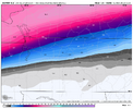
I always struggle figuring out what the Google AI shows but still looks pretty icy for Atlanta suburbs, especially for those to the eastGoogle is really cold at the surface, even with the north trend. RDU stays in mid 20's for Sunday but only good thing is precip has dwindled down to sub 1".
View attachment 187047View attachment 187049
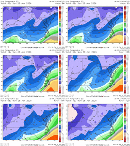
What is the trend like for weathernext2? For temps from 00z -> 6z -> 12zGoogle is really cold at the surface, even with the north trend. RDU stays in mid 20's for Sunday but only good thing is precip has dwindled down to sub 1".
View attachment 187047View attachment 187049
I wonder if lighter precip rates would lead to more efficient ice accrual. I'm all for lighter qpf if it means less ice but not sure we completely avoid issuesGoogle is really cold at the surface, even with the north trend. RDU stays in mid 20's for Sunday but only good thing is precip has dwindled down to sub 1".
View attachment 187047View attachment 187049
Last edited:
HailCore
Member
Fox 5 Atlanta is showing the ECMWF as an outlier solution for northern Georgia, which tells me that at least some of these on-air meteorologists believe there will be more ice/CAD further south than modeled (at least when compared to what the Euro shows). I also think they put a lot of faith into the BARON model which shows expansive ice totals much like the GFS, although it was too amped with the last storm showing snow all the way through northern Alabama (so maybe this one trends south using the same logic? Probably not much more other than an expansion of the CAD freezing rain under the existing storm track).
AlabamaWxWatcher
Member
Yep - marginal improvements for central MS into ALEPS follows its op which shows better out West then the same for us in the East. That makes sense since the Euro looked improved at first then went to crap later on. View attachment 187050
For those that care...here is the surface loop of Google. You can see the heavier front end is well north of the SE and then transfer takes place and somewhere across NC will get dry slotted.
This has gone from a east-west overrunning to to a legit miller b...and I don't expect many models to have the transfer correct so that might change who gets what. I wouldn't be surprised that Google is pushing the primary to far north before transferring.
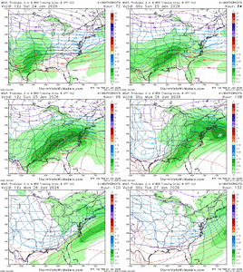
This has gone from a east-west overrunning to to a legit miller b...and I don't expect many models to have the transfer correct so that might change who gets what. I wouldn't be surprised that Google is pushing the primary to far north before transferring.

LukeBarrette
im north of 90% of people on here so yeah
Meteorology Student
Member
2024 Supporter
2017-2023 Supporter
For people watching front end thump, watch 700 mb not 850 mb. This system has its warming first higher aloft
SnowNiner
Member
For those that care...here is the surface loop of Google. You can see the heavier front end is well north of the SE and then transfer takes place and somewhere across NC will get dry slotted.
This has gone from a east-west overrunning to to a legit miller b...and I don't expect many models to have the transfer correct so that might change who gets what. I wouldn't be surprised that Google is pushing the primary to far north before transferring.
View attachment 187058
I feel like that may be the wild card the next day or 2. Does the low go that far north prior to the transfer? Or does it transfer to our south?
So you don’t think any of us are going to have to worry about a major sleet/ice storm lol
I go back and forth...the AIFS run from today is probably a reasonable solution from this far out but a 50-75 mile shift north would make this more a nuisance event for Raleigh atleast. I don't see N-W of 85 escaping this but the question of precip amounts with missing the front end thump and now figuring out miller b transfer.
And of course...a 50 mile shift south on the Euro AI would make this a potentially catastrophic event for the SE.
But...if I had to put money on this, I would bet nuisance event for Raleigh.
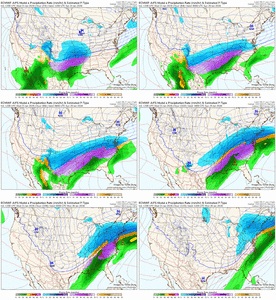
Agreed when it comes to sleet and freezing rain. I think if you’re wishing for a bunch of snow at the onset it’s just not in the cards for this storm for NC folks IMOVery small changes will make a big difference on the battle lines in a wedge scenario over here.
Webberweather53
Meteorologist
The only global model I personally take seriously with CAD is the Canadian. Just need to get another run or two closer for me to start buying into its solution. Tonight’s 0z should tell me a lot
Steady lighter prolonged precip with temps in mid 20’s is how you destroy the power grid. So while amounts have ticked under 1.5” I don’t see how that helps us at all.
Webberweather53
Meteorologist
Here you go...at 12z Sunday trend. But the problem with Google run is so the heavier precip is all. NW of the SE....this is why I am not worried about a "big" icing event for Raleigh.
View attachment 187056View attachment 187057
Freezing rain is a self limiting process and normally the worst ice storms we get around here involve longer duration, light-moderate precipitation rates.
I wouldn’t necessarily say it’s a good thing that the heavier precip is NW of us here
Alan Huffman’s thoughts for now subject to change he says.

Sent from my iPhone using Tapatalk

Sent from my iPhone using Tapatalk
This will be an extremely impactful winter storm for the Raleigh area.I go back and forth...the AIFS run from today is probably a reasonable solution from this far out but a 50-75 mile shift north would make this more a nuisance event for Raleigh atleast. I don't see N-W of 85 escaping this but the question of precip amounts with missing the front end thump and now figuring out miller b transfer.
And of course...a 50 mile shift south on the Euro AI would make this a potentially catastrophic event for the SE.
But...if I had to put money on this, I would bet nuisance event for Raleigh.
View attachment 187061
He’s one of the best to do it. I’m pretty much lock step with his ideas.Alan Huffman’s thoughts for now subject to change he says.

Sent from my iPhone using Tapatalk
Nerman
Member
Interesting. The NWS is still leaning toward an ice event for Atlanta NE.
not to mention it is probably harder to get sleet to save you when rates are not as heavySteady lighter prolonged precip with temps in mid 20’s is how you destroy the power grid. So while amounts have ticked under 1.5” I don’t see how that helps us at all.
NBAcentel
Member
Alan Huffman’s thoughts for now subject to change he says.

Sent from my iPhone using Tapatalk
I truly don’t think I-40 gets as much ZR as say CLT and GSP here, profiles on most modeling is truly a sleet bomb for I-40, even down to 85 for half the duration, the worst of the worst ZR to me is probably around the border south of Charlotte to CAE, just south of GSP into NE GA
iwantsouthernsnow123
Member
If you're talking about in terms of a southern trend, the baja low has shifted SW on 12z runs for the most part. Gotta monitor that to see if that continues to trend or not.Is there any way precip can uptrend again?
beanskip
Member
18z NAM coming in colder ahead of the storm in Ark/Tenn -- 850 OC line was in southern KY on 12z run -- now down into Tenn.
Mahomeless
Member
I fully expect more QPF in NC. I don't buy the SLP going so far inland and then transferring....that is what's causing the dry slot. IMO, there is much more likelihood that this is a major impact for most of NC than not.Is there any way precip can uptrend again?
Yeah think the northeast burbs are in the best chance to see significant icing. Whether it extends into the city remains to be seen. We’re talking a 1-3 degree shift hereInteresting. The NWS is still leaning toward an ice event for Atlanta NE.
At 33 hours the NAM has a slightly stronger Baja low and a slightly further east TPV in western Canada and that is all I will take from it this evening.
And yeah agree with @NBAcentel here on p-type corridors at the moment. For Carolinas I think a bit south of 85 from GSP to CLT to somewhere between RDU and FAY is the biggest ZR potential
And yeah agree with @NBAcentel here on p-type corridors at the moment. For Carolinas I think a bit south of 85 from GSP to CLT to somewhere between RDU and FAY is the biggest ZR potential
Mahomeless
Member
I would say that the NAM can start being trusted at this range out until about 18z on Saturday.....thats plenty of data worth analyzing to see how it may play out downstream.

