• Hello, please take a minute to check out our awesome content, contributed by the wonderful members of our community. We hope you'll add your own thoughts and opinions by making a free account!

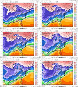
Wintry January 23rd-27th 2026

I understand the winter risks with this system, but if that warm sector really does stretch up into central Alabama and Georgia would there be a severe threat associated with it? I'm not well versed enough in reading all the maps, but that look of a warm sector with the sharp cutoff usually comes with at least a squall line I thought.

Yeah, that would a risk.
 
Weather next made a small move southward with temps but within the envelope of its recent runs. It’s an ice mess in the Carolinas and imo this has looked like an ice mess since Sunday night. Those GFS runs are fun but likely unrealistic. Better hope for some sleet to work in if you’re in an area that’s staring down the barrel of a legit ice storm
 
Weather next made a small move southward with temps but within the envelope of its recent runs. It’s an ice mess in the Carolinas and imo this has looked like an ice mess since Sunday night. Those GFS runs are fun but likely unrealistic. Better hope for some sleet to work in if you’re in an area that’s staring down the barrel of a legit ice storm
What did show for ATL? ( this might be banter..sorry)
 
So, it's fair to say that the GFS (while it has its issues) performs historically better with CAD as compared to the EURO?
I think the issue is how amped the low becomes. The UK is the extreme and has the low push up into western Tennessee cause most on the board to rapidly warm up. The CAD actually stays strong for east App areas. But even here the (freezing)temps are 10 degrees warmer.
 
There was a system years ago that I remember being modeled consistently for a huge Ice Storm in the southeast for several days on all of the models and about 60 hours out the models shifted the track of the low hundreds of miles north and ended up being a rainmaker for many except for a few in the CAD areas.
 
Weather next made a small move southward with temps but within the envelope of its recent runs. It’s an ice mess in the Carolinas and imo this has looked like an ice mess since Sunday night. Those GFS runs are fun but likely unrealistic. Better hope for some sleet to work in if you’re in an area that’s staring down the barrel of a legit ice storm
Agree. I think areas such as Greenwood, Abbeville, and Laurens counties (S of 85) are going to have the major issues with ice. For power, got to hope for more sleet than Freezing rain.
 
Essentially they’re unsure of trends at this point being the solution due to uncertainty about the northern stream energy which is currently in an area with poor obs, so could be poorly handled by models.

I -think- the 6z euro solution is unlikely to verify but if we get to the 0z cycle tonight and are leveled off or still headed this direction, even Mets in the Carolinas may have to change their tune some. Let’s see where she goes.
Yep, Mets will not jump ship with a couple of model runs. Although I was surprised Rah NWS still had snow here throughout the storm with possible mixing with ip/zr. Bigger surprise to me, no mention of Euro and it's trends in AFD, once again leaned heavily on NBM. Today's a big day for this one
 
I mean how does this happen? Somebody with more knowledge than me please explain how it can just bully all that hp out the way? I want to not believe it either, but I feel that's straw grasping since they all do except the GFS. And I'll never get letdown by the GFS again when it's on an island
View attachment 186849
The simple answer is that it won’t. The physics will cause the low to do a miller b transfer much further south than what you see here. I would encourage anyone to go back to January 2022 and see some of the crazy things that models were doing with that CAD, our last major CAD storm. In all honesty I’m surprised that we haven’t seen the GFS try to do something like this already
 
Google model has been the northern most model past couple of days and keeps ticking north. This thing needs to be taken seriously, it's led this all week.

Much less precip then other models for Raleigh.

View attachment 186853
So you're going with damaging ice for Raleigh then? or are we not using weathernext surface temps?
 
I think he was honking the horn alittle about the EURO!

 
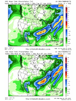
Latest EuroAI ENS...heavy precip axis shifting well NW...hopefully that keeps up to cut back on the icing and power outages. Wouldn't take much to get Raleigh out of this.

View attachment 186854

But even we just blend the GEFS/AIFSENS above then dang...it's lights out...

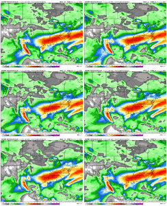
GEFS with a 2"+ mean right down I-85/40 in the SE with crippling ice

gfs-ensemble-all-avg-se-total_precip_inch-1768975200-1769493600-1769493600-20.gif
 
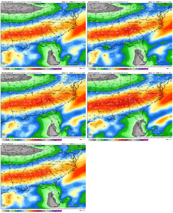
This is the Euro gradient from 00z on the tail end of the storm. Flashbacks of early 2000’s on steroids. Barring the miracle that we somehow lose this here in the next 12 hours, this is going to be one of the more angry wedge storms of our time I’m afraid. A clashing of heat (which is situated directly under the wedge), ample moisture and trapped funneling cold with roots out of the Arctic. This is going to be memorable for the wrong reasons for many posters on this board I’m afraid. My hope is that I am not one of them.IMG_7787.jpeg
 
The simple answer is that it won’t. The physics will cause the low to do a miller b transfer much further south than what you see here. I would encourage anyone to go back to January 2022 and see some of the crazy things that models were doing with that CAD, our last major CAD storm. In all honesty I’m surprised that we haven’t seen the GFS try to do something like this already

2022 had a better track than this time around.
 
If my memory serves, overrunning equals ice 9 out of 10 times in NC. We need more of a gulf low vs the sw to ne systems.

need to see changes at 12z or Id hang it up south of virginia.
 
Has anybody found NWS discussion on the latest model runs?
NWS CAE (Columbia)

National Weather Service Columbia SC
746 AM EST Wed Jan 21 2026

.WHAT HAS CHANGED...
Confidence continues in a potentially impactful winter storm
this weekend, with some small tweaks in the forecast thinking.

&&

.KEY MESSAGES...
- 1) The trend continues towards a potentially significant
winter storm this weekend.

- 2) After very cold start Wednesday, temps steadily moderate
through Friday along with some rain chances.

&&

.DISCUSSION...

KEY MESSAGE 1: The trend continues towards a potentially
significant winter storm this weekend.

Overview: The forecast thinking has not changed much for the weekend
system with potential for a highly impactful winter storm
continuing. The overall synoptic pattern is quite consistent across
all guidance with a deep digging trough off the NE CONUS,
strong confluence and an associated strong surface high in the
central- eastern CONUS, and an ejecting cutoff shortwave in the
SW CONUS. This patterns sets up a broad overrunning scenario as
the arctic high digs southeastward presenting an all-hazards
impactful winter storm potential for much of the southern and
eastern US, including GA and SC as strong cold air damming sets
up.

Trends and Forecast Challenges: While some disagreements continue,
guidance remains in above-typical agreement over the potential
impacts from this system given the 72-96 hour window, with historic
analogs and climatology concurring; this setup distinctly favors
mixed precip with snow-sleet-freezing rain-rain potential. A subtle
shift in some of the 18z guidance and more evident in much of the
00z guidance is a northerly shift in the axis of heaviest qpf,
thanks to a slightly more amplified flow and associated low pressure
development; this also pushes the surface edge of the CAD dome
north. This trend in guidance is seemingly driven by a very
subtle slowing of Pacific cutoff ejection and positioning of the
broad surface high; aircraft recon early Wednesday morning
should help improve this sampling, but not until the 12z
guidance. Thanks to this trend, the GEFS has steadily become
more and more of a cold- southerly outlier compared now with the
ECE, Canadian Ensemble, and AI suite being warmer- northerly.
As noted previously, shifts in the handling of both of the low
level cold air and the Pacific cutoff are expected as these are
two of the most notoriously difficult meteorological features
for guidance to handle. The current trends, and anticipating
typical model biases, reinforce the thinking that the I20
corridor will potentially lie along a steep gradient zone for
qpf and therefore potential winter impacts.

Potential Impacts: A range of impacts continues to be possible from
this system, ranging from a notable ice storm to a inconvenience-
nuisance event with a gradient of impacts across SC and eastern GA
looking more likely. A mix of precip-types is expected, but trends
over the last 24 hours suggest snow is less likely for central SC
and eastern GA. Confidence remains high that much of, if not the
entire, area will see at least some wintry weather from late
Saturday-Sunday, however specific geographic impacts remains unclear.
Based on the guidance trends, confidence is increasing that the I20
corridor will lie along the gradient of impacts; the probabilistic
WSSI for moderate impacts summarizes this well, with ~60-80%
chance north of I20 and then ~20-40% chance south of I20. While
details in the spatial impacts are still unclear, the high end
ceiling for this system remains, with notable ice storm potential
and lingering cold weather behind the system extending impacts
in time.

Summary: Guidance remains in fairly good agreement over much of this
forecast but subtle differences result in a range of impact
potential. Confidence is already fairly high that many areas of SC
and eastern GA will see at least some winter weather this weekend
but a gradient of impacts is likely geographically. Unlike many
southern winter events, the ceiling for this event is very high with
significant impact potential.

NWS GSP

Key message 3: A winter storm system is likely to impact the area this
weekend but details regarding precipitation amounts and type remain
uncertain. Confidence continues to increase that moderate overall
winter storm impacts could lead to hazardous travel and power
outages.

All eyes are looking at the potential weekend winter storm
forecasted to sweep across a wide swath of the south, from the
central CONUS to the Carolinas. Confidence continues to increase
that a storm system would likely impact the CWA Saturday and into
Sunday. The questions remaining are exactly what kind of
precipitation falls, quantity and how these p-types impact the area.
What we know at this point is there is high confidence of a strong
and cold air mass spilling into the central portion of the U.S. and
spreading eastward by Friday. Moisture in the south stretches ahead
of the frontal boundary, meaning wintry precipitation forms along
this boundary. Now, this is where the uncertainty remains as there
are many factors that will change and directly influence this system
for our area. Current guidance continues to trend at a wide swath of
p-types, including snow, ice, and sleet. Let`s talk snow first.
Current guidance from a variety of models are shifting snow further
to the north, meaning at this time, the higher totals could be over
the mountains and into parts of the NC Piedmont, along and north of
I-40. Probability for 12" of snow or higher is 30-40%. Depending on
where the transition zone sets up will highly influence this
potential for larger snow amounts.

Now for the less thrilling part of winter: sleet and ice potential.
At this time, this appears to be the primary p-type for areas south
of I-40, including Upstate SC, northeast Georgia and into the
southern portions of the NC Piedmont. Current trends are placing
more of the ice just to the south and sleet right in the middle,
affecting a larger chunk of the CWA. This doesn`t mean snow won`t
occur, but there is likely to be a transition from snow into the
mixed precip. Current model soundings show a weak snow profile for
Saturday before an elevated warm nose develops, indicating more of a
sleet event. However, ice probabilities are still 40-50% Saturday
night into Sunday. Though it`s too earlier for deterministic
amounts, current guidance shows a 50-60% chance for ice
accumulations of 0.25" or greater essentially southward from
the NC/SC stateline. The confidence is increasing that warning
criteria for ice and snow will be met this weekend. For this, a
Winter Storm Watch for the entire area is likely to be issued in
the coming forecast cycle.

Details will continue to be thoroughly looked over with each
forecast cycle leading up to this weekend, but preparation should
begin at this time. Regardless of the individual p-types, the
important thing to note is there will be plenty of QPF with this
storm. Wintry precip, whether it`s ice, sleet, or snow are going to
have widespread impacts from travel constraints, air travel
disruptions and power outages, especially in the locations where ice
occurs. Preparations should start being made for these impacts and
any disruptions to the power grid now.
 
The track did end up being fine, but my point was that the globals then were not handling the strength of that CAD well at all and were continuing to try to plow the low right into it which didn’t happen.
How did ATL fair in that storm? I don't remember that one. I remember the (2) 2000 storm and 2004 when I was in college.
 
Sleet is main threat for Charlotte gradually changing to snow in the Triad….Remember the Xmas at least 10yrs or so ago? Was a white one for most of the day in Winston but rain in Salisbury/Concord until around dark when it changed to all snow???…. Any similarities to that storm?
 
The track did end up being fine, but my point was that the globals then were not handling the strength of that CAD well at all and were continuing to try to plow the low right into it which didn’t happen.
I took detailed model notes for that one on Surface temps, for each model cycle leading up to the event starting from 84hrs out.

The Rgem was by far the best with surface temps and really nailed it. The ukmet was easily the worst and average 4-5 degree's too warm on average. GFS was a little too warm, Euro did ok but was actually a little too cold early on.
 
Whenever I see the EURO and UKMET with similar solutions, I have found they are hard to bet against. Yes they tend to erode CAD too fast but they also can pick up on the dreaded warm nose better than the GFS/Icon and that is what they are doing here. Surface temps will likely be predicted too high on them but the problem is the upper levels warming causing the ZR and IP to increase and snow to decrease in amount and area coverage. I am old so I remember a storm in W-S back in the early 80's and watching Paul Delagato explaining why we were getting IP instead of SN at 17 degrees. It never rose above that surface temp but the IP went on for hours it seemed.
The parent High has been nudging North now for several EURO runs and, even though it still remains pretty strong, it moved from NY up into Canada and that is never good for us regardless of the strength of the High. It is NOT just the millibars of the High but also the location of where it sits. Could things still make some changes, absolutely (and probably will) but I don't see them being major ones. I am still hoping Atlanta and Charlotte can miss out on the ZR because those metro areas have huge populations that could be dangerously affected by a lot of ZR
 
I took detailed model notes for that one on Surface temps, for each model cycle leading up to the event starting from 84hrs out.

The Rgem was by far the best with surface temps and really nailed it. The ukmet was easily the worst and average 4-5 degree's too warm on average. GFS was a little too warm, Euro did ok but was actually a little too cold early on.
Can’t recall an event at this range where we said the UK and CMC handled it well. So yeah, those agreeing with the Euro of being north I guess could give pause to see if Euro ticks back south today or tomorrow.
 
Just now getting up and seeing 0 and 6z stuff so don’t crucify me if I miss somethin, but AIFS ticking to more separation up top as well. ECMWF trend similar

View attachment 186848
Can someone correct me here, but we want more separation from the Baja low and the N trough correct? This forces the low to be neutral tilted with the trough, vs the Euro which almost looks to kick the low in front of it, allowing it come north?
 
Back
Top