-
Hello, please take a minute to check out our awesome content, contributed by the wonderful members of our community. We hope you'll add your own thoughts and opinions by making a free account!
You are using an out of date browser. It may not display this or other websites correctly.
You should upgrade or use an alternative browser.
You should upgrade or use an alternative browser.
Wintry January 23rd-27th 2026
- Thread starter SD
- Start date
RTRwx
Member
Hey hey! I rarely post (but read here often!).
One of the potential issues I see, even with an amped northern solution, is that surface temps will be over done on the globals in some of the areas where the euro shows mid 30s. The warm nose will be centered up near 800 MB. With coolish 925s, to me, it isn’t likely to overcome those low dew points at the surface (on Saturday morning) even with the triple phased Euro.
Lay down 2-3 inches of snow or some IP early on, and that will make it even more unlikely the northern 1/3 of AL and GA get out of the 20s with even ATL and BMX being at risk (with the amped solutions).
Long way to go. I hate ice… my region (almost 2000 feet up near Chattanooga) looks pretty locked in for ice unfortunately. Rooting for the GFS!
Just speculation. This is a wild one though.
This is a strong CAD. Here's a definition I like:Only in NC. It’s incredibly unpredictable in SC. Sometimes it reaches SW GA… and other times it doesn’t cross the nc/SC line
Sent from my iPhone using Tapatalk
*****A classic CAD (Cold Air Damming) weather system, common in the eastern US, traps a shallow layer of cold, dense air along the Appalachian Mountains, creating a "wedge" of cool conditions with potential for fog, freezing rain, and sleet inland while the coast stays warmer, driven by high pressure to the north and warm, moist air from the south, making it a tricky phenomenon for models to forecast accurately. *****
There could be some places that can stay sleet longer and others that hold on to freezing rain longer. We have three days of model tracking and then we'll still not know exactly what will happen.
Living and dying on EVERY model run is going to drive you crazy. Everybody take a step back. It's evident there is going to be a major if not historic winter storm for a lot of the region. The CAD is going to be very cold and deep and more than we've seen in many years. There will be a ton of moisture overspreading the cold dome.
The result will be snow/ice. I wouldn't sweat the exact dividing lines yet because it's too early, but this storm has been modelled for almost 5 days and we still have 4 days to go and IMO have been remarkably consistent since day one.
I realize everyone wants the snow the GFS 18z showed and no FRZ, but that's not going to happen for either. I'm simply telling everyone that a significant winter storm is coming and start preparing.
Let's see where it goes from here. I'm thinking it will adjust N some then settle slowly back to what the ensembles have shown the last few days.
Personally, I like the NBM right now.
Sent from my Pixel 10 Pro XL using Tapatalk
DCK
Member
I think it would be different if we were talking less qpf, but I don’t know many that are rooting for the insane ice totals a lot of the 18z models show. Even cut in half or more that is very dangerous and most people, myself included would just prefer to be all rain if the other option is ZR.Can someone tell me why we’re all rooting for some drastic North Trend now? This is stupid, grow a pair and let’s experience something more than rain
Sent from my iPhone using Tapatalk
LukeBarrette
im north of 90% of people on here so yeah
Meteorology Student
Member
2024 Supporter
2017-2023 Supporter
Yeah NAM definitely trending to the Euro camp but not firmly in it yet. NAM sucks but still worth watching its trends.
ChattaVOL
Member

Sent from my iPhone using Tapatalk
LukeBarrette
im north of 90% of people on here so yeah
Meteorology Student
Member
2024 Supporter
2017-2023 Supporter
it wouldn't be a huge surprise if precip started "earlier than expected" for many
lexxnchloe
Member
Not a good trend. The high is further NW than 18Z. That will in response allow the warm air to also be further NW
Sent from my SM-S156V using Tapatalk
Unfortunately as fast as we're going on here this is outdated to an extent for NC
Friendly reminder to take your bitching into the banter thread 
Getting a cold air push south as the precip coming in.Not a good trend.
ducketta27
Member
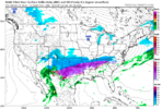
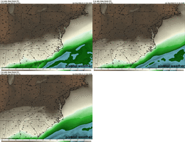
View attachment 186645
By the untrained eye looks like we getting a good cold press and no strong WAA push at 84 hour NAM.
The orientation of the precip SW to NE not great
Sent from my iPhone using Tapatalk
beanskip
Member
NAM can't even get the 850 0C line south of the N.C./SC line or the southern Tennessee border by 12z Saturday. Yuck.
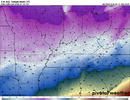
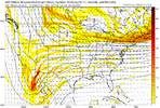
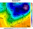
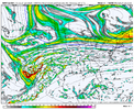
Yeah this thing is on life support in Georgia. Updating my forecast tonight to put more emphasis on rain-only solutions.And we start the 00Z runs with higher heights in the east and a full Baja capture.View attachment 186646
iwantsouthernsnow123
Member
Seen several people see the north trend on models and immediately think this is a "Lock" for a northern trend.
Yes, this is the NAM but it gives a general picture, and a similar scenerio to euro. We're over 60-80 hours right right now to the start.
It is extremely difficult for globals, even ensembles, high range as well in some situations like this to 100% figure out whats going to happen here. There is energy literally everywhere. The northern track you're actively seeing on many models now, is because you have 3 main phases going on.
Baja Low enters too fast, giving just not enough time for the cold air to settle in before amping up.
TPV has been trending towards digging into western Canada, reminds me quite a bit of the last system, before trending more eastward closely after recon data started coming in.
On top of this, because you're baja wave is coming just so early, it gives plenty of time to have phase with the triple wave, before phasing with some energy on the SW side of the TPV, thus making it a triple phase event.
Bottom line, any triple phase event is extremely difficult to globals (any model, including ensembles) to predict, and we seen it last week and unfortunately this week the confidence isn't a whole lot greater as there is just so much energy flying around, it's going to be nearly impossible for models to figure out what will "exactly" happen with this setup. Yes, this can and possibly will come north. But the smallest changes can affect the entire system. Recon data tomorrow will be EXTREMELY important.

rburrel2
Member
Even with the bad trends… the hi-res models are going to go nuts with this wedge in terms of surface temps.
- Joined
- Jan 23, 2021
- Messages
- 4,602
- Reaction score
- 15,197
- Location
- Lebanon Township, Durham County NC
Probably snowing across a good chunk of NC with those RH numbers.
Normal caveats apply re: long range NAM.
Normal caveats apply re: long range NAM.
my opinion is the CAD zones of far northeast Georgia and the upstate gets a substantial ice storm
Pops
Member
Is iit just me or does anybody else think somebody is gonna get an insane amount of sleet just south of the snow?
JimRussell
Member
I am weenie, but what bad trends is everyone gettin all up in arms about? Check up on this thread from earlier today and it goes from euphoria to despair, what gives?
You guys are bitching about long range NAM?!?!?
Normal crisis mode in the winter weather forums... We say let's not get all worked up for the weenie runs and as soon as you see a triple phaser on 1 Euro no one follows there same logic... and generally 1 person yells fire and everyone runs we shall see if it was Thursday I would say not much room for swingsI am weenie, but what bad trends is everyone gettin all up in arms about? Check up on this thread from earlier today and it goes from euphoria to despair, what gives?
Webberweather53
Meteorologist
ICON has the Baja low north already this run and the northern stream wave digging a bit more. Not great.
That Nam, looked like gfs at surface timing wise. Had it went out a little futher, looks like it wouldhave git here just in time to set initial sleet / snow transition line down i 40 TN ,NC then continously try to push down on it throughout time.Getting a cold air push south as the precip coming in.
My own opinion. But if I was sitting here rooting for a triple phaser like 18z euro. Odds of me seeing it actually happen in 3 days would be nill. Not from bad plain luck, but just from it actually happening, verifying. We aint getting a triple phaser. But we can get the junk in the trunk that it takes to whip one up. Want produce desirable results (50 straight hours of pure snow over the NC Zoo, thanks 18z gfs). But it will still send out a several hour long finger strip,pure snow and give a sleet storm for the ages on top possibly to some. Freezing rain aint bad till you approach .4-.5 mile marker. Then it gets expotienally bad every tenth of inch afterwards. You cross .75 mark and its still going with temps mid 20s, it becomes a region wide nightmare from that point on.
Be of good cheer, something besides brown ground and upper 50s is here!
Last edited:
ducketta27
Member
Normal crisis mode in the winter weather forums... We say let's not get all worked up for the weenie runs and as soon as you see a triple phaser on 1 Euro no one follows there same logic... and generally 1 person yells fire and everyone runs we shall see if it was Thursday I would say not much room for swings
You guys, we’re missing the point here. This wasn’t a 1 run “swing”… Euro has been trending NW the last 3 runs… EPS has gone north.
NAM (though horrendous at 84 hours) shows a similar solution… with the SW to NE precip orientation due to the ridge…
The awful Euro run from earlier is more like a warning shot this things going north… not a one-off we can toss
Sent from my iPhone using Tapatalk
We know the drill.. Lose it just to bring it back at this range. Just trying to be optimistic. 
Euro was trending south but always mostly icy for AL/GA even then and took a few jogs north again so just saying alot of of time still on table and variations and actually obs to be had stillYou guys, we’re missing the point here. This wasn’t a 1 run “swing”… Euro has been trending NW the last 3 runs… EPS has gone north.
NAM (though horrendous at 84 hours) shows a similar solution… with the SW to NE precip orientation due to the ridge…
The awful Euro run from earlier is more like a warning shot this things going north… not a one-off we can toss
Sent from my iPhone using Tapatalk
WolfpackHomer91
Member
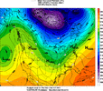
This is the analog now….snow is likely out the window for central NC and points south
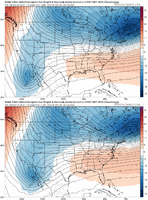
View attachment 186649View attachment 186650
Even in that though we got like 2-4” or something prior to the ice event that night.
Sent from my iPhone using Tapatalk
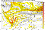
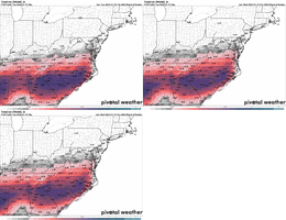
Have to with the 18z euro ingested into it. We gonna get hit hard no matter how you slice it. But our (hwy 64 NC) wiggle room is almost gone in order to avoid ice. Gotta do the walking on glass walk for 3 more days. We both know odds of holding it (frzrn) off are hard to do for that long.Ice threat creeping north on the NBM
View attachment 186651
Gotta take the ampage down 1 notch and or get a posotive timing shift 3-6 hrs with our hp sliding over faster or baja delaying just a blip. The MT shortwave disappearing would be best news.
iwantsouthernsnow123
Member
Generally this is when you suppress it then bring it back north, but not sure if this system we'll bring it north or not. I explained a lot of it earlier in a previous post. Just energy flying everywhereWe know the drill.. Lose it just to bring it back at this range. Just trying to be optimistic.
12z I thinkWhen does the new flight data get ingested into the models? Doubt the NAM has a clue at 84 hours.

