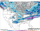
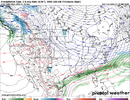
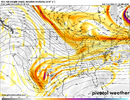
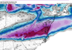
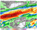
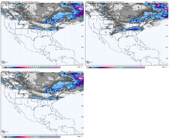
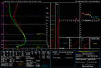
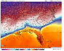
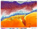
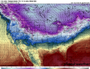
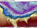
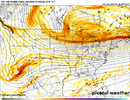
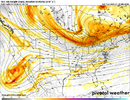
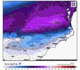
That massive warm nose/warm air has shown up very pronounced on all the models in the last few runs over central Alabama. Will be interesting to see if that sticks and when or if we change over to frozen precip. Maybe we’d dodge the bad ice with it
-
Hello, please take a minute to check out our awesome content, contributed by the wonderful members of our community. We hope you'll add your own thoughts and opinions by making a free account!
You are using an out of date browser. It may not display this or other websites correctly.
You should upgrade or use an alternative browser.
You should upgrade or use an alternative browser.
Wintry January 23rd-27th 2026
- Thread starter SD
- Start date
It’s a physics based event, I don’t see the ai models getting this right, I believe we see suppression for the next several runs with a n tick towards the short rangeIf banter I apologize….
Tim Buckley just posted this
Sent from my iPhone using Tapatalk
Will there truly be much of a NW trend if this high verifies as 1045+ hpa?I agree with you that there will be zr in the deep south, but I also think the precip/snow shield will be quite a bit farther north than the GFS/GEFS has and more into Kentucky and the lower Ohio Valley.
I just don’t see that much of a Warm Nose on this one. Especially with the arctic cold push on this setup.That massive warm nose/warm air has shown up very pronounced on all the models in the last few runs over central Alabama. Will be interesting to see if that sticks and when or if we change over to frozen precip. Maybe we’d dodge the bad ice with it
ChattaVOL
Member
Do you have the ZR map?
Sent from my iPhone using Tapatalk
weakening trend?HPs are 1038s Hmmmm
LP appears off Hatteras
all weather is physics basedIt’s a physics based event, I don’t see the ai models getting this right, I believe we see suppression for the next several runs with a n tick towards the short range
HPs are 1038s Hmmmm
LP appears off Hatteras
No weaker high pressure meaning further north of the low pressure.weaking trend?
icon looked north. more progressive baja low, less robust cold press. don't shoot me only the messanger
actually they built up during the run. Became strongerweakening trend?
JP152
Member
Great run for Virginia. looks more amped.icon looked north. more progressive baja low, less robust cold press. don't shoot me only the messanger
wow
Member
Same area as 12z but higher totals
pleading the 5th here in respect for my friends down southGreat run for Virginia.
ducketta27
Member
icon looked north. more progressive baja low, less robust cold press. don't shoot me only the messanger
In my opinion, ICON looks to make this a longer duration event for some.
Sent from my iPhone using Tapatalk
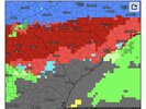
Note that there is for no good reason no explicit sleet shading on this Pivotal precip type map and that the “fzrz” (orange) goes all of the way to the snow virtually all of the way across. That’s not realistic based on history and it also isn’t intuitive. Thus, I can only conclude that “fzrz” is ZR in its S portion and sleet in its N portion.
More consolidated?Same area as 12z but higher totals
My guess is this is too high here but anomalous gradients create anomalous things
Can break this down my area? I am alittle confusedNote that they’re is for no good reason no explicit sleet shading on this Pivotal precip type map and that the “fzrz” (orange) goes all of the way to the snow virtually all of the way across. That’s not realistic based on history and it also isn’t intuitive. Thus, I can only conclude that “fzrz” is ZR in its S portion and sleet in its N portion.
wow
Member
Makeitsnow
Member
Just a ridiculous and devastating result. Hopefully its just playing catch up with more southward adjustments coming.This ICON run has 34mph wind gusts and 2.3" of QPF.. almost entirely freezing rain.
View attachment 185993
View attachment 185995
Webberweather53
Meteorologist
The GFS is running we will see how that turns out. I don't see the ICON be right with winter systems a ton though so that gives me hope. If we start to lose the Euro and GFS then there might be an issue.
Well we need the rain, can't recharge the water table with it frozen
This was probably a banter post my bad
This was probably a banter post my bad
guys please don't get hung up on qpf from an operational model (especially the icon). it is vapor in the wind
Keep in mind that ~1” of this in ATL, for example, is from earlier waves of rain falling prior to when the cold arrives. But that does still leave just over 2” of qpf when <32.
gfs pretty unchanged at hr 54 at 500mb. baja low held back west a touch but that could be considered noise imo
wow
Member
0z GFS similar to 18z so far at 63 hrs


