NBAcentel
Member
I’d be SHOUGHED if the AIGFS doesn’t come in colder here. The TPV on it is getting more separated 

I would say the snow footprint is north some but the overall QPF is similar to 0z. This doesn't make the mid-atlanic crew happy.The footprint is north
Would think this is just a bit of a "we see it, we're watching it" call from them at this range.GSP not as enthused
As for the even further out potential system for the weekend, model
guidance keeps the high pressure parked over the central part of the
country and eventually makes its way into the area. There is much
discrepancy and uncertainty if the frontal boundary is able to make
anything of the weak moisture return. Friday and Saturday could see
a mix of precip but again, its too far out. There is a possibility
for a wintry mix as the transition zone and colder air move in. A
few of the individual models show a signal for snow, but there is
still much uncertainty. Any shift north or south of the potential
boundary could be the difference in rain, snow, or nothing at all.
And as this location has seen again and again, it`s all a matter of
whether or not the cold air can even make it in time. Will continue
to monitor as this system is going to change this far out.


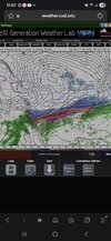
Part of me wants to play the streak here with leaving it back or stringing it out some. AI models make me think that won't be the case. Can't rule it out yet! EPS trend thru 0z.
View attachment 185591

One of the things I’ve always heard Brad P mention is just difficult it is to see a LP trend north when you have a strong and dry Arctic airmass in place and getting reinforced.If the tables were flipped I feel like a lot of people would not be buying the AI ops solutions near as much. Also it just seems like that strong of a high will not allow this to go but so far north .
Jan 88 is the Gold Standard for a lot us, especially the upstate. I would LOVE to have another one like it but of course those are rare for a reason. Always appreciate your input BTW.As I said.. not surprised. Looking good there. I still think Jan '88 is the top analog. That TPV is serious.

Ol' AI GFS here ain't ready for the big show yet. That's alright, beef up that NIL budget, get some guys from the portal and come to play next year.


richmond va snow capital of the united states!
EYE C what you did there. Football and wx reference.I’d be SHOUGHED if the AIGFS doesn’t come in colder here. The TPV on it is getting more separated View attachment 185598

Really don't exactly like how similar the setup is to Feb 2021 though.i wasn't alive or around then but from everything i've read about it this does feel 1988-esque, especially reading about the temps during that storm


It looks like it may have done it just enough to beef up the precip some without sacrificing much cold considering a better cold press this run. But will need to watch if it goes further eastunder the hood, on op gfs, baja low trended east

Not what I exactly like to see, itunder the hood, on op gfs, baja low trended east
Wouldn't count on it personally. That baja shifted well east on that run, not enough to cause too many problems, but it could be a start towards a more amped look.This is incredible. I don’t remember a time a radar ever looking like this during a winter storm. But I haven’t been following weather super long. Just wow if this verifies
Sent from my iPhone using Tapatalk