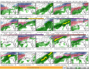
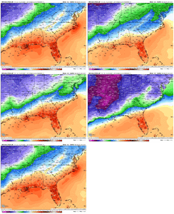
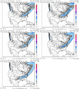
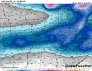
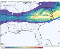
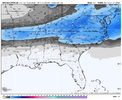
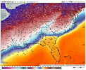
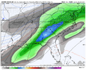
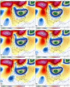
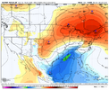
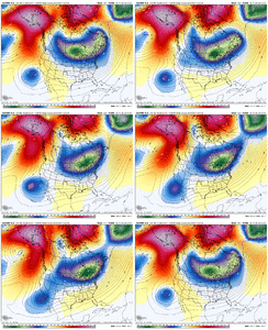
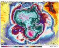
What I was kind of thinkingThankfully bam bam natgas said this is too strong
-
Hello, please take a minute to check out our awesome content, contributed by the wonderful members of our community. We hope you'll add your own thoughts and opinions by making a free account!
You are using an out of date browser. It may not display this or other websites correctly.
You should upgrade or use an alternative browser.
You should upgrade or use an alternative browser.
Wintry January 23rd-27th 2026
- Thread starter SD
- Start date
Webberweather53
Meteorologist
Thankfully bam bam natgas said this is too strong
Part of me thinks they said that because they’re probably trying to manipulate the market in their favor
Stormsfury
Member
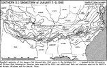
In the Jan 1988 storm, the SFC low was superweak (1016mb to 1012mb). Pure widespread overrunning over atop a stout wedge front fermented copious amounts of moisture for a long stretch.GFS wants to crash the HP down with some overrunning, but doesn't spin up a cyclone. The ingredients are there for a monster, though, just need a bit more energy to kick out from Baja to spin up a cyclone.
The high would be probably be there at 72 hours and still say too strongPart of me thinks they said that because they’re probably trying to manipulate the market in their favor
Part of me thinks they said that because they’re probably trying to manipulate the market in their favor
BAMwx has been struggling bigtime. They were way too cold for virtually the entire US for the first half of Jan. For example, they had the E 1/3 of the US BN and it ended up well above normal.
Aside: They clearly have a cold bias because they want more clicks/likes. That’s the problem with social media based pay wx services. Thus the NG mkt is smart enough to largely ignore companies like BAM.
Yep, if I recall that was a long steady persistent snowfall. Just kept producing well into the nightIn the Jan 1988 storm, the SFC low was superweak (1016mb to 1012mb). Pure widespread overrunning over atop a stout wedge front fermented copious amounts of moisture for a long stretch.
HailCore
Member
DylanWx
Member
I'm currently expecting around 18 inches in Raleigh next Saturday.
Came all the way back from kansas. we called it the M@M storm in NC. Murphy to ManteoYep, if I recall that was a long steady persistent snowfall. Just kept producing well into the night
packfan98
Moderator
rburrel2
Member
The ideal scenario is that Baja low barely gets captured and grinded down as it moves east, well after our high pressure is established. That’s how we go storm of the century.
Let it dump its contents in to the main trough after we have the cold air.
Let it dump its contents in to the main trough after we have the cold air.
GEFS looking a tad better than 12Z at hour 144 for a more southern solution (18Z Saturday)
View attachment 185254
Wow, that’s a rather big spread there.
Stormsfury
Member
Yeah it was. I remember a weather channel map that morning before school seeing the precipitation from Texas to just west of Charleston. Temp was 30 with a DP of 3 at 7am here. Started sleeting around 9am. School let out at 1pm. Temp was 21° at 1pm.Yep, if I recall that was a long steady persistent snowfall. Just kept producing well into the night
NEGaweather
Member

Sent from my iPhone using Tapatalk
Cindy131
Member
I remember we were without power around 1 week but there was another ice storm many years later we were without power 2 1/2 weeks. Less ice, different house (shorter street) but we had several power poles broken due to trees falling.While yes we are "far away" time wise but from looking at the current model outputs, this would be about as bad as the 1973 Ice Storm that struck Metro ATL/ North GA in Jan 1973. That one was more of a "tree/powerline" issue rather than a roadway problem in most areas. Many were without power for up to 4-5 days . Models have this one as much more widespread across the SE.
WolfpackHomer91
Member
Of course Bernie wants this thing going North …. He wants the big Markets in on it
Sent from my iPhone using Tapatalk
Am little worried with the AMP solution on the Euro AI model. Guess we need to ride the ensembles on this.
Jan 1988 was pure powder up here. Love to see a high ratio , sugar dust event. Tahoe style preferably, yard stick deep
Webberweather53
Meteorologist
Of course Bernie wants this thing going North …. He wants the big Markets in on it
Sent from my iPhone using Tapatalk
most meteorologists up north think this thing is going to trend back north.
NBAcentel
Member
Heavy precip and 19-20F in parts of NC. WOW!18z AIFS once again a big ice event View attachment 185264View attachment 185265
sleet you think? vs -zrHeavy precip and 19-20F in parts of NC. WOW!
NBAcentel
Member
LukeBarrette
im north of 90% of people on here so yeah
Meteorology Student
Member
2024 Supporter
2017-2023 Supporter
Was about to make this very point and its really the only difference between the two camps. More amped solution = picking up the baja low. GFS solution does not pick it up.One thing the Euro AI is doing is scooting that low in the west further east/quicker. Would be be nice if the PV would also scoot a little further east.
View attachment 185266
What do you think?most meteorologists up north think this thing is going to trend back north.
NBAcentel
Member
Honestly, I'd take my chances (mby) there if that New England HP is pressing cold in. Would overcome the cad shallowness probablyDec 2002 type of beat right there. Banana high that would put us into a disaster if we pick up that Baja low to quick View attachment 185267
NCWeatherNow
Member
Thats because they WANT it to go there.most meteorologists up north think this thing is going to trend back north.
JimBobs
Member
Everybody seems a little out over their skis. Gotta just watch for a couple days. This could be a total whiff for everybody south of VA and WV.
Don't prefer the lowest heights centered over the GL. Would still likely be a major winter storm for the SE, but not the kind most of us want.this is a ice storm trend right here View attachment 185268
We've seen a breakdown of the SE ridge all season, don't really see any reason for that to end now.What do you think?
I think it keeps trending south, though we'll likely see a lot of run-to-run variation over the next few days (including some that likely shift north or change the setup entirely).
I could see a scenario where the HP gets stronger and stronger and suppresses the system, preventing the Baja low from ejecting. This would lead to colder and a more over-running-like setup.
My way-too-early 'first' guess for the final outcome is a heavy snow event across the mid south (i40 and north) with multiple precip types for those south of i40, including areas that get ZR, IP, RN or a wintry mix.
ChattaVOL
Member
Webberweather53
Meteorologist
dsaur
Member
Lol....snow at 65. I can't imagine how many impossible things that would take. I hope they are off on their depiction of the ice monster that's looming.Tony,
I’m sure that happens sometimes as long as they’re not too far offshore, the wind is offshore and strong, and the airmass is very cold. But that’s beside my point that the WxBell Euro AI ensemble snow maps have to be using faulty algos. Here’s proof:
From today’s 12Z Euro AI, this is member #38’s 6 hour snow map for hours 270-276 showing a blob of a foot of snow in the Gulf 300 miles from the N Gulf coast meaning an avg of 2”/hour over 6 hours lmao:
View attachment 185246
That right there is proof enough that the snow algos are screwed up bigtime. But fwiw, I’ll also show the temp anomalies for hours 270 and 276 for that member:
Member #38 temp 2m anom hour 270:
View attachment 185249
Member #38 temp 2m anom hour 276:
View attachment 185250
Those temp maps show that the coldest it is during hours 270-6 where it has that snow blob is only ~8 BN. The SST there now is ~77F. That means that the air temp during the supposed snow is likely no colder than ~65F. There’s no way it could snow a foot way out in the Gulf while air temps are 65F+.
Conclusion: There is a major algo issue with these Euro AI ensemble snow maps. Thus, I’d be very wary about using these snow maps. Case closed!

