• Hello, please take a minute to check out our awesome content, contributed by the wonderful members of our community. We hope you'll add your own thoughts and opinions by making a free account!

Pattern January Joke

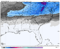
This is the kind of high that comes down and if it sets up in the right spot at the right time, you could actually get ZR down to like the GA-FL border from the cold air damming alone lol
I mean I already posted it but just for emphasis this map alone should get you fired up around here. Give me a setup so good that the trends in the next 3-4 days can't take it away

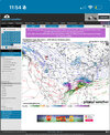
1768755243545.png
 
Next week has the potential to get at least 2 massive winter storms or a legit 2-3 day long duration event. I’m not even going to go into the total possibilities. The snow outcomes would be historic. The bad is the ice potential in this would be equally as historic.
Ice is absolutely on my radar next week. Models have been throwing fantasy ice warning shots for a while.
 
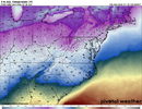
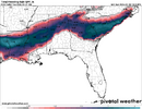
I’ll repeat it. Grandpa and grandma wedge View attachment 185043


The best ways to get truly big winter storms in the upstate of SC into the southwestern Piedmont of NC (GSP-CLT) is to have either an upper low move in or get a super deep and cold CAD wedge like this. You absolutely love to see things like this.
 
I mean I already posted it but just for emphasis this map alone should get you fired up around here. Give me a setup so good that the trends in the next 3-4 days can't take it away

View attachment 185041
Yeah this is the type of storm where the trends are less of “will there be a storm or not”.. to more of “how significant will the storm be?” Hard not to see a significant winter storm in a set up like this.
 
This is the kind of high that comes down and if it sets up in the right spot at the right time, you could actually get ZR down to like the GA-FL border from the cold air damming alone lol
Yeah ngl I’ve got PTSD from that high placement but if we are spinning that 50/50 with that kind of blocking it should sprawl out and bleed into the right places. Not really an issue of trying to time it up perfectly as it’s currently modeled. Saddle up
 
The best ways to get truly big winter storms in the upstate of SC into the southwestern Piedmont of NC (GSP-CLT) is to have either an upper low move in or get a super deep and cold CAD wedge like this. You absolutely love to see things like this.
This system's celling has some potential to be a generational CAD storms, but still many questions about it.
 
1768756259364.png
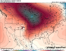
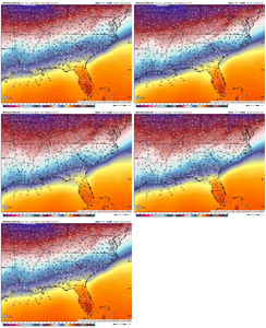
About 8 days out on the GEFS mean and its probably the warmest of the bunch in terms of ensembles, but it is making great strides towards the Euro camp. If I was living in the Northeast I would HATE these trends because of suppression.
 
View attachment 185052
About 8 days out on the GEFS mean and its probably the warmest of the bunch in terms of ensembles, but it is making great strides towards the Euro camp. If I was living in the Northeast I woul HATE these trends because of suppression.
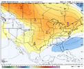
Great strides might be an understatement. Mean temps Sunday afternoon trending towards the 20s in NC. Mid afternoon mind you IMG_2707.gif
 
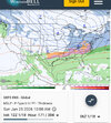
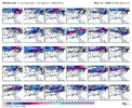
Wow!! I know the GEFS members doesn’t count for ice, but those ice panels are absolutely dangerously delicious to look at for the Deep South
 
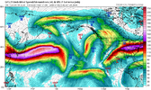
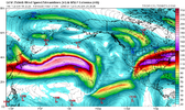
Man the subtropical jet stream is cranking east of Hawaii this week (thanks to the MJO). Lots of potential disturbances in the southern branch of the jet to potentially overrun this big arctic air mass.

I absolutely love to see that.


View attachment 185053

View attachment 185054
Folks need to realize just how significant 'this' you are pointing out can really be in the upcoming period
 
Can we get dedicated subs for these upcoming events? Maybe focus on each potential instead of January thread....PBP etc?
 
The best ways to get truly big winter storms in the upstate of SC into the southwestern Piedmont of NC (GSP-CLT) is to have either an upper low move in or get a super deep and cold CAD wedge like this. You absolutely love to see things like this.
You’ve mentioned February 2014 several times when talking about the potential of this timeframe. The way these models are all converging on the idea of a storm this far out definitely gives me those vibes
 
You’ve mentioned February 2014 several times when talking about the potential of this timeframe. The way these models are all converging on the idea of a storm this far out definitely gives me those vibes

Yeah if you want to reel in a big fish in that part of NC, a super deep cold CAD is one of the safest ways to go. Snow into the cold cad dome as much as you can before an inevitable changeover to sleet.
 
Back
Top