• Hello, please take a minute to check out our awesome content, contributed by the wonderful members of our community. We hope you'll add your own thoughts and opinions by making a free account!

Jan. 17-18, 2026 SE Winter Weather Threat

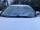
HRRR continues to say no snow for anyone in NC and it's the only model. But I'm starting to think it is correct, congrats to those that saw and will see snow. I'm out for several hours, behave

See I would tend to agree with you but the fact that the NWS updated there latest projections tells me otherwise


Sent from my iPhone using Tapatalk
 
36 and shut out in Loganville.

Congrats to all who see the white stuff!

Our areas needed like a 10-20 mile trend to the northwest to see measurable snow(maybe even any snow reach the ground at this point). Didn't quite make it...the models were pretty much right. The demarcation line seems to be about 25- 30 miles South and East of Atlanta.
 
Our areas needed like a 10-20 mile trend to the northwest to see measurable snow(maybe even any snow reach the ground at this point). Didn't quite make it...the models were pretty much right. The demarcation line seems to be about 25- 30 miles South and East of Atlanta.
Yeah, we got really close to at least seeing something. Temps were there, just not quite enough moisture. It's aggravating to be under 30dBZ returns for a couple of hours and not be able to squeeze out even a few flurries.
 
This is a change:

URGENT - WINTER WEATHER MESSAGE
NATIONAL WEATHER SERVICE PEACHTREE CITY GA
701 AM EST SUN JAN 18 2026

GAZ069>073-079>081-181800-
/O.UPG.KFFC.WW.Y.0001.000000T0000Z-260118T1800Z/
/O.EXA.KFFC.WS.W.0001.000000T0000Z-260118T1800Z/
UPSON-LAMAR-MONROE-JONES-BALDWIN-TALBOT-TAYLOR-CRAWFORD-
INCLUDING THE CITIES OF BUTLER, MILLEDGEVILLE, FORSYTH, GRAY,
ROBERTS, THOMASTON, BARNESVILLE, AND TALBOTTON
701 AM EST SUN JAN 18 2026

..WINTER STORM WARNING IN EFFECT UNTIL 1 PM EST THIS AFTERNOON

* WHAT...HEAVY SNOW. ADDITIONAL SNOW ACCUMULATIONS UP TO 1 TO 2
INCHES.

* WHERE...PORTIONS OF CENTRAL AND WEST CENTRAL GEORGIA.

* WHEN...UNTIL 1 PM EST THIS AFTERNOON.
 
This is hot off the press new:

URGENT - WINTER WEATHER MESSAGE
NATIONAL WEATHER SERVICE PEACHTREE CITY GA
713 AM EST SUN JAN 18 2026

GAZ089-090-181800-
/O.UPG.KFFC.WW.Y.0001.000000T0000Z-260118T1800Z/
/O.EXA.KFFC.WS.W.0001.000000T0000Z-260118T1800Z/
MUSCOGEE-CHATTAHOOCHEE-
INCLUDING THE CITIES OF COLUMBUS AND FORT BENNING
713 AM EST SUN JAN 18 2026

..WINTER STORM WARNING IN EFFECT UNTIL 1 PM EST THIS AFTERNOON

* WHAT...HEAVY SNOW. ADDITIONAL SNOW ACCUMULATIONS UP TO 1 TO 2
INCHES

* WHERE...CHATTAHOOCHEE AND MUSCOGEE COUNTIES.

* WHEN...UNTIL 1 PM EST THIS AFTERNOON.

* IMPACTS...PLAN ON SLIPPERY ROAD CONDITIONS.
 
HRRR keeps trending warmer over NC. Not a surprise
I got a question. It looks like, based on soundings, the latest HRRR initialized a degree to warm at my location and it doesn’t show any snow. The latest NAM3k initialized 4 degrees too warm and it remains adamant on giving me a few hours of snow later. Wouldn’t you think it would be the other way around?
 
This is hot off the press new:

URGENT - WINTER WEATHER MESSAGE
NATIONAL WEATHER SERVICE PEACHTREE CITY GA
713 AM EST SUN JAN 18 2026

GAZ089-090-181800-
/O.UPG.KFFC.WW.Y.0001.000000T0000Z-260118T1800Z/
/O.EXA.KFFC.WS.W.0001.000000T0000Z-260118T1800Z/
MUSCOGEE-CHATTAHOOCHEE-
INCLUDING THE CITIES OF COLUMBUS AND FORT BENNING
713 AM EST SUN JAN 18 2026

..WINTER STORM WARNING IN EFFECT UNTIL 1 PM EST THIS AFTERNOON

* WHAT...HEAVY SNOW. ADDITIONAL SNOW ACCUMULATIONS UP TO 1 TO 2
INCHES

* WHERE...CHATTAHOOCHEE AND MUSCOGEE COUNTIES.

* WHEN...UNTIL 1 PM EST THIS AFTERNOON.

* IMPACTS...PLAN ON SLIPPERY ROAD CONDITIONS.
Not surprising. Radar looks like Columbus is getting hammered right now.
 
Such a wasted opportunity here in Macon….had we changeover and hour or 2 ago, it would have been amazing. I can confirm that it’s not even trying to change over at this point.

It’s coming soon! It’s been snowing at nearby Forsyth 20+ min. Patience is recommended:

Here are 7AM hourly readings:

COLUMBUS LGT SNOW 31 29 92 NW9 30.16R VSB 3/4 WCI 23
6HR MIN TEMP: 31; 6HR MAX TEMP: 44; 6HR PCP: 0.04;

MACON LGT RAIN 37 35 92 NW10 30.10R WCI 30 TC 3
6HR MIN TEMP: 37; 6HR MAX TEMP: 45; 6HR PCP: 0.13;

ROBINS AFB RAIN 39 36 87 NW16 30.09R WCI 30 TC 4


CITY SKY/WX TMP DP RH WIND PRES REMARKS
LAGRANGE* CLOUDY 34 14 44 NW9 30.14R WCI 26 TC 1
SYLVANIA* RAIN 42 42 100 N6 30.04R TC 6
MILLEDGEVILLE* LGT RAIN 39 37 93 NW14G20 30.08R FOG WCI 31

275210be114933776e76a8dc10598d17.gif

Hang tight Macon!


Sent from my iPhone using Tapatalk
 
Such a wasted opportunity here in Macon….had we changeover and hour or 2 ago, it would have been amazing. I can confirm that it’s not even trying to change over at this point.
You have some great-looking returns headed your way. I wouldn't throw in the towel just yet.
 
Such a wasted opportunity here in Macon….had we changeover and hour or 2 ago, it would have been amazing. I can confirm that it’s not even trying to change over at this point.

The 3-5 inch boom potential is very likely gone, but still wouldnt surprise me to see your area end up with 1-2 inches.
 
PRELIMINARY LOCAL STORM REPORT
NATIONAL WEATHER SERVICE PEACHTREE CITY GA
726 AM EST SUN JAN 18 2026

.TIME... ...EVENT... ...CITY LOCATION... ...LAT.LON

.DATE... ....MAG.... ..COUNTY LOCATION..ST.. ...SOURCE.

..REMARKS..

0720 AM SNOW 1 NW MIDLAND 32.58N 84.83W
01/18/2026 M1.0 INCH MUSCOGEE GA PUBLIC

PUBLIC REPORT OF 1 INCH OF SNOWFALL IN
MIDLAND GEORGIA. SNOW IS ACTIVELY
ACCUMULATING.
 
I got a question. It looks like, based on soundings, the latest HRRR initialized a degree to warm at my location and it doesn’t show any snow. The latest NAM3k initialized 4 degrees too warm and it remains adamant on giving me a few hours of snow later. Wouldn’t you think it would be the other way around?

Doesn’t look good for rain/snow mix prospects downstream based on what I’m seeing in middle GA (namely Macon)
 
I’m trying to be cautiously optimistic here, but I just don’t see the precipitation changing over quickly enough for anyone to the SE of Macon to see anything of note.
 
I'm about 5 minutes away from the airport (to the north) and it's very, very light rain here. Like the teeniest drops.
Weird its all snow here now. Earlierit was pouring rain..and totally stopped for 10 minutes...no idea how based on radar...34.3
 
Back
Top