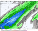
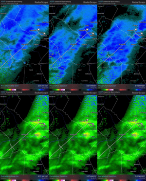
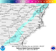
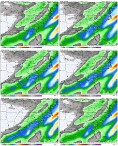
Don't know if this is the thread to post but I've got snow in Morganton someone wake CR up it's coming down good in town atm. Roads are white North of town on 181. Started as sleet at 4am. I've been cruising around checking road conditions.
-
Hello, please take a minute to check out our awesome content, contributed by the wonderful members of our community. We hope you'll add your own thoughts and opinions by making a free account!
You are using an out of date browser. It may not display this or other websites correctly.
You should upgrade or use an alternative browser.
You should upgrade or use an alternative browser.
Jan. 17-18, 2026 SE Winter Weather Threat
- Thread starter RBR71
- Start date
Shoulda seen this coming. Started wondering last night. Low dews across the region for some extra wet bulb fun
Backed off now. But future cast shows a little back building from the SW through 8am. Well see.
GeorgiaGirl
Member
Sadly wasn’t able to sleep through to even as long as I did yesterday, my NWS is now kinda sorta mentioning accumulations for tomorrow, baking in the trends.
It isn’t much (new snow total of less than a half inch), but it’s something. Lol
Now let me try and sleep again.
It isn’t much (new snow total of less than a half inch), but it’s something. Lol
Now let me try and sleep again.
Is there at least enough on the ground for @Rain Cold to build a snow fort when he wakes up?Backed off now. But future cast shows a little back building from the SW through 8am. Well see.
Lol I wish. But just a mile North of town it was 31° and the roads where turning white in shaded areas. Guess areas just along the escarpment had dews low enough to wet bulb down. I don't think we see snow tomorrow so this was a nice surprise. Now it's your turn jimmy.Is there at least enough on the ground for @Rain Cold to build a snow fort when he wakes up?
packfan98
Moderator
Very rate dependent. Back to sleet now stupid warm nose. I got two hours of snow/sleet this morning been riding around since 3am. Don't you just love this hobby. Nice trends over night though. Maybe the Piedmont of NC Upstate SC can get in on some fun tomorrow morning. Good Luck!
packfan98
Moderator
SegTindo
Member
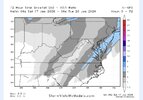
Same trend with the new euro
View attachment 184538
Where’s the cold air oriented?
Sent from my iPhone using Tapatalk
rburrel2
Member
Amazing, and we are likely not done. 2017 kept ticking until snow was falling.
packfan98
Moderator
TigerSnow
Member
I’m still worried this is a cold air chasing moisture setup. Those perform terribly for my area of NC so I’m tempering expectations.
accu35
Member
EPS should look good in a few
Webberweather53
Meteorologist
Global models are typically going to be behind the curve when it comes to these sorts of events that involve isentropic upglide, mid level warm advection, and last second NW trends. Just beware of that
Cad Wedge NC
Member
Looks like you nailed this one. When are you going to post an accumulation map?Global models are typically going to be behind the curve when it comes to these sorts of events that involve isentropic upglide, mid level warm advection, and last second NW trends. Just beware of that
Webberweather53
Meteorologist
Looks like you nailed this one. When are you going to post an accumulation map?
Probably sometime later today once I see how the surface temps are trending in the very short-term
iGRXY
Member
There’s still another 18-36 hours for this to continue to go northwest. Each NAM runs moves the precip shield back NW another 10-20 miles. I’m in the solid 1-2” range right now. Very easily could get into a 1-4” lollipop across the Piedmont and upstate IF we keep this up. Those areas are going to have the best chance of having the cold air available. Just need the heavier returns
Bigedd09
Member

Another western shift
Sent from my iPhone using Tapatalk
Sleet rules the early morning here. 33 degrees
Webberweather53
Meteorologist
I honestly highly doubt it’s going to get cold enough in the Triangle area for snow here.
When your surface temps are starting out in the low-mid 40s and you’re hoping for cold advection midday to save you, for a fast-moving system like this that doesn’t have a true cold source, it’s a recipe for disaster.
When your surface temps are starting out in the low-mid 40s and you’re hoping for cold advection midday to save you, for a fast-moving system like this that doesn’t have a true cold source, it’s a recipe for disaster.
MichaelJ
Member
36 here and a dew of 16 with very light snow/rain
Sleet it is…

Sent from my iPhone using Tapatalk

Sent from my iPhone using Tapatalk
The NWS in Raliegh is calling for this storm ending as wet snow with a coating on elevated surfaces at most. If we just had a high pressure over New England to feed more cold air into this then things would be golden. Cold air chasing precipitation doesn't work as well as having an established cold air source in place before a storm comes. I wish the areas to the south and west where the cold will be in place well and hope they put numbers on the snow scoreboard. The period from the 25th to the end of the month looks realistically like our best shot for winter weather in the NC Eastern Piedmont.
rburrel2
Member
One annoying thing for the upstate. We have a thermal profile conducive for snow, even on Saturday night, but we would need 1/10th of liquid or so to adequately cool the boundary layer I think. I think we probably start out as light rain and quickly flip to snow, but we’ll have to slog down from 40 to 32 at the surface.
As such, if we only get .10-.15 and it comes late Saturday night, our odds of accumulations aren’t good.
We will need heavy rates quickly Saturday night that adds up to .2-.3 liquid, or additional light precip Sunday morning to have any chance of sticking snow. Models are split on whether or not we get Sunday morning-ish precip. A lot of these bumps in qpf are coming from that initial band that develops Saturday night.(which will be iffy with the boundary layer)
For carolina folks, I find it interesting to see a bit of a dry slot here just to the east of the triangle. It is definitely a weak low, but all of the models are still showing some deepening as the Atlantic cyclone forms, to later push NW to give New England some snow. As the low starts getting its act together, expect more frontogenic forcing along that baroclinic zone. This will create more dynamics to create an area or bright banding somewhere in west-central NC. I think this is our best chance here to see some good snow for at least a few hours on Sunday as the trough swings through
Yeah I think we're cooked, I have doubts I'll even see a flake mix in now this far east. Good luck to others S and W of usThe NWS in Raliegh is calling for this storm ending as wet snow with a coating on elevated surfaces at most. If we just had a high pressure over New England to feed more cold air into this then things would be golden. Cold air chasing precipitation doesn't work as well as having an established cold air source in place before a storm comes. I wish the areas to the south and west where the cold will be in place well and hope they put numbers on the snow scoreboard. The period from the 25th to the end of the month looks realistically like our best shot for winter weather in the NC Eastern Piedmont.
I agree with you and not expecting a high impact event, but just one to two degrees can make a big difference here between seeing a few flakes mixed with rain and several hours of watching it snow, albeit without a lot of accumulation. I would be down with thatI honestly highly doubt it’s going to get cold enough in the Triangle area for snow here.
When your surface temps are starting out in the low-mid 40s and you’re hoping for cold advection midday to save you, for a fast-moving system like this that doesn’t have a true cold source, it’s a recipe for disaster.
The northwest trend was not our friend. No cold air source to feed the storm while things are happening did us in. One more thing, a good snowpack to the north of us may have also helped matters. The snowpack for this time of year across the United States as a whole is very lacking compared to normal.Yeah I think we're cooked, I have doubts I'll even see a flake mix in now this far east. Good luck to others S and W of us
Last edited:
rburrel2
Member
12z hrrr continues to shift north and west with precip shield.
LukeBarrette
im north of 90% of people on here so yeah
Meteorology Student
Member
2024 Supporter
2017-2023 Supporter
lol it’s in the mountains of NC at 10 pm tonight12z hrrr continues to shift north and west with precip shield.
Webberweather53
Meteorologist
I agree with you and not expecting a high impact event, but just one to two degrees can make a big difference here between seeing a few flakes mixed with rain and several hours of watching it snow, albeit without a lot of accumulation. I would be down with that
I don’t see that happening here, not when the cold air doesn’t show up first and your precip starts earlier
Bigedd09
Member
Need cold air!

Sent from my iPhone using Tapatalk

Sent from my iPhone using Tapatalk
iwantsouthernsnow123
Member
If I'm in North Georgia, which I am of course. Saying in general, I would be pretty satisfied with the trends especially on high res guidance given WAA will probably continue NW on a quickly clashing cold front.
iwantsouthernsnow123
Member
What about for North Georgia, are you liking the looks of this area?I don’t see that happening here, not when the cold air doesn’t show up first and your precip starts earlier
Athens GA is gonna be riding a fine line unless Teal 72 bumps the cold down and precip up a bit.
Whatever falls will likely melt relatively quick unless someone happens to get pasted
Whatever falls will likely melt relatively quick unless someone happens to get pasted
Makeitsnow
Member
Ive been worried about that too but now im in the 0.25 range in general . Gfs even showing amounts above 0.30 just south of atlanta. The question is will this trend continue, stop, or back off. If we get another couple of ticks till showtime even areas up to 85 will be doing surprisingly well compared to where we looked a day ago thats for sure.One annoying thing for the upstate. We have a thermal profile conducive for snow, even on Saturday night, but we would need 1/10th of liquid or so to adequately cool the boundary layer I think. I think we probably start out as light rain and quickly flip to snow, but we’ll have to slog down from 40 to 32 at the surface.
As such, if we only get .10-.15 and it comes late Saturday night, our odds of accumulations aren’t good.
We will need heavy rates quickly Saturday night that adds up to .2-.3 liquid, or additional light precip Sunday morning to have any chance of sticking snow. Models are split on whether or not we get Sunday morning-ish precip. A lot of these bumps in qpf are coming from that initial band that develops Saturday night.(which will be iffy with the boundary layer)
