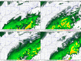
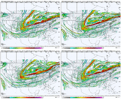
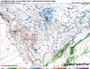
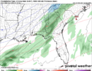
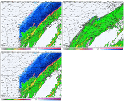
Not too shabby afterall. Just slightly less tilt than the prior runs. Close enough to parts of N. Georgia to keep me coming back for more.
-
Hello, please take a minute to check out our awesome content, contributed by the wonderful members of our community. We hope you'll add your own thoughts and opinions by making a free account!
You are using an out of date browser. It may not display this or other websites correctly.
You should upgrade or use an alternative browser.
You should upgrade or use an alternative browser.
Jan. 17-18, 2026 SE Winter Weather Threat
- Thread starter RBR71
- Start date
NBAcentel
Member
Will HH's current recon be filtered into 0z NAM, or would we expect that in the 06z/12z runs tomorrow?
Tsappfrog20
Member
Not great but not terrible either

Sent from my iPhone using Tapatalk

Sent from my iPhone using Tapatalk
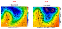
I know this sucks right now and many of us are clinging to life but that post above from 12/8/17 is crazy and just look at where we were 24 hours ago. You better believe it can turn around as fast as it’s gone down the last 24 hours. We just have to turn it around. Tomorrow is a HUGE day.
packfan98
Moderator
We're in the discussion thread....
this is banter thread
this is banter thread
Misc - General Banter Thread
Wow you look like a kid here lol He hasn't had his age posted, but tbh, my readthrough has always been that he probably isn't that much older than me, maybe by 5-6ish years (I'm 30). Edit: I was right.
southernwx.com
NBAcentel
Member
iwantsouthernsnow123
Member
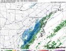
Ah yes don't we love when this happens, globals tick east then high res just starts going west.Just a fwiw rufus is a jog westward with the energy unlike the NAM. How it progresses we are about to find out. Maybe a warning shot for the GFS later on View attachment 184025
Blue_Ridge_Escarpment
Member
Worse tilt though..oddJust a fwiw rufus is a jog westward with the energy unlike the NAM. How it progresses we are about to find out. Maybe a warning shot for the GFS later on View attachment 184025
Brandon10
Member
ICON. Best track for ENC snow. And too dang warm 
ducketta27
Member
Looking through 00z guidance that is coming in..
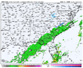
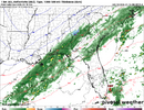
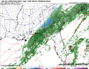
ICON and RGEM look like a slight NW shift from previous run. Interesting. View attachment 184032
Agreed, and WARM. Goodness
Sent from my iPhone using Tapatalk
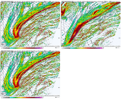
Here's a comparison of Dec 2017 vs our current storm on the 18z GFS as the trough axis is running back toward southern New Mexico. Big and deep trough there in 2017 with a very long moisture fetch aloft from NW Old Mexico to Cape Hatteras
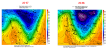
Same here, but with trough axis running thru Louisiana. Pretty big difference between the 2
iwantsouthernsnow123
Member
Skeptical until we get sampling. Which I think we'll get tomorrow. Just gotta hope for the best.Looking through 00z guidance that is coming in..
ICON and RGEM look like a slight NW shift from previous run. Interesting. View attachment 184032
NBAcentel
Member
The ICON and RGEM are just cold front passages with backside light snow or flurries. Too positive tilt trough for anything more, by the time it goes neg it's popping low ots. It's just 2 models right now but it's an option whether we like it or not unfortunately
NBAcentel
Member
Cad Wedge NC
Member
That energy over MN is preventing this from going negative. If that is modeled incorrectly or slows down, then this will look a lot different come go-time.
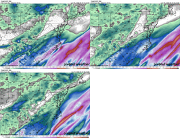
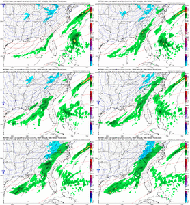
Really positive tilt on the RRFS. Seems like that’s gonna be the move. Unfortunately View attachment 184036
Looks like the backend of that lobe is kind of sheared off to the point where it isn't even tilting with the rest lol
trackersacker
Member
RGEM is keeping hope alive in *checks notes* East Tennessee
ChattaVOL
Member
RGEM is keeping hope alive in *checks notes* East Tennessee
Post ?
Sent from my iPhone using Tapatalk
iwantsouthernsnow123
Member
This thing needs to tilt if we tilt neutral the whole time it's just not a good look.RGEM is keeping hope alive in *checks notes* East Tennessee
HailCore
Member
On the bright side, if the threat was completely gone, there would not be any snow showing up anywhere nearby, so even though these runs aren't as good as 18z, they are not the worst. Hope I did not just jinx this
iGRXY
Member
This thing is on life support. I think you’re starting to see the Hi-Res pick up on the lack of cold air south and east of 85 where the precipitation is lining up to be. Even though the name had snow, it’s shrinking both in total and footprint each run. This Was my fear. I thought we would get more precip on the NW side vs what the EURO was showing (which it has on most guidance) but the cold air or lack there of made me very weary of any snow south and east of 85. That looks like it’s starting to be the most likely outcome
iwantsouthernsnow123
Member
While the trends overall haven't been great. It's important to know this was always doomed to have back and forth trends. Never expected consistent looks with this. Tomorrow will be a huge decision maker with this one as we start to sample data. Shifts are likely to occur tomorrow, question is north? or south? All remains to be seen. Overrunners in this setup tend to follow QPFs as close to the CF as possible in a lot of these scenerios. Adding on to this, tilt is key with this and you've seen it with RRFS. Should you have a slight tilt more negative then you get a more amped storm system allowing for a NW push of moisture. However, if you stay positive tilted it's going to have a flatter look and less likely to get good moisture in NW areas at least for a durations of time. Adding onto this, for whatever it count ICON and RDPS has certainly been having a NW trend. This system is extremely sensitive and the smallest changes change the entire outlook. Hopefully this message helps for anyone who's a little confused on why we're seeing this.
trackersacker
Member
It's 00z GFS time! This is a pretty big run IMO.
- Dropsonde data was assimilated from the recon missions in the Pacific.
- The entire system is in a good spot currently (as of 00z) for full profiling by GOES-West satellite and Canadian (and some US) soundings.
- Dropsonde data was assimilated from the recon missions in the Pacific.
- The entire system is in a good spot currently (as of 00z) for full profiling by GOES-West satellite and Canadian (and some US) soundings.
iwantsouthernsnow123
Member
Fingers crossed man. Gotta pull this. Snow drought far too longIt's 00z GFS time! This is a pretty big run IMO.
- Dropsonde data was assimilated from the recon missions in the Pacific.
- The entire system is in a good spot currently (as of 00z) for full profiling by GOES-West satellite and Canadian (and some US) soundings.
I feel like we are always curious when this data is ingested -- not just this storm, but every year when this happens and they run some missions and everyone asks "will this run include the data from the recon??".- Dropsonde data was assimilated from the recon missions in the Pacific.
Is this a guess or do you have some special insider way to know what data is included for a particular GFS run?
i think this cycle will be the nadir and we see modest improvements going forward. that timetable would mirror other threats
i wouldn't go pure doom but i would take a look in the mirror, take a deep breath, and internalize that if you're not under a heavy band it's likely not happening for you this go round. which i think most posters already have
i wouldn't go pure doom but i would take a look in the mirror, take a deep breath, and internalize that if you're not under a heavy band it's likely not happening for you this go round. which i think most posters already have
accu35
Member
Gfs looks different
*quietly* i kind of like the look here, shortwave digs a hair more, trough orientation a little less positive @hr42Gfs looks different
by checking the prepbufr file in NOMADS. It has all of the data used in assimilation from GDASI feel like we are always curious when this data is ingested -- not just this storm, but every year when this happens and they run some missions and everyone asks "will this run include the data from the recon??".
Is this a guess or do you have some special insider way to know what data is included for a particular GFS run?

