DadOfJax
Member
Exactly. Only a 50/50 shot that even the extreme northern parts of the northern tier counties get more than an inch. Hardly an I-20 special.
Sent from my iPhone using Tapatalk
Exactly. Only a 50/50 shot that even the extreme northern parts of the northern tier counties get more than an inch. Hardly an I-20 special.
Sent from my iPhone using Tapatalk
Just saying this low has been trending southeast on every run. So it would only take another 50-75 Miles shift to also get the I-20 in a inch or two zone. We have 2 1/2 days for this to happen. This is a long ways away from being set in stone.Exactly. Only a 50/50 shot that even the extreme northern parts of the northern tier counties get more than an inch. Hardly an I-20 special.
How much change can we still see with the energy at this juncture? How often has there been significant changes with a system like this 48hr and under to go?Not going to get in a negative pissing match with you. Just saying this low has been trending southeast on every run. So it would only take another 50-75 Miles shift to also get the I-20 in a inch or two zone. We have 2 1/2 days for this to happen. This is a long ways away from being set in stone. You can think what you want to think. But being negative about something isn’t going to get you nothing but a bunch more negative.
Not being negative, just stating facts as they stand today. Things can always change, but as of now, it's not looking good. Sorry that upsets you.Not going to get in a negative pissing match with you. Just saying this low has been trending southeast on every run. So it would only take another 50-75 Miles shift to also get the I-20 in a inch or two zone. We have 2 1/2 days for this to happen. This is a long ways away from being set in stone. You can think what you want to think. But being negative about something isn’t going to get you nothing but a bunch more negative.
How much change can we still see with the energy at this juncture? How often has there been significant changes with a system like this 48hr and under to go?
Well a lot of changes. Especially with upper level lows. (Weatherman Lows). We will probably have a good idea by Tomorrow Night 0Z runs. And a lot of help with short range models.How much change can we still see with the energy at this juncture? How often has there been significant changes with a system like this 48hr and under to go?
Nah. Lol. Just saving the drama for my momma. Lol.Not being negative, just stating facts as they stand today. Things can always change, but as of now, it's not looking good. Sorry that upsets you.
I meant to say also. I know how it feels to be so close to getting a snow but get nothing but a stupid cold rain. It sucks!!! Sorry didn’t mean to get ugly in earlier post.Not being negative, just stating facts as they stand today. Things can always change, but as of now, it's not looking good. Sorry that upsets you.
Huntsville NWS now saying 1 to 3 inches and maybe more, much different than they sounded yesterday. Things are actually looking up here in the Tennessee ValleyTrends aren't great for AL. Inch by inch, the snow keeps creeping north. May end up where only the northern counties get anything worth mentioning. Really thought we were going to end up with a good system for central AL, with a more SW to NE orientation of snow. Still time!
I'm hearing utterings of thundersnow may be possible...think that's legit?Huntsville NWS now saying 1 to 3 inches and maybe more, much different than they sounded yesterday. Things are actually looking up here in the Tennessee Valley
that's what Brad Travis of channel 48 said last night.I'm hearing utterings of thundersnow may be possible...think that's legit?
This probably won't be as good of a run on in the 12z nam
Sent from my SM-J320VPP using Tapatalk
Just so it's clear, THEY aren't saying that. Their disco just points to the Euro and NAM solutions that are possible. I have yet to see them commit to any specific forecast, but yes, it definitely looks better along the immediate AL/TN border. Hoping for further south trends today that would bring heavier snow to the Huntsville area, and at least and inch or two down around Gadsden.Huntsville NWS now saying 1 to 3 inches and maybe more, much different than they sounded yesterday. Things are actually looking up here in the Tennessee Valley
Never really closes off and does not go negative west of the Mississippi river like previous runsh5 looks messy
I think the trends are a bit in the not so good categoryNice hit for west Tennessee
Sent from my SM-J320VPP using Tapatalk
Tennessee is sitting greatI think the trends are a bit in the not so good category
You want to disagree with everything I post, but the facts, word for word say this, and they DO say what I said, ;period: They aren't just saying a model said it, they say at this time that's how it looks.Just so it's clear, THEY aren't saying that. Their disco just points to the Euro and NAM solutions that are possible. I have yet to see them commit to any specific forecast, but yes, it definitely looks better along the immediate AL/TN border. Hoping for further south trends today that would bring heavier snow to the Huntsville area, and at least and inch or two down around Gadsden.
 Hey storm5, I think their might be a few people driving to the cliff after looking at one bad run of the nam. Lol
You want to disagree with everything I post, but the facts, word for word say this, and they DO say what I said, ;period: They aren't just saying a model said it, they say at this time that's how it looks.
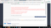
At this time, it looks like heaviest amounts would be in Southern Middle
Tennessee and north of the Tennessee River, generally one to three
inches. If some other models are correct, including the NAM12, the
surface/upper low are much further south and will move northeast
slower through the overnight hours on Friday night. This could
produce heavier snowfall totals if this occurs.

my forecast at this time from them is 2.5 inches..argue with that.Here is all of it....
Models seem a bit more uncertain this run whether a upper level
low and associated surface low will develop along the southern base
of the longwave trough axis associated with this strong cold front.
This is leading to differences concerning how long the precipitation
will linger along the western and northwestern edge of the surface
low late Friday afternoon into Friday night. Also, how quickly the
freezing temperatures and colder air aloft pushes across northern
Alabama.
NAM12 is the slowest moving the cold air in behind the
front, but still brings freezing temperatures and a change over to
snow/sleet by 3 or 4 pm into northwestern Alabama.
ECMWF and GFS are bit quicker moving this colder air in behind the front.
ECMWF seems to be the quickest, bringing mid to upper 20 degree temperatures into
northwest Alabama around noon and producing between 1 and 3 inches
of snow in northwestern Alabama. It then spreads this snowfall east
northeastwards Friday evening across the remainder of the area. At
this time, it looks like heaviest amounts would be in Southern Middle
Tennessee and north of the Tennessee River, generally one to three
inches.
If some other models are correct, including the NAM12, the
surface/upper low are much further south and will move northeast
slower through the overnight hours on Friday night. This could
produce heavier snowfall totals if this occurs.
When simply broken down, it is very evident that they are pointing to each models solution, not that they are agreeing with any of them specifically. Very smart move by the NWS, as we are already seeing the models trend the wrong way this morning.