• Hello, please take a minute to check out our awesome content, contributed by the wonderful members of our community. We hope you'll add your own thoughts and opinions by making a free account!

Pattern January Joke

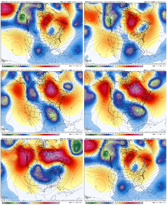
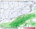
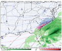
Is this something that we should completely ignore? I mean, gfs op not even showing the possibility here but yet these members are picking up. Someone got a clue?
Wow, nearly all ensemble members now have precipitation moving toward the lower southeast. Even if it’s all rain, still needed!
 
Very intrigued to see where we stand in a week. I’d say my main concerns at this stage are with cold air sources.

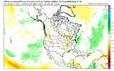
Feeling pretty optimistic about precip chances. You’ve seen long range models (namely the AI ones) tossing out a more active storm track up the coast and the EPS reflects it some with some + precip anoms along the classic gulf to NE track. It at least looks more active than the next 7-10 days.
IMG_5961.png

still lots and lots of model runs to sift through. There’s fail modes, it’s not perfect, but you got to remember there is a LOT of time for things to move around in good or bad directions. I’d like to see a bit more reliable cold and a more obvious signal begin to emerge within the next week to feel more confident beyond “pattern looks solid”
 
Very intrigued to see where we stand in a week. I’d say my main concerns at this stage are with cold air sources.

Feeling pretty optimistic about precip chances. You’ve seen long range models (namely the AI ones) tossing out a more active storm track up the coast and the EPS reflects it some with some + precip anoms along the classic gulf to NE track. It at least looks more active than the next 7-10 days.
View attachment 180143

still lots and lots of model runs to sift through. There’s fail modes, it’s not perfect, but you got to remember there is a LOT of time for things to move around in good or bad directions. I’d like to see a bit more reliable cold and a more obvious signal begin to emerge within the next week to feel more confident beyond “pattern looks solid”
I thought the cold was already looking good?
 
Is this something that we should completely ignore? I mean, gfs op not even showing the possibility here but yet these members are picking up. Someone got a clue?
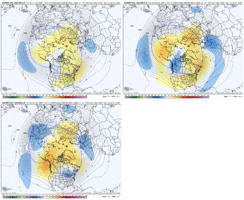
I can give my take on this. The GEFS is not great. I am not a fan of that sorta blended version of the members either that weatherbell offers.

But yeh, I just think the GEFS follows its op to much & because it has less members than the EPS, it is skewed much easier by a couple individual outlier members. I don't even show the GEFS on any of my social media platforms much unless it's aligning with the EPS.
for example, I'll show it here because it's now trending towards the EPS. Like the follower it is..gfs-ensemble-all-avg-namer-z500_anom-1766858400-1767679200-1767679200-20.gif
 
Last edited:
I will try to put something up this evening on some research I found on the MJO being buried in the null phase in this pattern.

Summary: it’s going to be very tough to get snow even in the mountains this January.

Always hoping something changes.
Love the positivity man. Thanks for your research!
 
I will try to put something up this evening on some research I found on the MJO being buried in the null phase in this pattern.

Summary: it’s going to be very tough to get snow even in the mountains this January.

Always hoping something changes.
If you are referring to a weak phase on the left of the circle, Larry has already provided plenty of evidence it's a good place to be for winter storms.
 
If you are referring to a weak phase on the left of the circle, Larry has already provided plenty of evidence it's a good place to be for winter storms.
Thank you. I couldn’t remember who put that study together. Earlier today I mentioned the winter of 2013-14. That winter saw the MJO enter COD in late December on the left side and basically circled around mostly on the left until spring. It’s one example obviously, but we all know that turned out.
 
Been lookin like that for several runs in a row. Hopefully the latter half of January will deliver


Sent from my iPhone using Tapatalk
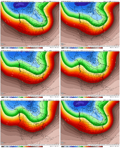
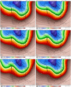
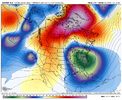
It is just now incorporating the block in the 0Z, you can see how it is slowing the flow more in the 7-12 day range. I would expect it to further retrograde the SE Canada vortex further if the block holds in future runs.
 
It is just now incorporating the block in the 0Z, you can see how it is slowing the flow more in the 7-12 day range. I would expect it to further retrograde the SE Canada vortex further if the block holds in future runs.
You got it Stormdoc. It has the roadblock / backup plan we’re looking for as we sacrifice the Jan 8 storm for better things behind it. But in the end, it’s too far west with everything that wraps up behind. Just try to be in the ballpark / in the realm of possibility is all we can shoot for in the long range, and that’s what we have here

IMG_4467.gif
 
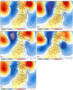
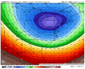
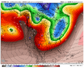
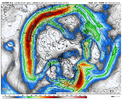
Euro went big early with the Pac Jet extension and associated western ridge this run, leading to the sharp eastern trough. Combine that with the west based NAO block, and you’ve got the suppressed storm track

View attachment 180176
Honestly gotta like what it did generally speaking. Lot of cold air and energy flying around second week of January. Big things can happen.
 
Back
Top