CNCsnwfan1210
Member

30 here in SW Wilson county…decent amount of frost.
Sent from my iPhone using Tapatalk

I finally had a frost on my yard this morning. 4 days after my first measurable snowNear mega frost this morning
No real rain in sight either. The storm after Thanksgiving is drying up fast east and south of the mountains.Gotta water my green Giants on a mid november day, they hurting.
this isn't of any real major significance but i will take the minimum amount of AN i can get no matter what
View attachment 176604
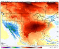
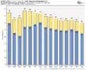
Had a gust to 35 so far
#canright where we want it View attachment 176719
In first: weather mod
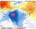
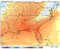
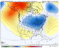
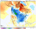
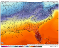
In the short(er) range, I'm focused on Thanksgiving. Nobody (me) wants a warm Thanksgiving. Here's the surface temps on the 0z Euro for midday Thanksgiving:A euro wudge-giving for your monday morning
View attachment 176742
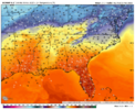
ec-ai ens doesn't entirely discount the idea, with a handful of members biting, and you can see the wedge footprint on wednesday
View attachment 176743
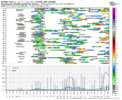
the real fun comes after that, with the ec-ai ens being much more excited about big front potential late next week vs the eps
View attachment 176744
View attachment 176745
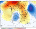
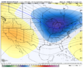
the solutions diverge the most after early week, when the ec-ai ens develops enough western ridging to dump cold more eastward, with the eps just drops troughing right down on the west coast. considering we are, in theory, moving into mjo p7 within the next 10ish days, we'll hopefully start to favor taller wrn ridging. hopefully that can come to fruition and give us a break from the goose cooking of the next 8-12 days (wedge pending)
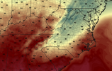
I have a feeling with the -NAO we might start seeing wedge events that kinda mute this milder period east of the mountains… especially with daytime highsIn the short(er) range, I'm focused on Thanksgiving. Nobody (me) wants a warm Thanksgiving. Here's the surface temps on the 0z Euro for midday Thanksgiving:
View attachment 176749
interesting to me that hardly any eps members show wedging. the h5 look isn't terribly far off from various composites in CAD research papers (its not great either, but you can't expect it to be given there's not much on the individual members lol). eps has thoughts of sfc HP over the east coast as well. probably making something of nothing and it'll disappear at 12z, but what else do we have to talk aboutIn the short(er) range, I'm focused on Thanksgiving. Nobody (me) wants a warm Thanksgiving. Here's the surface temps on the 0z Euro for midday Thanksgiving:
View attachment 176749
BeautIn the short(er) range, I'm focused on Thanksgiving. Nobody (me) wants a warm Thanksgiving. Here's the surface temps on the 0z Euro for midday Thanksgiving:
View attachment 176749
In the short(er) range, I'm focused on Thanksgiving. Nobody (me) wants a warm Thanksgiving. Here's the surface temps on the 0z Euro for midday Thanksgiving:
View attachment 176749


Yuck. I don’t want 70s on Thanksgiving.In the short(er) range, I'm focused on Thanksgiving. Nobody (me) wants a warm Thanksgiving. Here's the surface temps on the 0z Euro for midday Thanksgiving:
View attachment 176749
MoveYuck. I don’t want 70s on Thanksgiving.
I am lol.Move
Just think, 180 days till summer starts to crank up.It's 67 degrees at 8am 9 days before Thanksgiving
This is crazy. Our average high is 61!
It does seem like we're slowly heading there by the weekend. Maybe
Thanksgiving is also the coldest day showing up but it looks short lived again
This makes sense with P7. It's cool to see the models adjust as the mjo flows around the horn. They'll all catch on to a cold east pretty soon.wrapped up my forecast for the week this morning and boy howdy, i am not breaking any news here but it is a booooring yet somehow pesky stretch around here. lots of clouds and scattered shwr chances. also, nice inversion up in wnc with waynesville at 29F and nearby 5000' fryingpan mountain at 49F.
beyond that, my birthday wudge dreams are clinging to a shred of ai generated hope
View attachment 176790
a little bit of support on this morning's op euro as well. i just don't want 70s for my birthday lol
View attachment 176791
and if its a cold thanksgiving you're hoping for, well, the further west the better. but either way, disagreement remains on our potential big ol front late next week. the robot bunch continues to be more bullish on earlier arrival and a more exciting thanksgiving with fropa occurring during the day for many. a bit of a scattered signal for a rainy turkey day for some in the mid/deep south as well
View attachment 176789
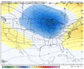
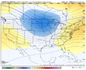
AIFS was going for the arctic hammer for western areas to start Dec as well. we gotta pin down this first potential cold shot first. 6z black friday on the ai-ens vs the eps vs the gefs. ai continues to have a more stout western ridge (something we've talked about a few times so far this fall) vs the eps which drops another trough in the west (you can see it starting to break down the wrn ridge in this frame), muting the potential for us out east. I will be cautiously optimistic for now
View attachment 176792
View attachment 176793
View attachment 176794
lots of pictures in my posts nowadays
