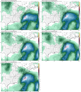
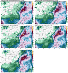
Nothing else going on
-
Hello, please take a minute to check out our awesome content, contributed by the wonderful members of our community. We hope you'll add your own thoughts and opinions by making a free account!
You are using an out of date browser. It may not display this or other websites correctly.
You should upgrade or use an alternative browser.
You should upgrade or use an alternative browser.
Pattern Oct 10-13 Nor Easter or No Easter
- Thread starter SD
- Start date
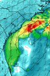
East of I-95 up through southern New England. Going to be lots more coastal erosion.
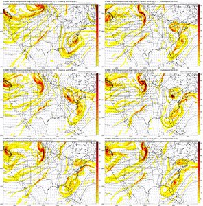
But seriously though, what IS this thing? Extratropical but maybe a hint of subtropical?
Downeastnc
Member
But seriously though, what IS this thing? Extratropical but maybe a hint of subtropical?
Yeah i was wondering the same thing....the NHC doesn't have anything for it no lemon etc so I guess its a glorified wannabe noreaster.
I assume it will be a cold core low not sure what the criteria are for extra tropical or sub tropical....
King Tide to bootEast of I-95 up through southern New England. Going to be lots more coastal erosion.
Brent
Member
But seriously though, what IS this thing? Extratropical but maybe a hint of subtropical?
I think it's basically a noreaster in one word
An Alabama TV station posted like it's gonna be named... Like it's not even in the outlook
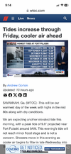
A 10.4 ft high tide is being forecasted for Ft. Pulaski for late Friday morning:
That would be tied for the 7th highest tide on record at Ft. Pulaski going back ~90 years, tied with the 8/11/1940 hurricane. It would be only barely lower than the highest tide on record there not associated with a TC, which is the 10.45’ of 11/7/2021!
The following is from this morning’s updated KCHS discussion:
TIDES/COASTAL FLOODING
STRONG NE WINDS RESULTING FROM BUILDING HIGH PRESSURE INLAND AND
DEVELOPING LOW PRESSURE OFFSHORE WILL ALLOW TIDAL DEPARTURES TO
INCREASE THROUGH THE NEXT SEVERAL HIGH TIDE CYCLES. ASTRONOMICAL
TIDE VALUES ARE ALREADY ELEVATED OWING TO THE RECENT FULL MOON AND
PERIGEE, WHICH COMBINED WITH INCREASING DEPARTURES WILL RESULT IN
COASTAL FLOODING WITH EACH HIGH TIDE CYCLE INTO THE WEEKEND. WHILE
CONFIDENCE IS HIGH IN COASTAL FLOODING OCCURRING, THE POSITION OF
THE DEVELOPING LOW PRESSURE WILL HIGHLY INFLUENCE THE TIDAL
DEPARTURE.
CHARLESTON HARBOR TIDE GAGE: THE LATE MORNING HIGH TIDE CYCLES TODAY
THROUGH SATURDAY HAVE THE POTENTIAL TO HIT MAJOR COASTAL FLOODING
(>8 FT MLLW). A COASTAL FLOOD WARNING IS IN EFFECT FOR CHARLESTON
AND COASTAL COLLETON COUNTIES THROUGH FRIDAY AFTERNOON. A COASTAL
FLOOD ADVISORY IS IN EFFECT FOR TIDAL BERKELEY COUNTY THROUGH
FRIDAY AFTERNOON.
FORT PULASKI TIDE GAGE: THE LATE MORNING HIGH TIDE CYCLES THROUGH
SATURDAY HAVE THE POTENTIAL TO REACH MODERATE COASTAL FLOODING (10
TO 10.5 FT MLLW). A COASTAL FLOOD ADVISORY IS IN EFFECT FROM
BEAUFORT COUNTY, SC SOUTHWARD TO MCINTOSH COUNTY, GA FROM 8 AM THIS
MORNING UNTIL NOON TODAY.
That would be tied for the 7th highest tide on record at Ft. Pulaski going back ~90 years, tied with the 8/11/1940 hurricane. It would be only barely lower than the highest tide on record there not associated with a TC, which is the 10.45’ of 11/7/2021!

The following is from this morning’s updated KCHS discussion:
TIDES/COASTAL FLOODING
STRONG NE WINDS RESULTING FROM BUILDING HIGH PRESSURE INLAND AND
DEVELOPING LOW PRESSURE OFFSHORE WILL ALLOW TIDAL DEPARTURES TO
INCREASE THROUGH THE NEXT SEVERAL HIGH TIDE CYCLES. ASTRONOMICAL
TIDE VALUES ARE ALREADY ELEVATED OWING TO THE RECENT FULL MOON AND
PERIGEE, WHICH COMBINED WITH INCREASING DEPARTURES WILL RESULT IN
COASTAL FLOODING WITH EACH HIGH TIDE CYCLE INTO THE WEEKEND. WHILE
CONFIDENCE IS HIGH IN COASTAL FLOODING OCCURRING, THE POSITION OF
THE DEVELOPING LOW PRESSURE WILL HIGHLY INFLUENCE THE TIDAL
DEPARTURE.
CHARLESTON HARBOR TIDE GAGE: THE LATE MORNING HIGH TIDE CYCLES TODAY
THROUGH SATURDAY HAVE THE POTENTIAL TO HIT MAJOR COASTAL FLOODING
(>8 FT MLLW). A COASTAL FLOOD WARNING IS IN EFFECT FOR CHARLESTON
AND COASTAL COLLETON COUNTIES THROUGH FRIDAY AFTERNOON. A COASTAL
FLOOD ADVISORY IS IN EFFECT FOR TIDAL BERKELEY COUNTY THROUGH
FRIDAY AFTERNOON.
FORT PULASKI TIDE GAGE: THE LATE MORNING HIGH TIDE CYCLES THROUGH
SATURDAY HAVE THE POTENTIAL TO REACH MODERATE COASTAL FLOODING (10
TO 10.5 FT MLLW). A COASTAL FLOOD ADVISORY IS IN EFFECT FROM
BEAUFORT COUNTY, SC SOUTHWARD TO MCINTOSH COUNTY, GA FROM 8 AM THIS
MORNING UNTIL NOON TODAY.
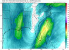
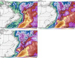
Typically a storm inching NW within 120 hours is not at all surprising. Given the fact its working beneficial rains west makes me skeptical since we have batted just about 1.000 on hitting every single way to miss out for basically 60 days nowView attachment 175425
West trend looks legit...ICON
Shaggy
Member
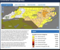
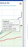
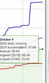
I'm assuming these maps are based off shorter term amounts? There's no way the central coastal plains is In D2 when they are only .50 inch behind their yearly average while I'm in D0 and we are a full 12 inches behind for the year.What we would give for the west trend to continue. Piedmont/Coast Plain is getting a bit crunchy. BTW, the most boring PNG any of us could post. Drought Monitor.
View attachment 175429
That euro run was a real turd
Shaggy
Member
I'm a wind guy so if that happens I hope it has some decent gusts to match the rain......it won't though
lizajane
Member
Let's not forget about PTC 8. That sucker was destructive.
Shaggy
Member
I had about 45 minutes of TS force conditions with that as the worst part of the low moved overheadLet's not forget about PTC 8. That sucker was destructive.
Shaggy
Member
Hi res models are much more bullish with winds along the the coast
From KCHS: the highest tide of the series is still progged to be today’s late morning tide
TIDES/COASTAL FLOODING
STRONG NE WINDS RESULTING FROM HIGH PRESSURE INLAND AND DEVELOPING
LOW PRESSURE OFFSHORE WILL ALLOW TIDAL DEPARTURES TO INCREASE
THROUGH THE NEXT SEVERAL HIGH TIDE CYCLES. ASTRONOMICAL TIDE VALUES
ARE ALREADY ELEVATED OWING TO THE RECENT FULL MOON AND PERIGEE,
WHICH COMBINED WITH INCREASING DEPARTURES WILL RESULT IN COASTAL
FLOODING WITH EACH HIGH TIDE CYCLE INTO THE WEEKEND.
CHARLESTON HARBOR TIDE GAGE: THE LATE MORNING HIGH TIDE CYCLES
FRIDAY AND SATURDAY HAVE THE POTENTIAL TO HIT MAJOR COASTAL FLOODING
THRESHOLDS (>8 FT MLLW). A COASTAL FLOOD WARNING IS IN EFFECT FOR
CHARLESTON AND COASTAL COLLETON COUNTIES FOR THE LATE MORNING HIGH
TIDE CYCLE WHEN LEVELS COULD PEAK IN THE 8.3-8.5 FT MLLW RANGE. A
COASTAL FLOOD ADVISORY IS IN EFFECT FOR TIDAL BERKELEY COUNTY.
FLOODING CAN OCCUR SEVERAL HOURS BEFORE AND AFTER THE TIDE PEAKS.
IT'S WORTH NOTING CONFIDENCE IS NOT QUITE AS HIGH IN REACHING MAJOR
ON SATURDAY AS PURE ASTRONOMICAL VALUES START TO COME DOWN. WHILE
THE MORNING TIDES ARE DOMINANT, MINOR COASTAL FLOODING WILL BE
POSSIBLE WITH THE EVENING HIGH TIDES. THE THREAT FOR COASTAL
FLOODING SHOULD DECREASE EARLY NEXT WEEK.
FORT PULASKI TIDE GAGE: THE LATE MORNING HIGH TIDE CYCLES FOR TODAY
THROUGH SATURDAY HAVE THE POTENTIAL TO REACH MODERATE COASTAL
FLOODING (10 TO 10.5 FT MLLW). A COASTAL FLOOD ADVISORY IS NOW IN
PLACE FOR THE LATE MORNING HIGH TIDE CYCLE WHEN LEVELS COULD
PEAK IN THE 10.2 TO 10.4 FT MLLW RANGE. ADDITIONAL COASTAL
FLOOD ADVISORIES ARE EXPECTED. MINOR COASTAL FLOODING WILL BE
POSSIBLE WITH THE SUNDAY EARLY AFTERNOON TIDE CYCLE, THEN THE
THREAT FOR COASTAL FLOODING SHOULD DECREASE.
Shaggy
Member
I'm so desperate for a good wind storm I'm starting to chant HRRR in my head to get it to come true
I’m so desperate for a decent rain, while not as bad as some areas it would help with the last few mows of my dust bowl yard! Hopefully the western trend continues on the short term models and more importantly provides a little bit!I'm so desperate for a good wind storm I'm starting to chant HRRR in my head to get it to come true
Suprised that this isn't really garnering much attention. We've been starved for any kind of weather, let alone...rain. Coast is gonna get rocked a good lick. Plus the fine line between pretty much nada to a soaking wetting for a bit.
Avalanche
Member
No northward progression of the rain shield
The NWS office in Raleigh is calling for .25 to .50 inches of rain in areas west of 95 and from 1 to 2 inches in inland areas west of the coast from this coastal system based on QPF. I'm hoping this will be an overperformer because the rain is much needed all across North Carolina
Shaggy
Member
Avalanche
Member
What inland areas east of the coast?The NWS office in Raleigh is calling for .25 to .50 inches of rain in areas west of 95 and from 1 to 2 inches in inland areas east of the coast from this coastal system. I'm hoping this will be an overperformer because the rain is much needed all across North Carolina
Oops, I was holding my Boy Scout compass upside down.What inland areas east of the coast?
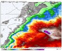
Would still warrant a ride to one of the local beaches if this can come to fruition View attachment 175447
Waves are already the size of a house at Fort Fisher
Shaggy
Member
Probably head down that way tomorrow. Maybe lunch at the Oceanic !
They got some good vittles, Shaggy?Probably head down that way tomorrow. Maybe lunch at the Oceanic !
Shaggy
Member
Very good.They got some good vittles, Shaggy?
Shaggy
Member
Hrrr very aggressive with winds along the beaches now
TriangleWhat inland areas east of the coast?
Avalanche
Member
Triangle is west of the coastTriangle
Triangle is west of the coast
Check out the big brain on Vasco da Gama!
That 18z 12k would change my complaining from lack of rain to lack of cold
Avalanche
Member
Well the man said inland areas east of the coast. I was trying to figure out what he was getting at.Check out the big brain on Vasco da Gama!

Just kidding with you Avalanche. It was a misstatement for sure. Stay safe. I have in-laws in Wilm.Well the man said inland areas east of the coast. I was trying to figure out what he was getting at.

