Interesting/concerning stuff weaker early on allows it to get caught in the upper level low blob over the SE and get farther away from Humbeto. Then this actually yields a stronger storm late since it interacts with the jet streak up the apps and the jet off of the NE coast.
-
Hello, please take a minute to check out our awesome content, contributed by the wonderful members of our community. We hope you'll add your own thoughts and opinions by making a free account!
You are using an out of date browser. It may not display this or other websites correctly.
You should upgrade or use an alternative browser.
You should upgrade or use an alternative browser.
Tropical TS Imelda
- Thread starter SD
- Start date
Dang didn’t realize the hurricane models were biting so hard on a stronger storm
It’s worth noting there may be some more error than usual in these models because I believe they are not built for more than one storm. I don’t know that they’ll “see” Humberto
Brent
Member
It’s worth noting there may be some more error than usual in these models because I believe they are not built for more than one storm. I don’t know that they’ll “see” Humberto
Yeah I'm trying to stress that this situation is pretty much unprecedented. There's never been two hurricanes that close to each other for a reason. Will that reason hold up here is the question
Allan is watching this closely…
Sent from my iPhone using Tapatalk
Allan Huffman is not the only one watching this closely after last night's model runs. There is still a lot of uncertainty but the plot has thickened as far as a possible tropical storm or hurricane paying the Southeast a visit. A lot will depend on Humberto and how what is now
94L interacts with it. A stronger Humberto and a slower track for 94L will enhance the pull on this system out to sea. If the opposite happens then it will interact with the atmospheric features along the Southeast coast which will steer it towards the mainland. This will be interesting to watch.
Shaggy
Member
My brain still goes back to the AI from 4 or 5 days ago that developed something later south of Cuba and raced it north. More separation between the storms will certainly increase the risk to the SEInteresting/concerning stuff weaker early on allows it to get caught in the upper level low blob over the SE and get farther away from Humbeto. Then this actually yields a stronger storm late since it interacts with the jet streak up the apps and the jet off of the NE coast.
For sure. No reason to think the models will handle this system well when they struggle in much simpler scenarios!It’s worth noting there may be some more error than usual in these models because I believe they are not built for more than one storm. I don’t know that they’ll “see” Humberto
rburrel2
Member
Let’s hope this storm doesn’t get left behind and trapped like the gfs/cmc show. Would be especially awful if that happens over the mountains. This set up has very high end flooding potential assuming that plays out.
I’m getting ahead of myself here but a notable backdoor front into a remnant TC is not a situation I can recall seeing before. I’m not sure I know what that would do rain-wiseLet’s hope this storm doesn’t get left behind and trapped like the gfs/cmc show. Would be especially awful if that happens over the mountains. This set up has very high end flooding potential assuming that plays out.
But let’s figure out if this storm will even do anything first
HUGO ALERT


precip enhancement. think in situ cad- isentropic lift over the cold(er) dome. it's an element that made matthew potent that doesn't get talked about a lotI’m getting ahead of myself here but a notable backdoor front into a remnant TC is not a situation I can recall seeing before. I’m not sure I know what that would do rain-wise
But let’s figure out if this storm will even do anything first

Right at my house...


I’ll be chasing if anything happens
The relative strength of 94L is heavily dependent on its proximity to Humberto. The closer the two are, the weaker 94L (future Imelda) will be. Alot of models speed it up ahead of Humberto which would push the path more inland and also result in a stronger storm.
yeah i was wondering if that would be it. something to keep an eye onprecip enhancement. think in situ cad- isentropic lift over the cold(er) dome. it's an element that made matthew potent that doesn't get talked about a lot
BrickTamland
Member
I guess we have been lucky since Helene last year with avoiding a landfall in NC and SC. Looks like Imelda could be changing that next week.
I guess we have been lucky since Helene last year with avoiding a landfall in NC and SC. Looks like Imelda could be changing that next week.
You’re not even mentioning Chantal, which had a landfall in SC and a major impact in especially parts of C NC earlier this year with tornadoes and record 24 rainfall in some areas. Most years don’t have that much impact in the Carolinas.
Shaggy
Member
Sure seems an area of virticity is forming on the north coast of Hispaniola?
@Saggy & I are already here..I’ll be chasing if anything happens
it's a look you'd recognize and would make sense theoretically. enhanced easterlies beef up veering wind profile, more WAA, more lift. on the northern fringe dry air eats into qpf and there's a sharp gradientyeah i was wondering if that would be it. something to keep an eye on
lexxnchloe
Member
lexxnchloe
Member
lexxnchloe
Member
lexxnchloe
Member
With a consensus forming maybe it will turn east, lol
lexxnchloe
Member
Icon gets it closer to FLA before turning east

GFS looks a bit stronger compared to 6z at 57. Let’s see where it goes

Shaggy
Member
A bit west as well. Let's see if it increase the threat to SCGFS looks a bit stronger compared to 6z at 57. Let’s see where it goes
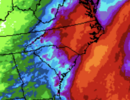
View attachment 175091
Tokenfreak
Member
At hour 78 it looks like its starting the hook left and stronger...A bit west as well. Let's see if it increase the threat to SC
Trending quicker as well. Guessing this run ends up in GA/SCA bit west as well. Let's see if it increase the threat to SC

Sure seems an area of virticity is forming on the north coast of Hispaniola?
Honestly, seeing this year, I would not feel crazy leaning even farther west than the models are showing.
Landfall Monday evening

GeorgiaGirl
Member
Trending quicker as well. Guessing this run ends up in GA/SC
View attachment 175092
Yeah it looks as if the ULL has captured it at 102.
Still seems until it forms as if it'll be a close shave between the ULL capturing it and Humberto slingshotting it away from the US.
 come on man
if (big if) this storm threads the needle and avoids humberto interaction, I think a SC landfall is favored as I think both the ULL and the HP that builds in from the north will limit how much latitude this can climbA bit west as well. Let's see if it increase the threat to SC
Tokenfreak
Member
Not looking good for us folks in the Carolinas right now ugg. Hopefully something changes soon.
GeorgiaGirl
Member
Ends up being a major issue for WNC involving flooding a little over a year after Helene smh.
LovingGulfLows
Member
- Joined
- Jan 5, 2017
- Messages
- 1,499
- Reaction score
- 4,100
View attachment 175094come on man
Screaming mid-level winds pushing right up against the mountains equals nasty flooding.